Miller Peak - 6.28.2008
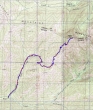
rodman's 1975 GPS route to Miller Peak... same route we took today... 8 miles roundtrip, gaining 3232 feet of elevation.
|
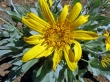
Balsamroot
|
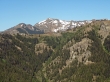
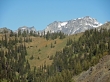
After hiking in the trees for 2.5 miles, we got this view of Earl Peak.
|
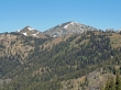
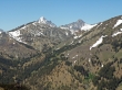
Little Navaho (a.k.a Freedom Peak) and Navaho Peak.
|
A closeup of Colchuck Peak and Dragontail Peak.
|

Bitterroot
|
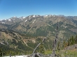
Navaho Peak and Three Brothers in front of The Stuart Range.
|
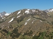
A closeup of Navaho Peak in front of Mt. Stuart and Argonaut Peak.
|
The West and Middle summits of Three Brothers.
|
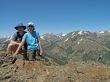
Frank and Nanda on the Miller Peak summit (6432').
|
