Icicle Ridge - 5.6.2010
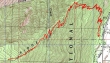
rodman's GPS route for our hike up Icicle Ridge... where we stopped at 5440 feet... 10 miles roundtrip, gaining 4258 feet of elevation.
|
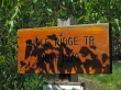
From the west end of Leavenworth... drive 1.4 miles on the Icicle Creek Road... turn right and look for the trail sign.
|
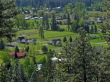
Some of the Leavenworth homes... as we gain elevation on the Icicle Ridge trail.
|
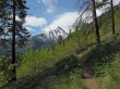
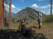
Still siwtchbacking higher... with Wedge Mtn in the distance.
|
The trail crests the ridge at 3000 feet and offers this view of Tumwater Mtn.
|
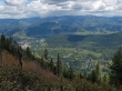
Looking down on Leavenworth and the convergence of Icicle Creek and the Wenatchee River.
|
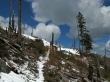
Patches of snow at 3500 feet.
|
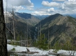
Watching the Wenatchee River rip down Tumwater Canyon... Tumwater Mtn on the right.
|
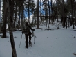
rodman goes to snowshoes at 4200 feet.
|
rodman nears our high point (5440+) for the day.
|
Mt. Stuart.
|
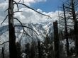
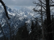
Looking up the Rat Creek drainage to Cannon Mtn on the right and Edward Mesa on the left.
|
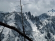
A closeup of 'The Mole'... a.k.a. Edward Peak.
|
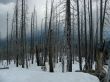
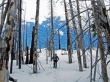
Several years ago a fire crossed our high point.
|
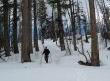
ragman on the way back to the car.
|
