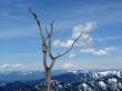
Earl Peak - 5.12.2010
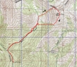
rodman's GPS route of our snowshoe trip to Earl Peak... 6.25 miles roundtrip, gaining 3358 feet of elevation.
|
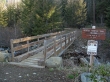
From 29 Pines Campground... drive ~4 miles on the N. Fork Teanaway road... turn right just before crossing Beverly Creek and drive to the Beverly Turnpike trailhead (3600') at end of the road.
|
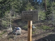
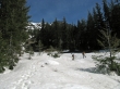
We hiked a half mile on trail #1391 (Beverly Turnpike) and turned right onto trail #1391.1 (Bean Creek).
|
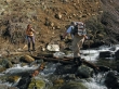
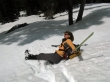
At the first Bean Creek crossing (4100'), BarbE tells rodman where to step.
|
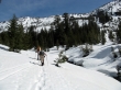
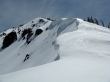
rodman and BarbE crossing the second avalanche gully (4800')... where the continous snow started.
|
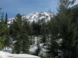
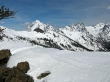
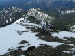
Shortly after crossing the second avalanche gully we got our first good look at Earl Peak.
|
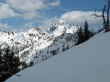
Looking for a place to recross Bean Creek... and head for the ridge above that connects Bean Peak and Earl.
|
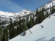
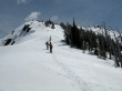
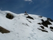
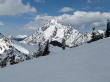
The terrain gets a lot steeper as we head for the ridge... Bean Peak in the distance.
|
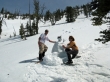
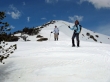
rodman and BarbE take a snowman break a few hundred feet below the NW ridge of Earl Peak.
|
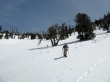
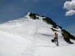
rodman heading steeply again for Earl's NW ridge.
|
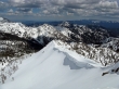
From Earl's NW ridge at 6500 feet... Mt. Stuart, Sherpa Peak, Argonaut Peak and Colchuck Peak.
|
On the NW ridge of Earl Peak.
|
Mt. Rainier from Earl's NW ridge.
|
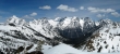
Pano shot of the Stuart Range from Earl's NW ridge.
|
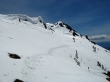
Still 500 feet of elevation gain left to reach the summit.
|

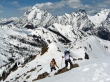
rodman and BarbE prepare for the final push to the summit... Bean Creek Basin on the left... close peak views of Mary, Bill, Bean, Fortune and Ingalls.
|
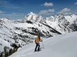
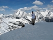
BarbE ascending the NW ridge of Earl Peak.
|
rodman and BarbE staying on Earl's NW ridge... heading for the summit area on the far right.
|
The summit is in the distance... through the gap.
|
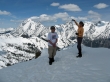
rodman and BarbE getting ready to go over this last bump.
|
Barb is beyond the last bump on the NW ridge.
|
rodman is getting ready to step onto the Earl Peak summit (7036').
|
BarbE and ragman near the Earl Peak summit... Stuart, Sherpa, Argonaut and Colchuck behind.
|
rodman on the Earl Peak summit.
|
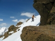
BarbE identifies Argonaut Peak.
|
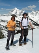
BarbE and ragman on the Earl Peak summit.
|
Little Navaho in the sunshine and Miller Peak in the shade.
|
Navaho Peak and Three Brothers.
|
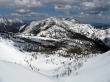
Looking along the Earl/Bean ridge to Bean Peak, Fortune Peak and the three summits of Ingalls Peak.
|
Leaving the Earl Peak summit and heading for the summer trail.
|
Almost to the saddle at 6200 feet.
|
A closeup of Mt. Stuart and Sherpa Peak as we descend towards Bean Creek Basin.
|
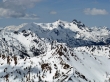
The descent is getting steeper now... Bean Peak, Mt. Stuart and Sherpa Peak in the distance.
|
There will be many surprises on our descent to Bean Creek Basin.
|
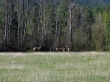
Elk grazing near the N. Fork Teanaway River Road.
|
