Fourth of July Peak - 7.24.2010
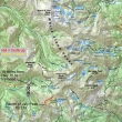
Drive 44.6 miles north of Ketchum on Idaho Hwy 75 and turn right on the Fourth of July Creek road... then drive 10 miles to the trailhead (8720').
|
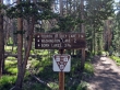
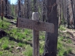
The sign says 1.25 miles to the Fourth of July Lake, but it is closer to 1.5 miles.
|
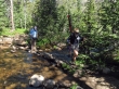
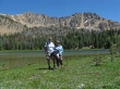
Anna Purna and Denali Girl at the first stream crossing.
|
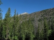
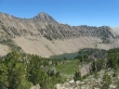
Blackman Peak on the ridge north of the trail.
|
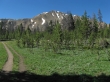
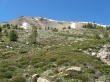
At ~1.3 miles continue towards Washington Lakes.
|
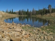
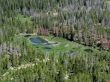
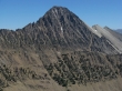
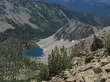
Fourth of July Peak from Fourth of July Lake.
|
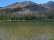
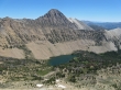
Patterson Peak (10,877') from Fourth of July Lake (9365').
|
I continued on trail to the tarn in the pass between Fourth of July Lake and Washington Lake... the Fourth of July Peak false summit is on the right.
|
Leaving the trail at the tarn in the pass between Fourth of July Lake and Washington Lake... Blackman Peak is in the distance.
|
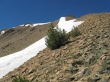
A good look at the Fourth of July Peak summit on the left.
|
The lower of the two Washington Lakes as I head for the Fourth of July Peak summit.
|
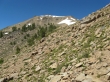
Still gaining elevation on my way to the summit.
|
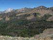
Ponds just south of Fourth of July Lake.
|
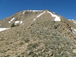
Almost on the summit ridge now.
|
Fourth of July Lake from the false summit... D. O. Lee Peak on the left and Patterson Peak on the right.
|
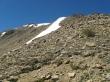
Still trying to get to the false summit.
|
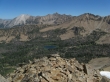
Castle Peak and the lower of the two Washington Lakes.
|
D. O. Lee Peak and Patterson Peak from the false summit of Fourth of July Peak.
|
A closeup of D. O. Lee Peak in the center of the photo... lots of limestone.
|
Phyllis Lake below Ebony Peak.
|
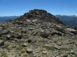
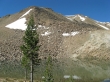
Walking over to the Fourth of July Peak summit (10,713').
|
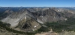
Fourth of July Lake on the left... Washington Lake on the right... and the pass connecting the two.
|
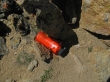
Someone donated their watter bottle for the summit register.
|
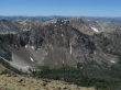
The ridge in the center of the photo runs straight to the Ivory Peak summit... Ebony Peak on the right.
|
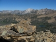
A closeup of Castle Peak.
|
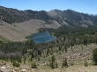
The higher of the two Washington Lakes.
|
A pano showing both of the Washington Lakes.
|
On the way down now... still a few hundred feet above Washington Lake.
|
Looking back up at the Fourth of July Peak summit.
|
larman and Anna Purna at Fourth of July Lake... 1.5 miles left to get back to the car... the trip was ~6 miles roundtrip, gaining ~2000 feet of elevation.
|
