Hex Mountain - 2.2.2011
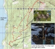
rodman's GPS route of our trip to hex mtn... 8.25 miles roundtrip, gaining 2815 feet of elevation... take exit 80 off of I-90... drive thru Roslyn and Ronald... and park in a plowed area just south of the signed Newport Bridge (2400').
|
Park in a plowed area just south of the Newport Bridge... continue over the bridge and in ~75 yards, turn right and head uphill on Newport Creek Drive.
|
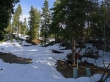
After hiking ~.5 miles there is a 'Y' in the road... we took the left fork, however, the best route is via the right fork... look for blue paint on the tree near this power box with the orange post.
|
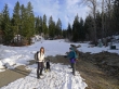
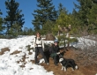
snowdog, Izzy and rodman on the way to Hex Mtn.
|
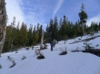
Very chilly today... at ~3150 feet we left the road and headed cross country between Points 3723 and 3501... staying on the east side of Bell Creek.
|
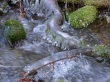
Bell Creek ice formations.
|
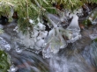
More Bell Creek ice.
|
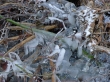
Ice jumble near Bell Creek.
|
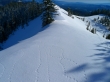
rodman, snowdog and Izzy continue cross country on the west side of Point 3501.
|
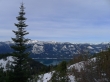
Cle Elum Lake comes into view as we gain elevation.
|
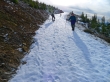
At ~3650 feet we found the road again.
|
Looking north from the end of the road (4650')... where we found the summer trail that will follow a rib to Sasse Ridge.
|
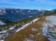
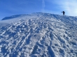
We've reached Sasse Ridge (~4900')... leaving a quarter mile hike east to the Hex summit.
|
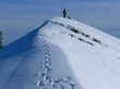
rodman reaches the Hex Mountain summit (5034').
|
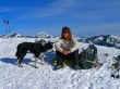
Izzy (left) and snowdog enjoy the Hex Mtn summit... Stuart Range in the distance... Jolly Mtn in left foreground... Elbow Peak in right foreground.
|
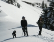
Izzy, ragman and snowdog on Sasse Ridge... two inches of powder snow on the ridge today.
|
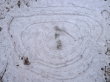
Small, confused tracks on Sasse Ridge.
|
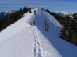
snowdog and Izzy on the bump just east of the Hex summit.
|
rodman looking north towards the heart of the Alpine Lakes Wilderness.
|
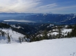
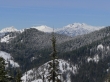
Looking across Cle Elum Lake to Mt. Rainier.
|
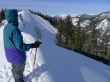
rodman, Izzy and snowdog heading back to the summit.
|
A closeup of Bears Breast Mtn, Mt. Hinman and Mt. Daniel from the Hex summit.
|
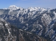
A closeup of the Stuart Range from the Hex summit.
|
On our return trip we stayed on the south rib (summer trail) to ~3500 feet... where we got back on the road.
|
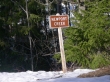
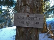
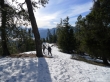
snowdog, ragman and Izzy at the Hex Mtn trailhead (3500')... look closely at the sign... maybe the sign-maker was hexed... still a couple mile road walk to get back to the car.
|
