Umtanum Ridge - 2.26.2011
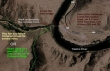
Take the E82/S97 (exit 110) off of I-90... then drive 3 miles and take Exit 3 (Thrall Road)... then drive .4 miles and turn left on to Canyon Road (aka Hwy 821)... then drive 8.1 miles to the trailhead.
|
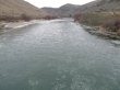
The parking area for the Umtanum Creek Recreation area... and the footbridge that crosses the Yakima River.
|
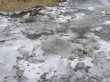
Ice floating down the Yakima River... 15 degrees at the trailhead.
|
Did I mention that it was 15 degrees at the trailhead.
|
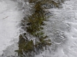
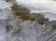
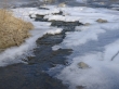
Water running underneath the ice.
|
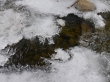
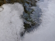
More ice formations.
|
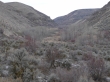
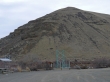
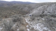
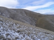
Looking up the Umtanum Creek valley (another hiking option if you want to stay low and follow the creek) as we turn left and head uphill towards Umtanum Ridge.
|
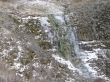
This waterfall has stopped flowing.
|
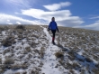
Denali Girl heading uphill... Umtanum Ridge in the distance.
|
Harsh.
|
Denali Girl gaining elevation on the way to Umtanum Ridge.
|
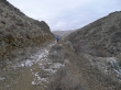
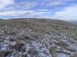
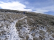
You can see the snow covered trail in the center of the photo... snaking its way to the top of Umtanum Ridge.
|
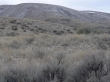
Even in winter there is color in the area.
|
Denali Girl and the great wide open.
|
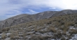
The main path to the ridge is on the rib on the horizon... but we have chosen to take a more direct route... there are lots of ways to reach the ridge top.
|
Near the top of the ridge under a blue sky.
|
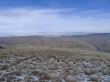
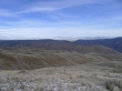
Looking at the snowy foothills above Ellensburg... the Yakima River is 2000 feet below on the right.
|
Denali Girl near our high point on Umtanum Ridge.
|
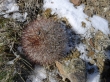
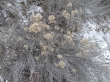
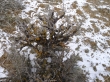
The hedgehog cactus look a little different in the winter.
|
Sunshine on Umtanum Ridge while the Cascades are gray.
|
Denali Girl coming down from Umtanum Ridge... we decided to take the main path for our return to the car.
|
Looking east to the route we used on the way up to the ridge.
|
Still very chilly in the valley.
|
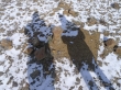
Ice.
|
Almost back to the car... the hike was ~6 miles roundtrip, gaining ~2000 feet of elevation.
|
