Pratt Mountain - 3.17.2011
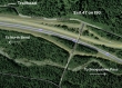
We started from the Pratt Lake Trailhead... take Exit 47 and find the trailhead on the north side of I90.
|
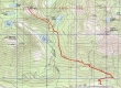
rodman's GPS route of our snowshoe trip to Pratt Mountain... 9 miles roundtrip, gaining 3381 feet of elevation.
|
There are lots of options at the Pratt Lake Trailhead (1850')... we will be looking for the Talapus/Olallie junction.
|
After a mile of hiking (2500') we stayed left at the junction with the trail to Granite Mountain.
|
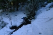
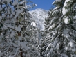
Lots of stream crossings on this hike... we didn't need our snowshoes for the first 2.5 miles.
|
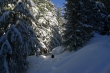
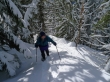
We have turned north and are heading up-valley towards Olallie Lake... wearing snowshoes now.
|
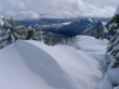
Pure as the driven snow.
|
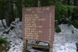
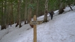
ragman points to the sign at the junction for Talapus and Olallie Lakes.
|
For comparison purposes, this is the same sign as in the previous photo... but it was taken 7 weeks earlier.
|
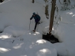
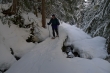
rodman crossing the Olallie/Talapus Creek.
|
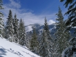
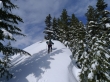
Heading steeply uphill now above Olallie Lake... Bandera Mountain comes into view.
|
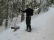
rodman heading uphill.
|
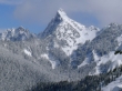
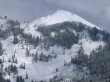
Tusk O'Granite comes into view as we gain elevation towards the ridge.
|
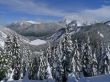
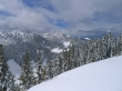
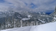
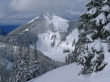
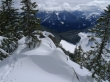
We've reached the ridge (4300')... and have this view of Pratt Lake and Preacher Mtn (left)... and clouds hovering over Roosevelt, Kaleetan, Chair and Bryant.
|
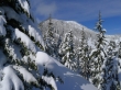
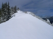
Still some work left to reach the summit of Pratt.
|
Looking back on Tusk O'Granite as we continue along the ridge towards the Pratt summit.
|
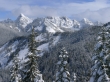
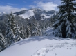
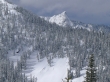
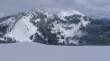
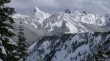
Clouds still on top of Chair Peak... but Roosevelt, Kaleetan, Bryant and Hemlock are showing.
|
A closeup of Kaleetan Peak... Mt. Roosevelt on the left.
|
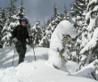
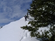
ragman and one of the many snow aliens.
|
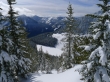
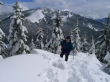
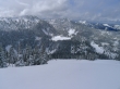
Looking down on Talapus Lake as we gain elevation.
|
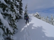
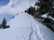
rodman going over the top of the rock outcropping at ~4600 feet.
|
rodman continues over the rock outcropping... the crux of the trip.
|
rodman ascending... with Tusk O'Granite and the true summit of Granite behind.
|
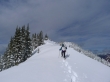
Still some elevation gain left... but we can see the summit in the distance.
|
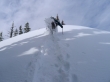
rodman kicking up a storm!!
|
Island Lake below Bandera Mountain.
|
A closeup of McClellan Butte.
|
Most of the elevation gain is over and done with.
|
rodman making a dash for the summit.
|
Rainbow Lake (lower right)... Island Lake below Bandera Mtn... with McClellan Butte and Mt. Washington to the right.l
|
Tusk O'Granite and Granite.
|
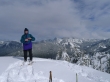
ragman made the Pratt summit (listed as 5099')... but with 10 feet of snow on it, I'm calling it 5109 feet.
|
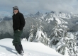
rodman was there also.
|
Heading down now... cornices along the final portion of the ridge leading to the summit.
|
Bandera Mtn... with Island Lake and Rainbow Lake.
|
A closeup of Mt. Defiance and Lake Kulla Kulla.
|
A closeup of Granite Mountain.
|
Back at the rock outcropping now... Talapus Lake below.
|
rodman coming down the rock outcropping.
|
A last look at the big ones before leaving the ridge and heading back down towards Olallie Lake.
|
