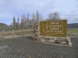
Ginkgo Petrified Forest State Park - 3.27.2011
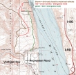
Drive ~25 miles east of Ellensburg on I-90 and take Exit 136... drive thru the small town of Vantage and turn right on Recreation Road... then .3 miles to the trailhead (700').
|
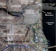
I started on the dirt road... then decided to head cross country to get views of the Columbia River... then out to Point Sternberg and back to the car on a trail... ~5 miles roundtrip, gaining ~900 feet of elevation.
|
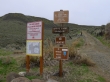
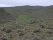
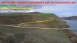
Not the most friendly starting point I've ever seen... I assumed that a permit was only needed if I was going to drive... so I started walking uphill on this road.
|
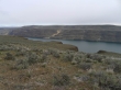
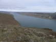
Gaining elevation on the road gives a view of the Columbia River.
|
Looking up Hells Kitchen.
|
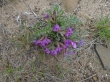
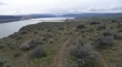
Penstemon... not a lot of flowers yet... wait another month for the best show.
|
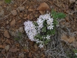
Phlox
|
Looking south to Vantage... and the bridge.
|
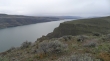
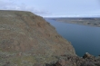
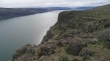
Looking across the river to the basalt cliffs.
|
My high point (~1500')... the dirt road comes to this spot, but views of the river are delayed if you stay on the road.
|
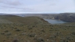
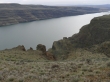
Looking north from my high point... I think that I'll head over to Point Sternberg in the center of the photo.
|
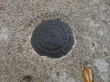
The marker at Point Sternberg was placed in 1957.
|
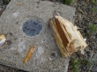
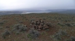
Petrified wood at Point Sternberg.
|
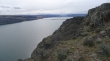
Looking north from Point Sternberg... looks like a small town up river... perhaps a suburb of Quincy?
|
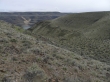
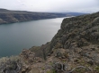
Looking south from Point Sternberg... I think I'll stay just above the cliffs on my return to the car.
|
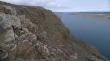
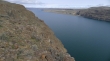
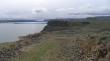
Looking down on the basalt cliffs.
|
I can see a trail leading over to the cliff tops.
|
Heading back to the car now... looking back to the north... Point Sternberg on the left.
|
Looking south.
|
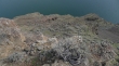
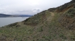
Looking straight down... looks like a shoreline... but it is just a shelf... a few hundred feet above the river.
|
Looking north.
|
Looking south.
|
Looking north.
|
Looking south.
|
I can see Vantage now... getting close to Recreation Road now.
|
I will use this abandoned road to get back down to the main road.
|
Almost down to the main road now... looking across to the park museum.
|
I decided to take the short drive over to the park museum.
|
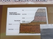
A history lesson at the park museum.
|
From the park museum I'm looking at the route I took on my return to the car.
|
