Black Canyon - 4.8.2011
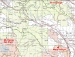
Black Canyon is located in the L. T. Murray State Wildlife Recreation Area... due east of Mt. Rainier Nat. Park and due south of the Stuart Range.
|
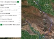
From Ellensburg... take Exit 110 and drive 97/82E for 25.7 miles... take Exit 26... turn right at WA-821 N and drive .2 miles... turn left at WA-823 S (a.k.a Harrison Rd) and drive 1.9 miles... turn right at N Wenas Rd and drive 16.5 miles to the dirt road turnoff for Black Canyon.
|
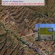
There is no road sign for Black Canyon... just a large yellow 'Public Notice' sign... drive the rough road 1.2 miles and park where the road is blocked to motorized vehicles.
|
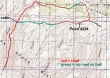
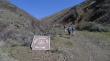
rodman's GPS route of our Black Canyon hike... 7.5 miles roundtrip, gaining 1832 feet of elevation.
|
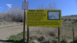
After driving ~16.5 miles on N Wenas Road, look for this large yellow 'Public Notice' sign... turn onto this dirt road.
|
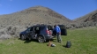
After driving 1.2 miles on the rough dirt road, park at 2520 feet.
|
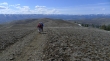
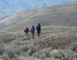
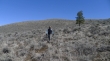
Nanda, Denali Girl and rodman start hiking up Black Canyon.
|
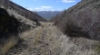
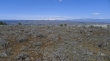
Looking south back down Black Canyon... we are hiking on an abandoned road.
|
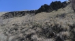
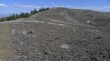
Basalt cliffs in Black Canyon.
|
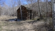
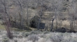
After hiking ~1.25 miles we arrive at the old settler's cabin... which looks to be in poor shape from this angle...
|
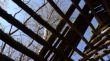
And the roof of the cabin is in worse shape.
|
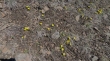
Lots of yellow on the hike... but the best flowers are yet to come.
|
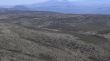
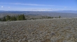
At ~3600 feet we left the road because of muddy conditions... and got this look at the Stuart Range and Teanaway Peaks when we reached the ridge (3840').
|
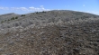
Lots of ups and downs on the ridge.
|
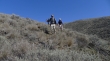
rodman, Nanda and Denali Girl are giving back a little elevation and coming over to our eastern terminus.
|
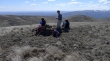
Nanda, rodman and Denali Girl at our eastern terminus (4120')... Denali Girl is looking at something with the binoculars...
|
A herd of elk in the center of the photo... Selah Butte on the left with the tower on it.
|
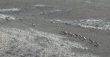
rodman's closeup of the elk herd.
|
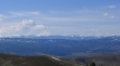
A closeup of Mount Rainer to our west.
|
Nanda and Denali Girl leaving our high point (Point 4224)... marked as 'Rattler' on the map.
|
The Teanaway Peaks and the Stuart Range from our high point.
|
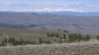
A closeup of the Teanaway Peaks and the Stuart Range.
|
Looking back on Point 4224 (a.k.a Rattler).
|
Nanda, Denali Girl and ragman heading for the barn.
|
We have left the road and are heading cross crountry towards Black Canyon.
|
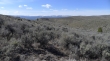
Lots of sage brush on the hillsides... but pretty easy to find a reasonable route through it.
|
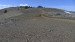
Almost down to the canyon floor now.
|
Just a few feet above the settler's cabin and the canyon floor... a 1.25 mile hike will get us back to the car.
|
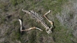
Not sure.
|

On the drive back we couldn't pass up the opportunity to take rodman's photo next to the road named in his honor.
|
