Yakima Peak - 8.28.2011
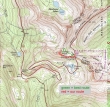
Yakima Peak is the 6226 foot peak above Tipsoo Lake near Chinook Pass. There is no official trail... 2 miles roundtrip, gaining 1000 feet of elevation.
|
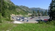
Park on the north side of Chinook Pass.
|
The best way to do this one is to head for the pass between Yakima Peak and Point 6280+ to the north... before reaching the pass you will find a good boot path that contours around the east side of the peak.
|
We didn't find the good boot path... instead heading directly for the peak.
|
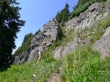
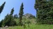
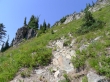
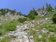
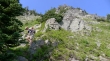
By missing the best route we got into a cliffy area.
|
Looking across Hwy 410 to Naches Peak.
|
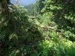
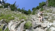
Denali Girl is doing some bush whacking.
|
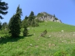
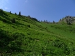
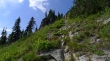
Finally above the cliffy area and in the open... we are looking for the boot path.
|
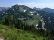
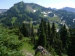
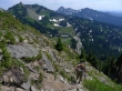
High enough now to see Tipsoo Lake.
|
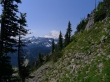
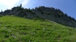
The boot path that contours around the east side of Yakima Peak.
|
Our first look at Mt. Rainier since starting the hike.
|
Denali Girl coming up.
|
We are heading for the low point on the ridge above. This gully is steeper than it looks.
|
Denali Girl ascending... Naches Peak on the left.
|
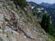
Did I say that it was steep?
|
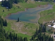
Tipsoo Lake from the Yakima Peak summit (6226').
|
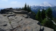
The flatish top of Yakima Peak... Mt. Rainier in the distance.
|
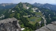
Naches Peak and Tipsoo Lake from the Yakima Peak summit.
|
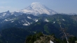
Looking across Governors Ridge and Tamanos Mountain to Mt. Rainier.
|
Denali Girl descending from the ridge.
|
Almlost done with the rotten gully.
|
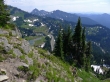
Back on reasonable boot path now.
|
Traversing on the east side of Yakima Peak... heading for the pass between the peak and Point 6280+.
|
Point 6280+ is in the center of the photo... we are on a boot path now that will get us back to the car.
|
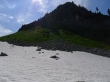
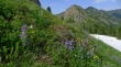
Hard to believe that there is still snow here on August 28.
|
