Smith Rock State Park - 9.27.2011
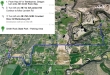
Smith Rock State Park is located ~2 miles NE of Terrebonne, Oregon.
|
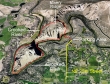
We did a loop hike using the Misery Ridge Trail to go up and over the ridge... then closed the loop using the River Trail... a 3 mile hike that gained ~900 feet of elevation.
|
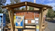
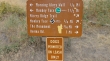
Five dollars a day or 30 dollars for an annual pass to use this area.
|
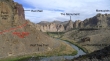
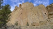
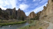
From the parking area... looking west at the Smith Rock Group (far left) and looking NW at Picnic Lunch Wall (right).
|
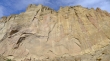
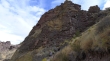
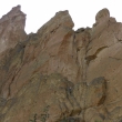
A closeup of Picnic Lunch Wall... Misery Ridge is on top.
|
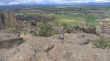
Looking NE from the parking area.
|
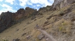
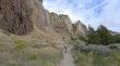
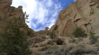
Lots of hiking and climbing options here.
|
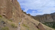
Denali Girl on the Misery Ridge Trail at the base of Picnic Lunch Wall.
|
Denali Girl nearing the top of Misery Ridge.
|
Denali Girl nearing the top of Misery Ridge.
|
Denali Girl heading for the high point on Misery Ridge... bad weather over the Cascades, but sunshine here.
|
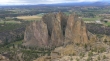
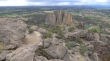
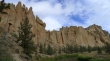
The Smith Rock Group from Misery Ridge.
|
Looking NE from the high point on Misery Ridge... Gray Butte (in the distance on the right) is the high point in the area.
|
Denali Girl relaxing below the high point on Misery Ridge and looking at the Smith Rock Group.
|
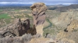
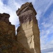
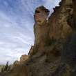
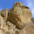
Monkey Face from the top of Misery Ridge.
|
Monkey Face... on the west side of Misery Ridge and heading down to the Mesa Verde Trail.
|
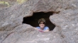
Denali Girl... framed.
|
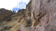
On the west side of Misery Ridge.
|
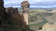
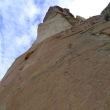
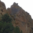
Looking up at Monkey Face as we head down to the Mesa Verde Trail.
|
Denali Girl on the Misery Ridge Trail.
|
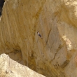
At the base of Monkey Face and looking up.
|
On the Mesa Verde Trail... looking back at Monkey Face as we head for the River Trail.
|
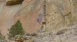
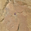
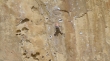
A climber on the Mesa Verde Wall.
|
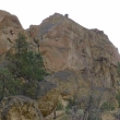
Six climbers near the Mesa Verde Wall.
|
Same six climbers near the Mesa Verde Wall.
|
On the River Trail now... looking back at Monkey Face and the Mesa Verde Wall.
|
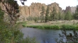
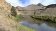
Denali Girl on the River Trail... near the southern end of the park by the Smith Rock Group.
|
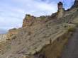
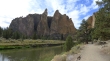
Still on the River Trail, we have rounded the southern end of the park and looking at the Dihedrals (columns in the left center of the photo).
|
Christian Brothers (left)... Dihedrals (center)... and Morning Glory Wall (right).
|
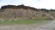
Asterisk Pass.
|
Climbers on the White Satin route of the Smith Rock Group.
|
Look hard for the two climbers on the Zebra route on the Morning Glory Wall.
|
A closeup of the two climbers on the Zebra route on the Morning Glory Wall.
|
A climber on the 'Cool Ranch Flavor' route on the Morning Glory Wall.
|
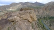
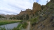
Looking back at the Smith Rock Group as we walk along the River Trail.
|
A climber on an inverted wall (in the shade).
|
Closeup of the climber on an inverted wall.
|
Almost ready to close our hiking loop... looking back at the Smith Rock Group (left) and Asterisk Pass (center).
|
We will close our loop hike at the bridge that crosses the Crooked River... the Burma Road crosses the hillside in the distance below the Marsupials.
|
After crossing the bridge we will need to gain 100 feet of elevation to get back up to the parking area.
|
