Cowiche Mountain - Snow Mountain Ranch - 5.23.2012
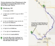
See the google map instructions on how to reach the Cowiche Mountain trailhead.
|
After driving 2.4 miles on the Cowiche Mill Road, park (~1900') across the street from an excavating company and the Cowiche Creek Nursery. Our route in red is not a GPS route... it is my best guess.
|
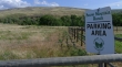
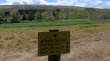
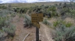
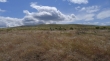
The sign for the parking lot... with Cowiche Mountain beyond.
|
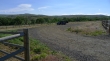
Plenty of room to park... a sign asks that you only park on the gravel.
|
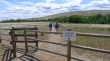
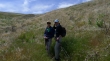
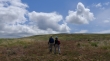
Denali Girl and BarbE leaving the parking area to hike down and across the South Fork of Cowiche Creek.
|
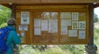
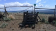
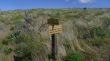
After crossing the creek there is a kiosk with lots of information on the trail system and the Cowiche Canyon Conservancy.
|
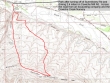
We are going to do the Cowiche Mtn Loop trail... however, we will follow the Riparian Trail East and do the mountain loop trail in a clockwise direction (a tip from someone we met at the kiosk)... and it was an excellent tip.
|
Denali Girl and BarbE on the Riparian Trail East... with Cowiche Mountain in the distance on the right.
|
Time to leave the Riparian Trail East and get on the Cowiche Mountain Loop trail.
|
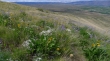
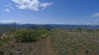
Starting to gain elevation now... looking back across the valley.
|
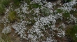
No idea what this is... but there were tons of them.
|
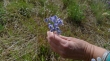
Lupine
|
Heading for the summit... it is up there somewhere.
|
Looking back across the valley.
|
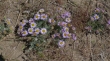
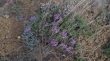
Asters
|
Several trail junctions along the way, but we will stay with the Mountain Loop Trail.
|
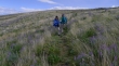
Denali Girl and BarbE on the Cowiche Mountain Loop Trail.
|
Daisey???
|
No idea.
|
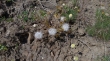
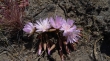
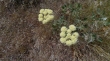
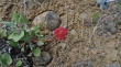
Lewisia... more on this hike than I have ever seen.
|
More Lewisia.
|
Still gaining elevation.
|
Desert parsley or desert buckwheat... not sure.
|
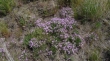
Phlox
|
Phlox
|
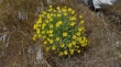
Yellow asters.
|
Lewisia
|
Desert buckwheat??
|
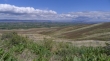
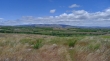
Still gaining elevation... broader views now... looking across the valley.
|
Not sure on this one.
|
BarbE and Denali Girl going through lupine lane.
|
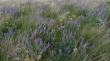
Lots and lots of lupine.
|
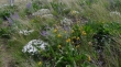
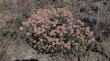
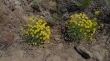
Balsamroot with lupine and phlox.
|
Looking down to the valley as we near the summit.
|
We turned left at this fence and walked a quarter mile to a nice view of the Yakima Valley.
|
|
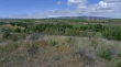
Broad view of the Yakima Valley from a spot near our high point.
|
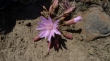
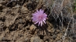
Penstemon
|
Heading west along Cowiche Mountain... looking for the trail down that will complete our loop.
|
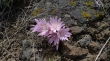
More Lewisia.
|
No idea.
|
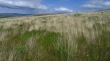
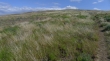
Feels like amber waves of grain to me.
|
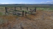
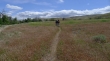
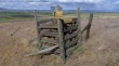
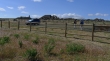
We saw a few corrals along the way.
|
We decided to take the Wildflower Trail here... a slightly more direct route back to the car.
|
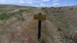
Staying with the Wildflower Trail at this junction.
|
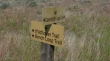
ragman's advertisement for viagra... don't expect sales to skyrocket.
|
Making our way down the Wildflower Trail and looking back up at the summit area.
|
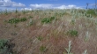
Lots of thistles here... should be very pretty when they bloom.
|
At the junction with the Balanced Rock Trail, but we will take the Wildflower Trail all the way down to the valley floor.
|
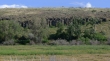
Back near the kiosk now... closing our loop hike... and looking over to the balanced rock (I think).
|
Back at the parking area... you can see the excavating company on the other side of the road... a 6 mile loop hike, gaining 1140 feet of elevation.
|
