Putrid Pete's Peak and Mt. Defiance - 6.27.2012
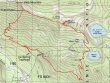
rodman's GPS route for our loop hike of Putrid Pete's Peak and Mount Defiance... 9.5 miles roundtrip, gaining 4089 feet of elevation.
|
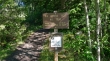
Take Exit 45 on I-90 and drive FS 9031 to the Ira Spring trailhead (2200') at the end of the road.
|
Hike a short distance on the Ira Spring Trail and take the boot path at the first hairpin turn in the trail.
|
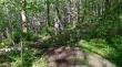
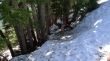
The boot path traverses west for at least a half mile before heading steeply uphill.
|
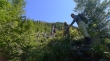
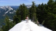
BarbE, Snowdog and rodman... finally out of the woods at ~3800 feet.
|
Izzy came with us on this hike.
|
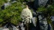
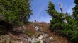
Bear grass.
|
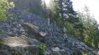
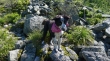
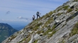
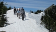
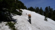
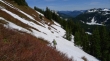
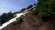
Continuing up on steep terrain.
|
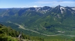
Looking south across I-90... Kent's Court, Mt. Kent and McClellan Butte in the foreground... Mt. Rainier in the distance.
|
Mount Defiance (left) and Bandera Mountain.
|
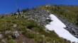
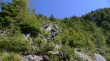
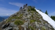
BarbE leading the charge... we can see the summit on the ridge above.
|
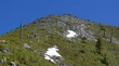
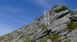
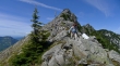
Getting closer to Putrid Pete's Peak.
|
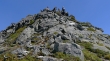
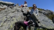
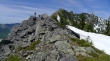
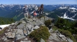
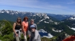
Summit party on Putrid Pete's Peak (5200+).
|
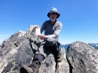
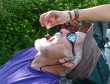
BarbE got this shot of me on the summit.
|
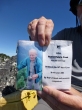
A photo of Pete Schoening in the summit register... one of Washington State's famous mountaineers... check him out on the Internet for his amazing adventure on a climb of K2.
|
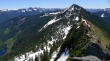
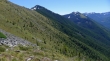
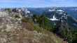
From the Putrid Pete summit we are looking at our general route over to the shoulder of Mt. Defiance.
|
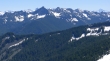
Foreground peaks... Mt. Roosevelt (left), Kaleetan Peak, Chair Peak, Snoqualmie Mountain, Bryant Peak and The Tooth... Mt. Stuart in the distance on the far right.
|
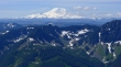
A closeup of Mt. Rainier from Putrid Pete's.
|
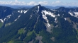
A closeup of McClellan Butte from Putrid Pete's.
|
Lunch break just below the Putrid Pete summit... Mt. Defiance and Bandera Mountain beyond.
|
nwhikers ree and Galadriel are approaching the Putrid Pete summit.
|
ree and Galadriel celebrate on the Putrid Pete summit.
|
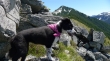
BarbE, Snowdog and Izzy just below the summit.
|
ree and Galadriel are working their way over to join us for the ridge walk over to Mt. Defiance.
|
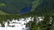
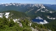
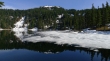
Looking down on Spider Lake.
|
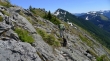
rodman and Izzy lead the way along the ridge toward Mt. Defiance.
|
BarbE on the ridge... with the Putrid Pete summit behind.
|
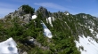
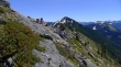
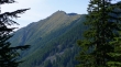
Looking back at Putrid Pete (second bump from the left) as we head for Mt. Defiance.
|
On Banana Ridge and heading for Mt. Defiance.
|
Miss Isabel on Banana Ridge.
|
Looking back at Putrid Pete's Peak in the center of the photo... as Galadriel, BarbE and ree hike along Banana Ridge.
|
Izzy on the edge.
|
ragman leading five ladies... a scary proposition for the ladies... Putrid Pete's Peak on the far right.
|
We have parted ways with ree and Galadriel now... and are heading for the Mt. Defiance summit.
|
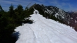
Nearing the Mt. Defiance summit... the trail has melted out near the summit.
|
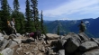
Broad views from the Mt. Defiance summit (5584').
|
Group shot on the Defiance summit... Snowdog, BarbE, rodman and ragman... Lake Kulla Kulla below.
|
Looking down on Lake Kulla Kulla from the Defiance summit.
|
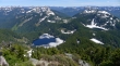
Lake Kulla Kulla (center)... Mason Lake and Little Mason Lake on the right... Blazer, Rainbow and Island are also visible.
|
A stitch of the previous two photos.
|
Leaving the Defiance summit and heading for Mason Lake (right).
|
Still some snow below the Defiance summit... Lake Kulla Kulla below.
|
Compact snow in the trees... using an ice axe and microspikes now.
|
rodman on the main trail now... on the south side of Defiance... Mason Lake on the right.
|
Looking back at the south slope of Mt. Defiance.
|
Mason Lake... with Bandera Mountain above.
|
Past Mason Lake now... back on the Ira Spring Trail... looking at Putrid Pete's Peak.
|
A short break where the Ira Spring memorial plaque is located... Rainier in the distance.
|
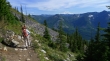
Three miles of easy, downhill trail walking to get back to the car.
|
Life is good back at the trailhead.
|
