Soldier Pass - 4.8.2013
Directions to the Soldier Pass Trailhead.
|
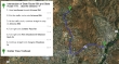
A google earth look at the terrain around Soldier Pass... we also made an off-trail visit to the base of Point 5296... making our trip ~6 miles roundtrip, gaining ~850 feet of elevation.
|
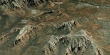
Point 5296 is the one on the right... we will visit gaps to the left of it and to the right of it.
|
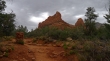
Devils Kitchen.
|
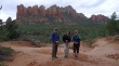
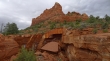
We are near Devils Kitchen... the rock formation on the left end of the ridge above is Coffeepot Rock.
|
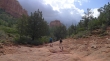
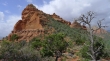
Off trail now and heading for Point 5296 in the center of the photo.
|
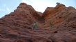
BarbE nearing the base of Point 5296.
|
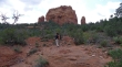
Looking back toward Soldier Pass on the right... we will go there later.
|
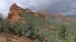
We are standing between this unnamed point and Point 5296.
|
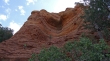
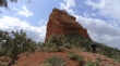
tomman below Point 5296.
|
A closer look at tomman below Point 5296.
|
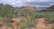
Capitol Butte is in the distance.
|
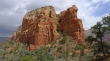
The south side of Point 5502.
|
The wind is blowing us away from Point 5296.
|
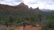
Nearing Soldier Pass... looking back at Point 5502 and Point 5296... no more photos on the trip as rain is starting to fall.
|
