Fay Canyon - 4.9.2013
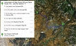
Directions to the Fay Canyon Trailhead.
|
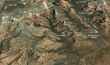
A google earth look at the terrain around Fay Canyon... our hike was 4.5 miles roundtrip, gaining 500 feet of elevation.
|
Fay Canyon is located in the Red Rock Secret Mountain Wilderness.
|
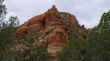
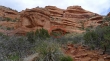
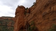
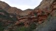
Beautiful red rock.
|
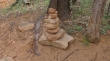
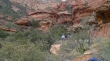
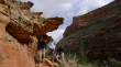
We didn't hike very far into the canyon and we found the cairn that marks the turnoff to the Fay Canyon Arch.
|
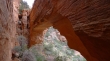
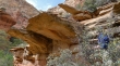
The Fay Canyon Arch is in the center of the photo.
|
A closer look at the arch.
|
Underneath the Fay Canyon Arch... for perspective, tomman is underneath the arch.
|
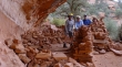
A nice wind shelter underneath the arch... ragman, Denali Girl, tomman and BarbE.
|
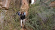
tomman and I decided to get up on top of the arch.
|
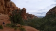
The main trail comes to an end after hiking a couple of miles... but we decided to continue on to the left... looking down the canyon to Courthouse Butte in the distance.
|
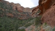
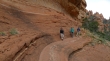
Continuing on a nice shelf 100 feet above the canyon floor.
|
BarbE, Denali Girl and tomman hiking on the shelf.
|
The canyon is coming to a dead end... Bear Mountain above.
|
The brush gets a bit denser near the end of the canyon.
|

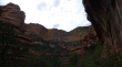
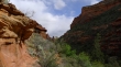
Looking down canyon... awesome cliffs.
|
We can see Capitol Butte in the distance... way beyond the entrance to the canyon.
|
We will only go a little further.
|
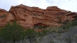
Love the red rock.
|
Group shot before we head back.
|
On the way back to the car... nice view down the canyon.
|
Love the rock formations.
|
The gang has found some shade.
|
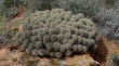
When this Claret Cup cactus blooms, it will be quite the show.
|
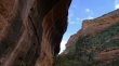
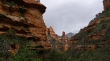
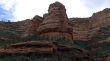
The cliffs of Fay Canyon.
|
