Capitol Butte (aka Thunder Mountain) - 4.20.2013
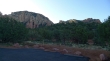
Directions to the Chuck Wagon Trailhead... this is a good spot to park for Capitol Butte although you won't be using a trail that starts here.
|
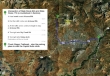
A google earth look at the terrain around Capitol Butte... 4.6 miles roundtrip, gaining 1830 feet of elevation.
|
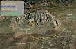
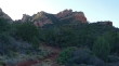
From the Chuck Wagon Trailhead... looking at Capitol Butte (aka Thunder Mountain) on the left... Lizard Head is near the end of the ridge line on the right.
|
From the parking area, walk back down the Vultee Arch Road .1 miles and start walking toward Lizard Head on the Lizard Head Trail.
|
On the Lizard Head Trail now... with Lizard Head in view above (right center).
|
We have left the Lizard Head Trail too soon on a sucker-path... note that Lizard Head is barely visible in the upper right corner of the photo. There is a wash to hiker's right that should be crossed before heading up hill.
|
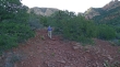
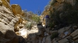
After hiking a quarter mile on the sucker-path we have figured out that we are on the wrong side of the wash... ugh... time to scramble down it.
|
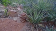
On the correct side of the wash now and working our way through the manzanita and cacti toward Lizard Head above.
|
Comforting to see that others have made the same error.
|
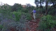
Still looking for a better path as we head up hill toward Lizard Head.
|
We know there is a good path... because one of the Sedona locals told us about it... right?
|
Getting closer to Lizard Head... still looking for the good path.
|
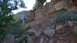
Finally found the good path (see huge cairn in center of photo) just below a small cliff band... the route will be cairned from here on.
|
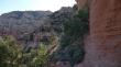
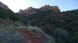
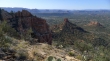
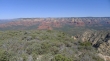
Following the path that goes underneath Lizard Head... the Capitol Butte summit is in the distance on the left.
|
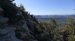
Near Lizard Head now... looking down on our route from the parking area.
|
We gained the ridge just east of Lizard Head and are now above it.
|
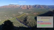
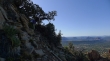
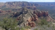
Views of Sedona... Chimney Rock in the center foreground... with Courthouse Butte, Bell Rock and Cathedral Rock in the distance.
|
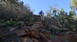
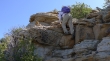
rocman is working around the first of two rock outcroppings on the SW ridge of Capitol Butte.
|
So far we have only encounterd a few Class 2 sections on the path.
|
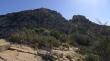
Successfully around the first rock outcropping now... and looking at the much larger rock cropping on the right... summit on left.
|
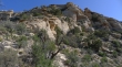
rocman is dwarfed by the second rock outcropping.
|
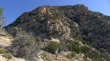
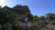
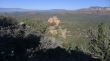
Past the second rock outcropping now... with rugged looking terrain between us and the summit.
|
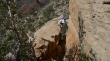
rocman negotiates some of the Class 3 sections of the climb.
|
Class 2.
|
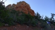
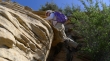
Steeper than it looks.
|
On the last Class 2 section before the terrain eases for the last quarter mile to the summit.
|
Summit shot looking NE to Wilson Mountain.
|
Summit shot looking west to Bear Mountain.
|
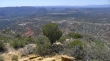
Summit shot looking south across Sedona and the airport to Courthouse Butte, Bell Rock and Cathedral Rock.
|
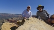
rocman and ragman on the Capitol Butte summit (6355')... awesome climb.
|
