Fortune Peak - 10.15.2013
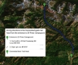
Directions from the entrance to 29 Pines Campground to the trailhead we used for our trip to Fortune Peak.
|
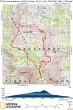
rodman's GPS track for our trip to Fortune Peak... 7 miles roundtrip, gaining 3169 feet of elevation.
|
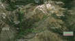
A google earth look at the terrain around Fortune Peak.
|
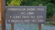
The trailhead is located at the end of FS 9737... from the parking area all hikes in the area begin on the Esmerelda Basin Trail.
|
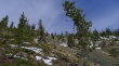
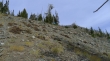
After hiking on the Esmerelda Basin Trail for a quarter mile we turned onto the Ingalls Way Trail.
|
After hiking a couple of miles we bypassed the Longs Pass Trail and continued on the Ingalls Way Trail.
|
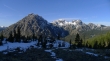
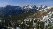
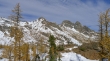
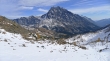
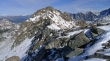
Looking across Esmerelda Basin to the multiple summits of Esmerelda Peaks... the high point is in the center of the photo.
|
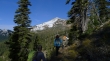
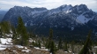
Hiking on the Ingalls Way Trail... with Fortune Peak in the distance.
|
High enough now to see Hawkins Mountain on the far right... Mt. Rainier is in the distance behind Esmerelda Peaks.
|
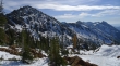
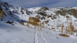
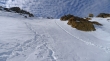
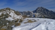
Continuous snow a few hundred feet below Ingalls Pass.
|
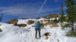
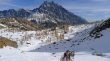
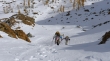
BarbE and Snowdog heading for Ingalls Pass on the far right.
|
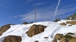
Nice.
|
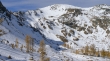
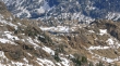
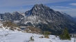
Nearing Ingalls Pass and looking back at 'Not Hinkhouse' Peak on the left... the ridgeline across the middle of the photo goes over to Longs Pass and continues all the way to Teanaway Peak.
|
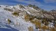
At Ingalls Pass... looking across the larch trees in Headlight Basin to the three summits of Ingalls Peak.
|
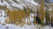
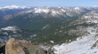
A golden Headlight Basin.
|
Mount Stuart from Headlight Basin.
|
A closer look at the three summits of Ingalls Peak from Headlight Basin.
|
We will leave Headlight Basin and follow some nice steps up to Fortune Peak.
|
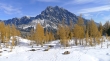
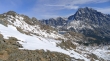
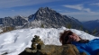
A closer look at Fortune Peak.
|
Heading up out of Headlight Basin... with Mt. Stuart in the distance.
|
Thanks to whoever made these steps... an interesting sky above.
|
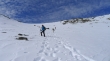
Gaining elevation above Headlight Basin.
|
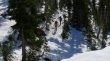
Snowdog showing off... don't try this at home.
|
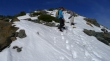
Almost to the east ridge of Fortune Peak.
|
High enough now to see Ingalls Lake.
|
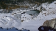
A closeup of Ingalls Lake from the east ridge of Fortune Peak.
|
On the east ridge of Fortune Peak now... just a couple hundred feet of elevation gain left to get to the summit.
|
Ingalls Lake between Ingalls Peak on the left and Mt. Stuart on the right.
|
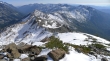
Mass quantities of Teanaway Peaks from the summit of Fortune Peak.
|
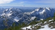
Looking between Esmerelda Peaks and Hawkins Mountain to Mount Rainier on the horizon.
|
Looking at the ridge that leads over to South Ingalls... Glacier Peak is in the distance on the far left.
|
Mt. Hinman and Mt. Daniel on the far left... Scatter Peaks, The Cradle and Mt. Harding in the center... Galcier Peak on the far right.
|
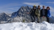
Group shot from the Fortune Peak summit... Mt. Stuart, ragman, Snowdog, rodman and BarbE.
|
BarbE catches some rays next to the Fortune Peak summit cairn.
|
Looking down at Lake Ann from the summit.
|
Ingalls Lake and Mt. Stuart from the Fortune summit.
|
BarbE and Snowdog discuss when the government shutdown will end.
|
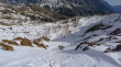
Heading down now... where we took a direct route down the south side of Fortune Peak... Esmerelda Peaks across the valley.
|
Steep terrain on the south side of Fortune Peak.
|
Almost down to the Esmerelda Basin Trail... which we will use to close the loop portion of our trip and get back to the car.
|
