Jim Hill Mountain - 7.10.2014
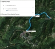
Directions from Stevens Pass to the Stevens Pass Nordic Center... where we parked to start this trip.
|
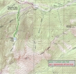
Our approximate route to the summit of Jim Hill Mountain... ~6 miles roundtrip, gaining ~3800 feet of elevation.
|
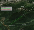
A google earth look at the terrain around Jim Hill Mountain.
|
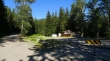
We parked at the Stevens Pass Nordic Center (3000')... we will find the trailhead a very short distance up the road on the left.
|
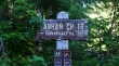
The Lanham Lake Trailhead sign has seen better days.
|
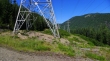
The trail crosses underneath a power line after hiking less than a half mile.
|
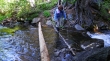
After hiking 1.6 miles, BarbE crosses the outlet of Lanham Lake (4143')... and continues around the east side of the lake on a good path.
|
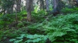
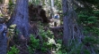
Approximately 50 yards after crossing the outlet of Lanham Lake we left the path and headed uphill in dense brush.
|
Really?... you have got to be kidding.
|
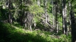
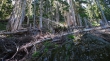
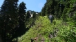
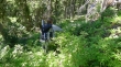
Lots of this in getting from Lanham Lake up to the north ridge of Jim Hill Mountain.
|
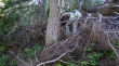
Tree hugging on the way to the north ridge of Jim Hill Mountain.
|
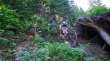
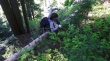
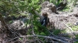
Did I mention the dense brush?
|
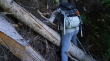
Route finding by BarbE.
|
Arg...
|
Will it ever end?
|
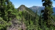
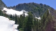
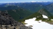
Finally we reached the north ridge (5500') of Jim Hill Mountain... Rock Mountain, Mt. Howard and Mt. Mastiff in the distance on the right.
|
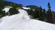
On the north ridge of Jim Hill Mountain... and heading toward it... much friendlier terrain now.
|
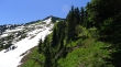
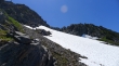
On the north ridge of Jim Hill Mountain and getting closer.
|
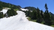
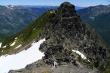
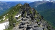
The true summit is in the right center of the photo... we will head for the notch in the center of the photo.
|
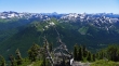
Looking back down the north ridge of Jim Hill... Glacier Peak in the distance on the left... with Rock, Howard and Mastiff in the right foreground.
|
Our approximate route to the Jim Hill summit.
|
BarbE, Izzy and Snowdog are heading for the notch... while an alien ship watches from above.
|
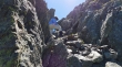
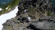
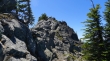
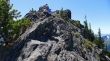
BarbE heads up a gully that leads to the notch.
|
Snowdog and BarbE wait for me in the notch.
|
Looking down on Lanham Lake from the notch area.
|
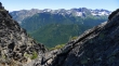
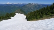
The Chiwaukum Mountains from just above the notch.
|
Snowdog tethers Izzy in the notch while BarbE starts up.
|
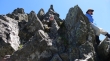
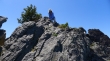
There is a 50 foot section where no mistakes are allowed.
|
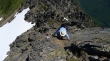
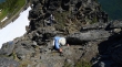
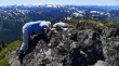
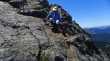
Almost done with the Class 3 climbing.
|
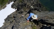
Almost done with the hard stuff.
|
Snowdog starts up the crux... with the east summit behind.
|
Easier terrain now... but that isn't the summit.
|
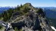
Just a stroll now over to the summit.
|
Looking north from the Jim Hill summit... part of the Chiwaukum Mountains on the left... with the Stuart Range beyond.
|
BarbE and Snowdog looking for the summit register.
|
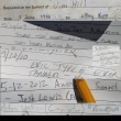
A montage of entries in the summit register... which was placed 28 years ago.
|
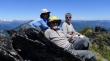
BarbE, ragman and Snowdog on the Jim Hill summit (6765')... and one pesky mosquito.
|
Snowdog leads the way down from the summit.
|
BarbE works her way back down to the notch.
|
BarbE still descending.
|
Almost back down to the notch.
|
Heading back down the north ridge of Jim Hill Mountain.
|
Oh joy... it is time to bushwhack our way down to Lanham Lake.
|
Did I mention the dense brush?
|
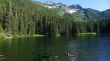
Back to Lanham Lake... and Izzy gets to swim... Jim Hill Mountain above... a 1.6 mile hike on good trail will get us back to the car.
|
