Dixon Mountain - 8.8.2014
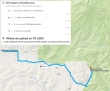
Directions from Whittaker's Bunkhouse in Ashford to where we parked on FS-5260.
|
Our approximate route from the Borrow Pit to the summit of Dixon Mountain... ~8 miles roundtrip, gaining ~2000 feet of elevation... 3.6 of the 8 miles was on FS-5260.
|
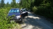
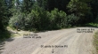
We drove 3.7 miles on FS-5260... and parked (~3400') due to poor road conditions.
|
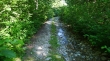
An example of what FS-5260 looks like for the next third of a mile beyond where we parked.
|
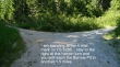
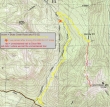
After walking FS-5260 for a third of a mile... the road makes a hairpin turn at the 4 mile mark... leaving another 1.5 miles to reach the Borrow Pit.
|
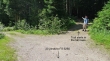
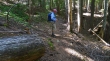
Denali Girl at the Borrow Pit (~4000').
|
From the Borrow Pit we have walked 50 yards back the way we came... and will follow the side road for 20 yards.
|
20 yards from FS-5260 the road forks... stay to the right and enter a small campsite area.
|
The unsigned, unmaintained trail starts from the campsite area.
|
The cut tree in the left foreground indicates that this trail got some kind of attention in the past... and the trail was easy to follow for the first half-mile while it stayed in the tall trees.
|
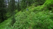
The trail was harder to follow after the first half-mile.
|
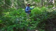
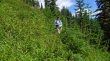
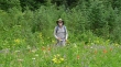
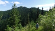
Denali Girl is on the overgrown trail.
|
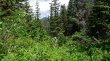
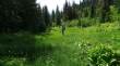
Still on the trail... with Mt. Rainier barely visible in the clouds beyond.
|
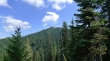
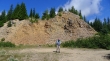
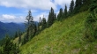
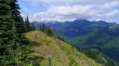
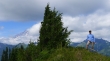
First good look at Dixon Mountain.
|
Yes... still on the trail.
|
On the trail and bashing our way through.
|
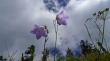
ragman and some nice flowers.
|
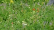
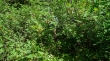
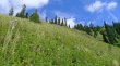
Lots of variety.
|
Still able to follow the unmaintained trail.
|
We have lost the trail... but just need to work our way up to the ridge above.
|
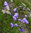
Harebells... and not sure what the white flower is.
|
Underneath a couple of harebells.
|
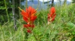
Paintbrush.
|
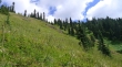
Denali Girl is traversing on the west side of Dixon Mountain... as the faint path leads us over to Dixon's south ridge.
|
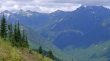
From Dixon's south ridge it was short walk up to the summit (5134')... some of the Tatoosh Peaks on the horizon... with Mt. Rainier peaking above the clouds on the left.
|
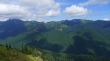
Plummer Peak on the far left... then Pinnacle Peak and The Castle... with Manatee Peak in the center... and Unicorn Peak on the right in the clouds.
|
Unicorn Peak is in the clouds on the left... with Tatoosh Peak on the right.
|
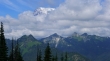
Mount Rainier towers over Point 5868 in the left foreground... with Plummer Peak, Pinnacle Peak and The Castle beyond.
|
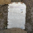
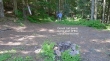
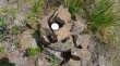
Fay Pullen placed the summit register in 2008... and only 23 entries since then.
|
The summit register was wet... so I dried it out... and gave it some more protection.
|
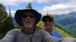
A selfie from the Dixon Mountain summit... Mt. Rainier is in the clouds above Denali Girl's head.
|
Preparing to leave the Dixon Mountain summit.
|
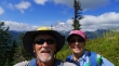
A selfie taken just below the Dixon Mountain summit... with Mt. Rainier in the distance.
|
Coming down from the Dixon Mountain summit area.
|
Last look at Dixon Mountain... a half-mile or so to get back to the trailhead... then a 1.8 mile road walk to the car.
|
