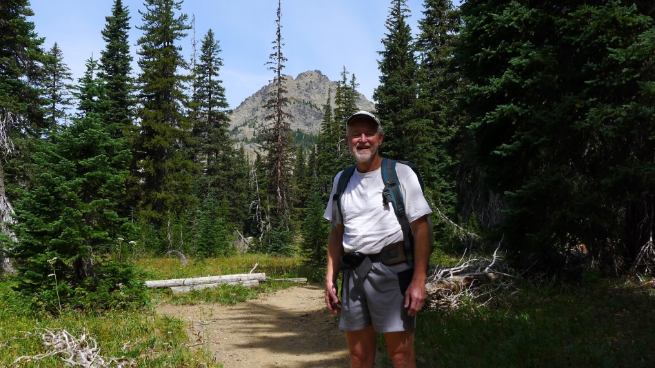
Hawkins Thimble - 7.15.2015
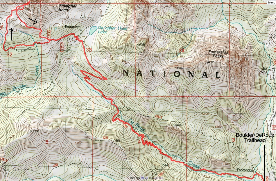
A photo of the GPS track for our trip to Hawkins Thimble... 11.8 miles roundtrip, gaining 3564 feet of elevation.
|
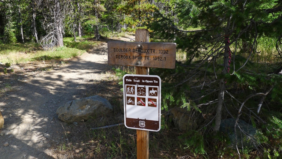
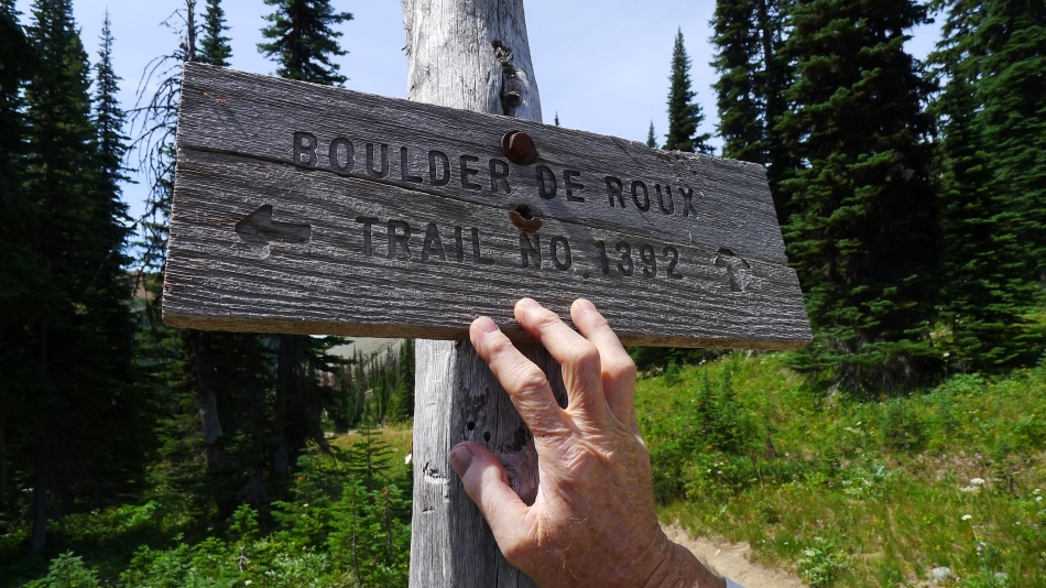
We started at the Boulder DeRoux Trailhead located at the north end of the DeRoux Campground... the 'Trailhead Directions' link above these photos will only take you to the entrance for the campground... then you still need to drive another quarter mile to the north end of the campground to find the trailhead.
|
After hiking ~1.5 miles we reached a junction with the DeRoux Spur Trail... but we will continue toward Gallagher Head Lake.
|
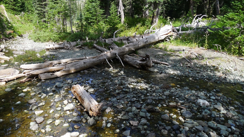
After hiking ~3 miles the trail crosses DeRoux Creek.
|
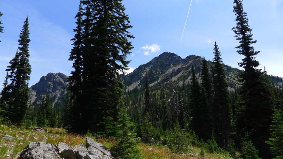
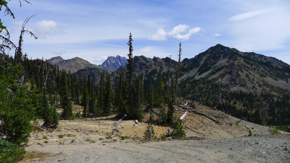
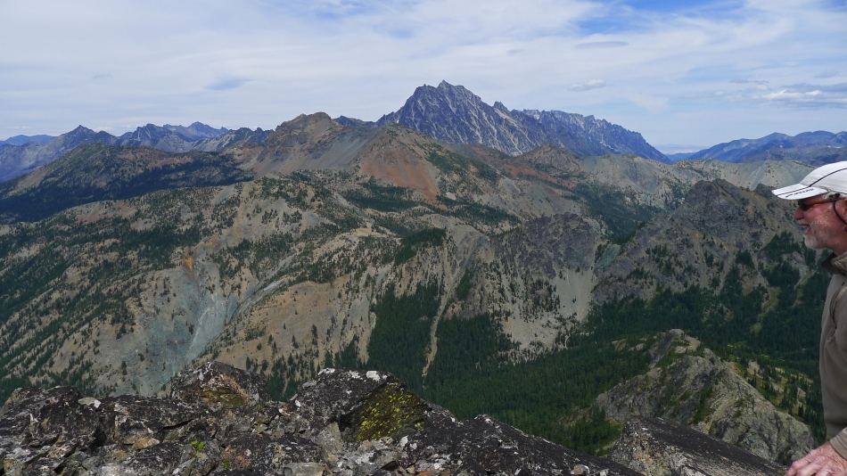
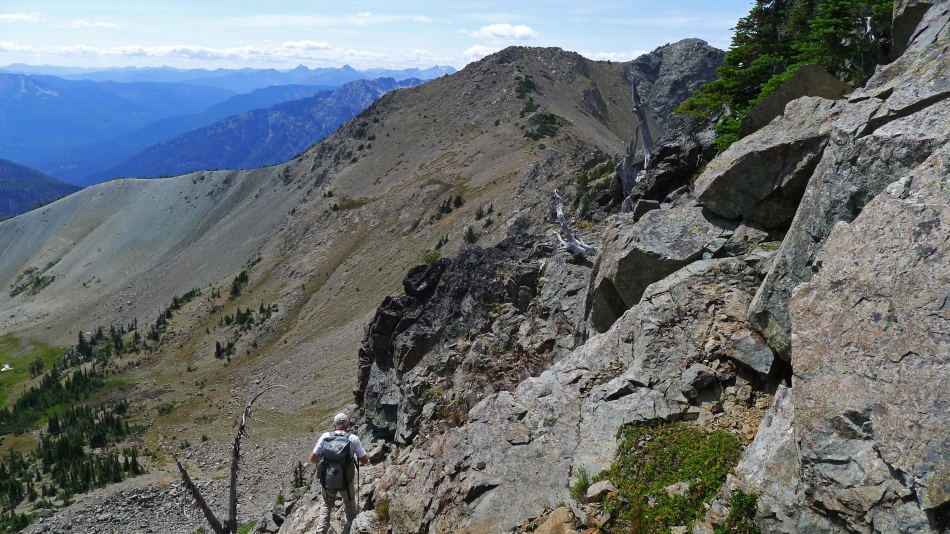
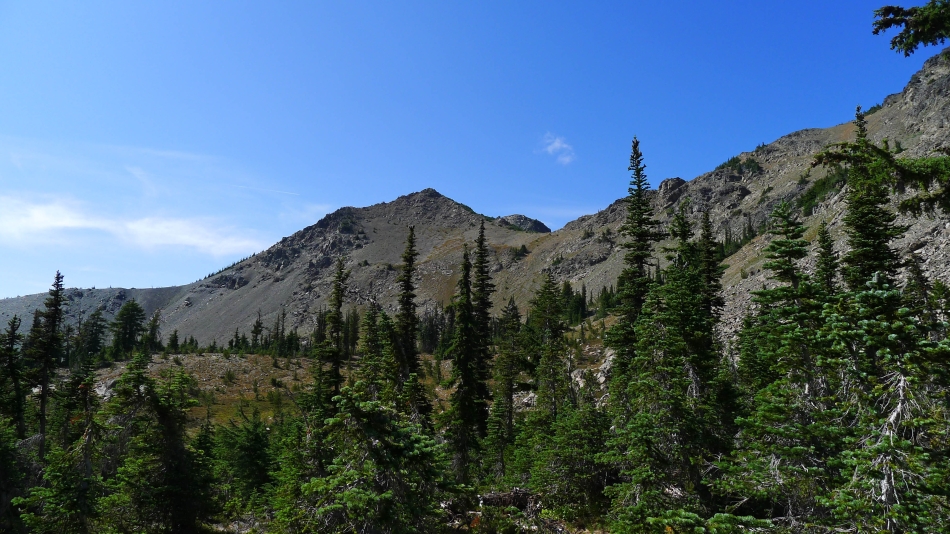
Shortly after crossing DeRoux Creek we got our first good look at the east end of Hawkins Mountain... and Hawkins Thimble is in that vicinity.
|
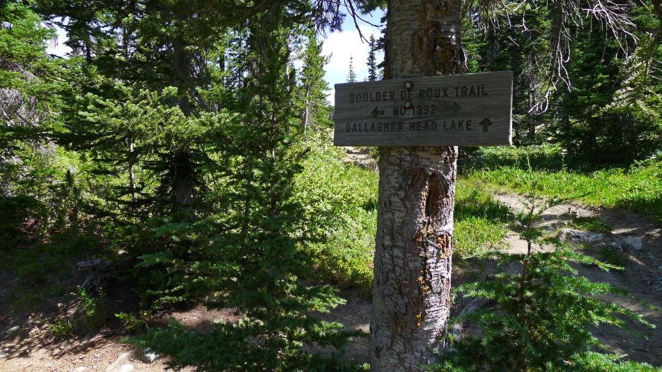
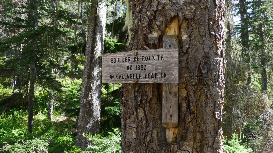
After hiking ~4 miles we have reached a junction with the trail leading to Gallagher Head Lake... but we will continue on the Boulder DeRoux Trail.
|
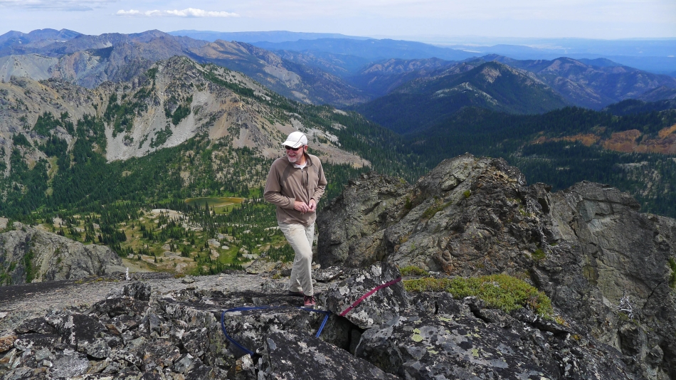
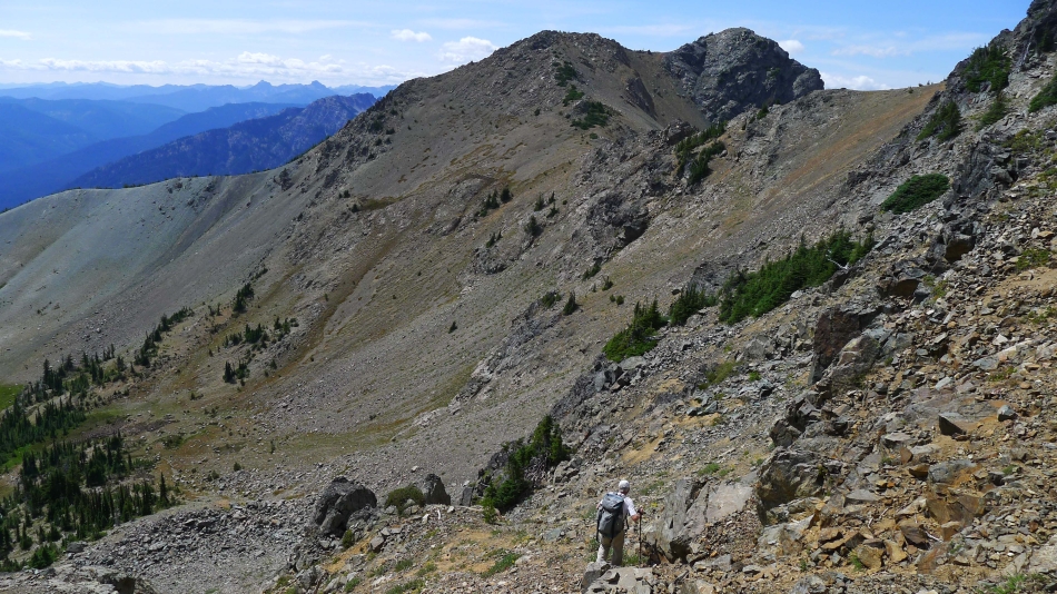
High enough above Gallagher Head Lake to see the west end of Esmeralda Peak on the right... and the end of Esmeralda's north ridge on the left.
|
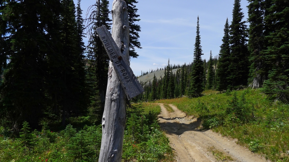
This trail sign is in trouble... but rocman will give it some assistance in the next photo. This is Road 301... and it goes downhill from here and connects with the Boulder DeRoux Trail in a half-mile... and then continues on for another half-mile and dead ends on the NW side of DeRoux Peak.
|
rocman holds up the broken piece of the trail sign... we will turn right here and go slightly uphill on Road 301... back in the direction of Gallagher Head Lake and look for Road 304.
|

We walked on Road 301 for a very short distance and turned left onto Road 304.
|
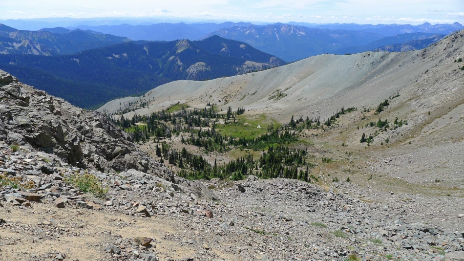
Near the end of Road 304 which has taken us into the basin on the south side of Hawkins Mountain... looking back at Ingalls Peak and Fortune Peak on the left... and through the gap to Mt. Stuart... with Esmeralda Peak on the right.
|
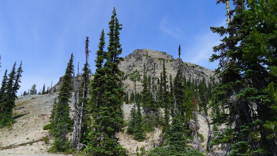
The main summit area of Hawkins Mountain from the basin.
|
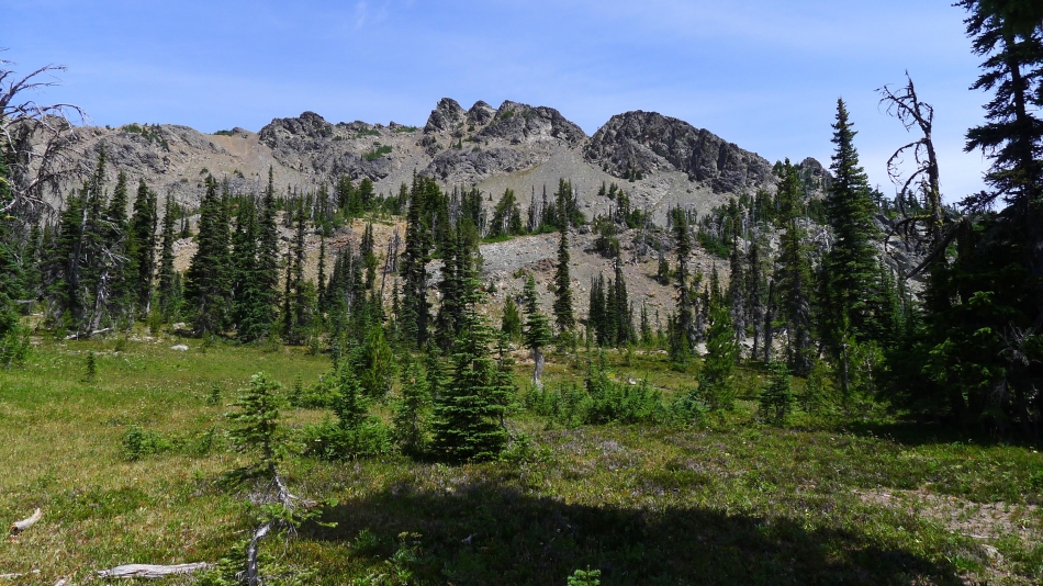
Hawkins Thimble is up there somewhere... but which bump?
|
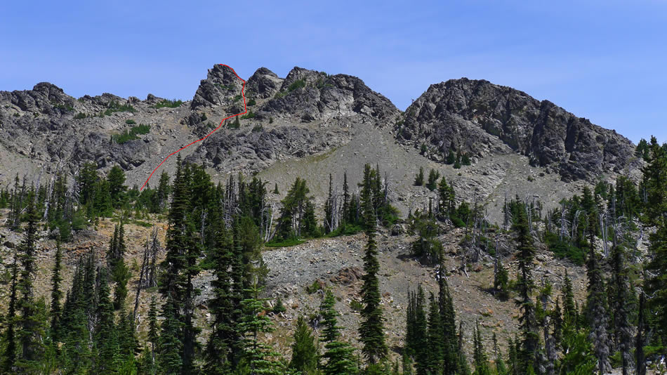
We didn't know it at the time I took this photo... but this ended up being our route to the top of Hawkins Thimble.
|
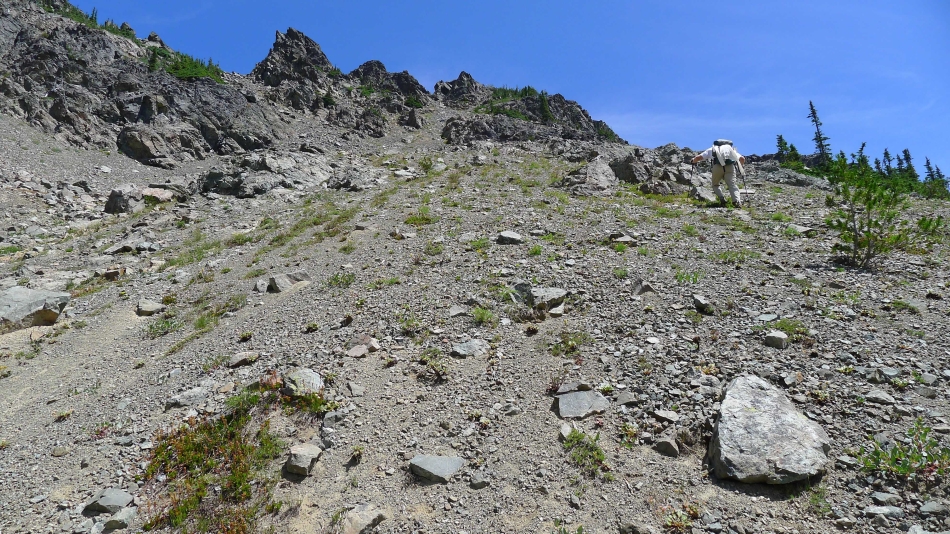
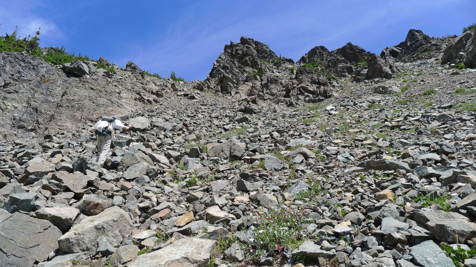
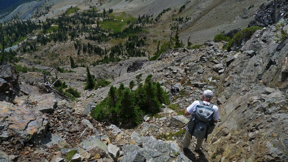
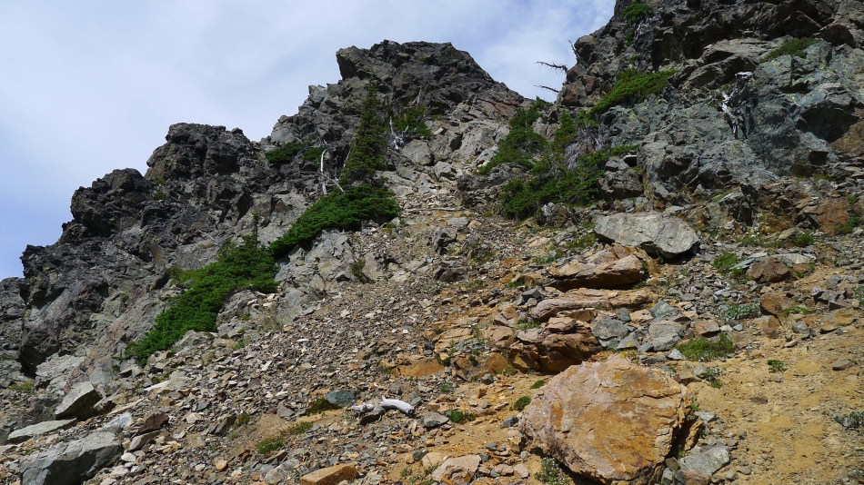
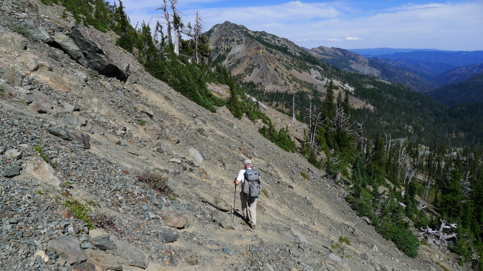
The terrain is steeper than it looks in the photo... not the most pleasant part of the trip.
|
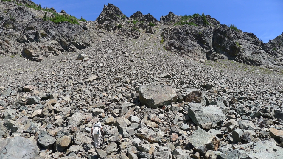
The boulder field is a lot better than the loose scree we were on earlier.
|
rocman working the boulder field.
|
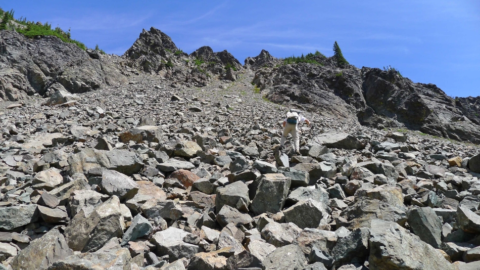
Still on the boulder field... heading for the bump in the center of the photo.
|
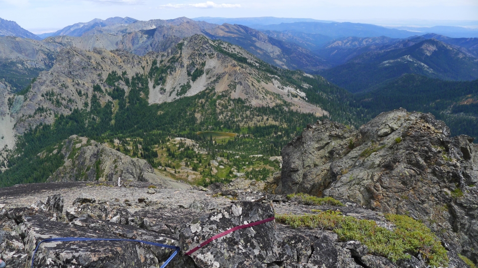
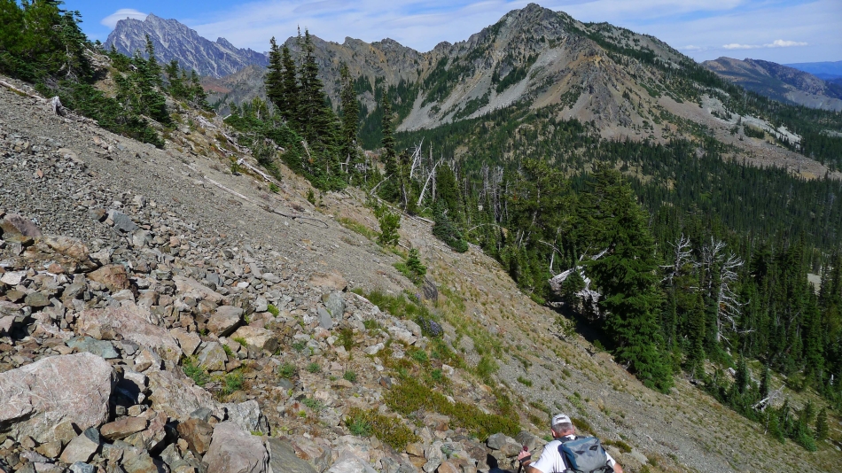
Looking back down at the basin on the south side of Hawkins Mountain.
|
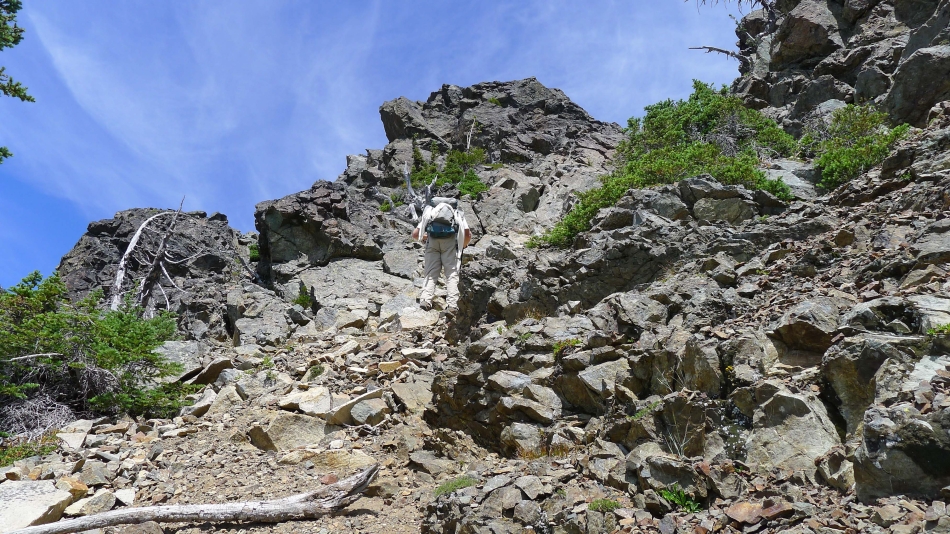
Still ascending toward Hawkins Thimble.
|
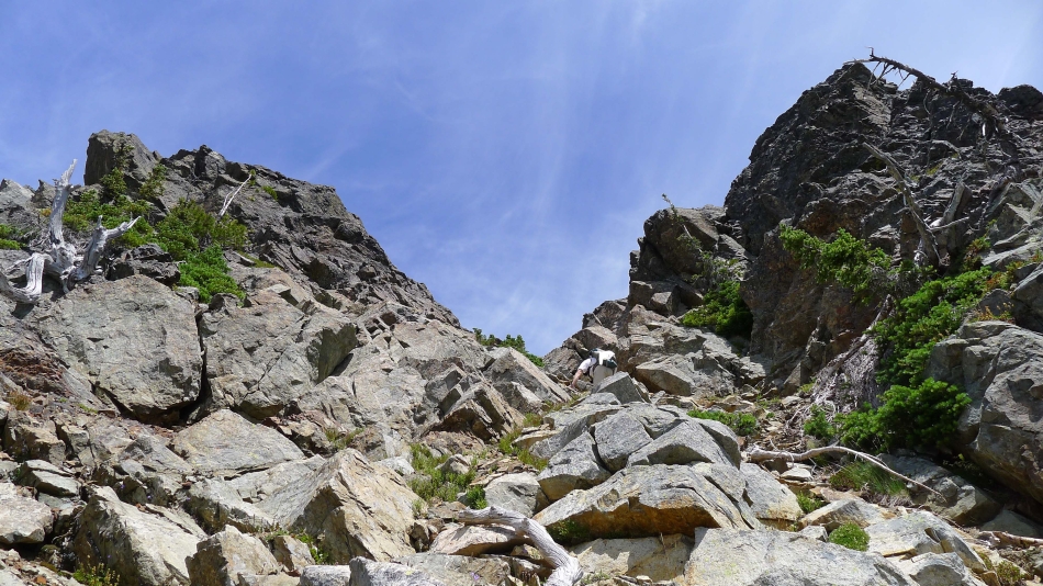
Nearing the col between Hawkins Thimble (left) and a false thimble on the right.
|
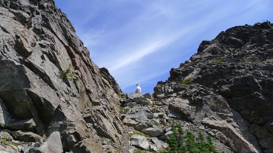
rocman at the col... looking for the best way to get to the top of Hawkins Thimble.
|
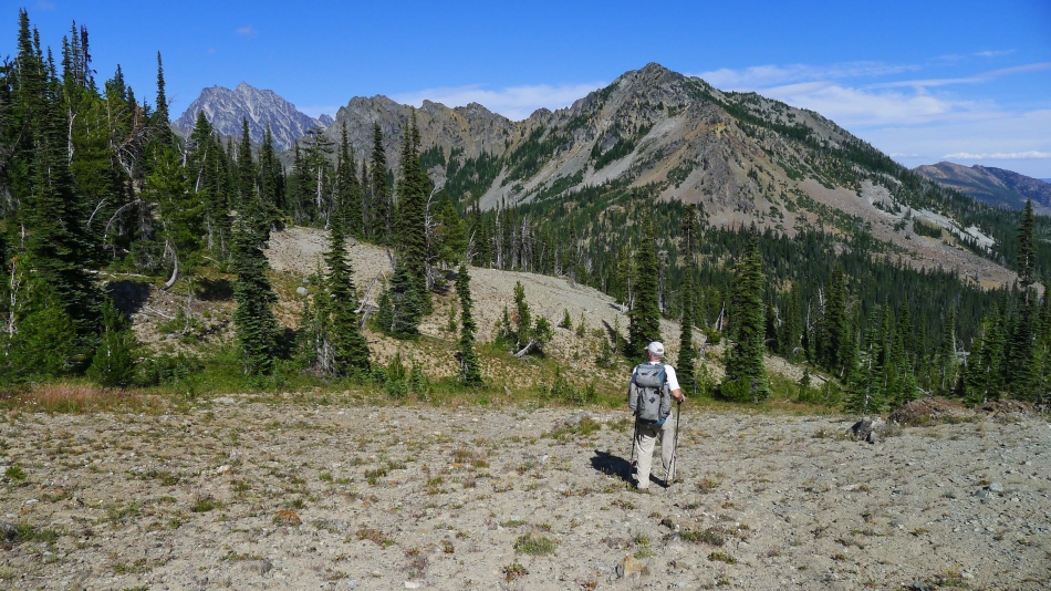
From the col we are looking at Ingalls Peak and Fortune Peak in the left foreground... with Esmeralda Peak and Gallagher Head Lake in the right foreground... with the Stuart Range on the left horizon... and lots of Teanaway Peaks on the right horizon.
|
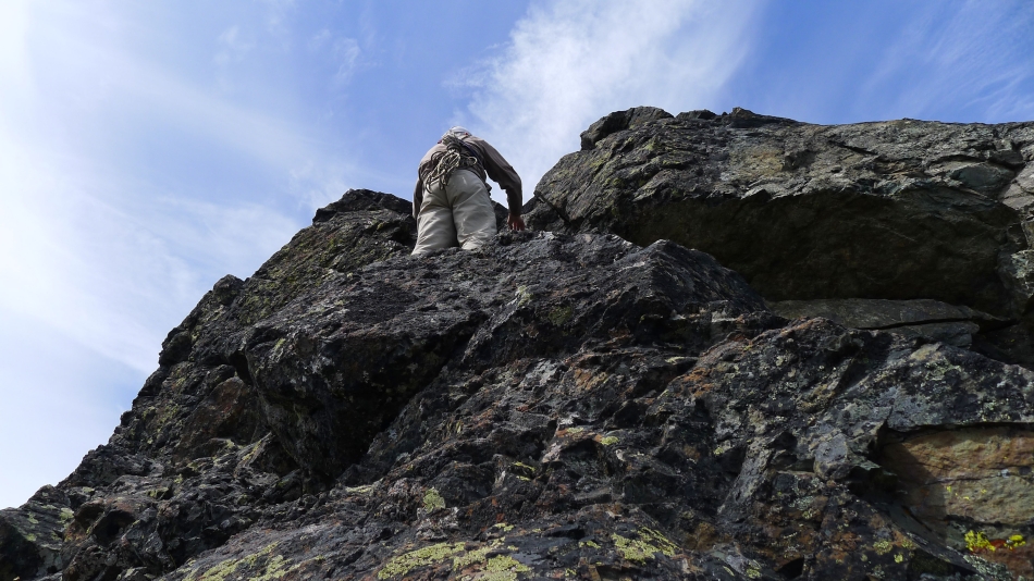
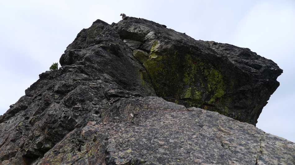
This is what we ended up doing to get to the top of Hawkins Thimble.
|
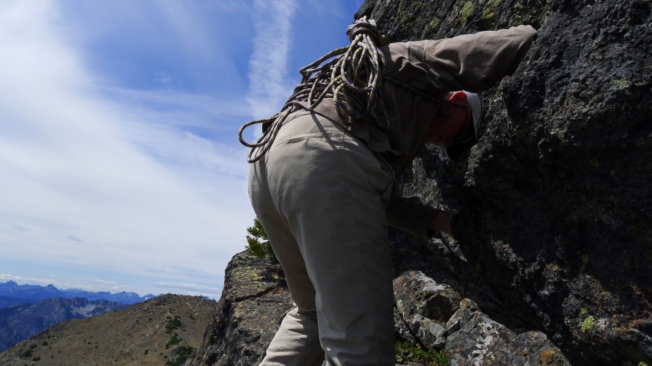
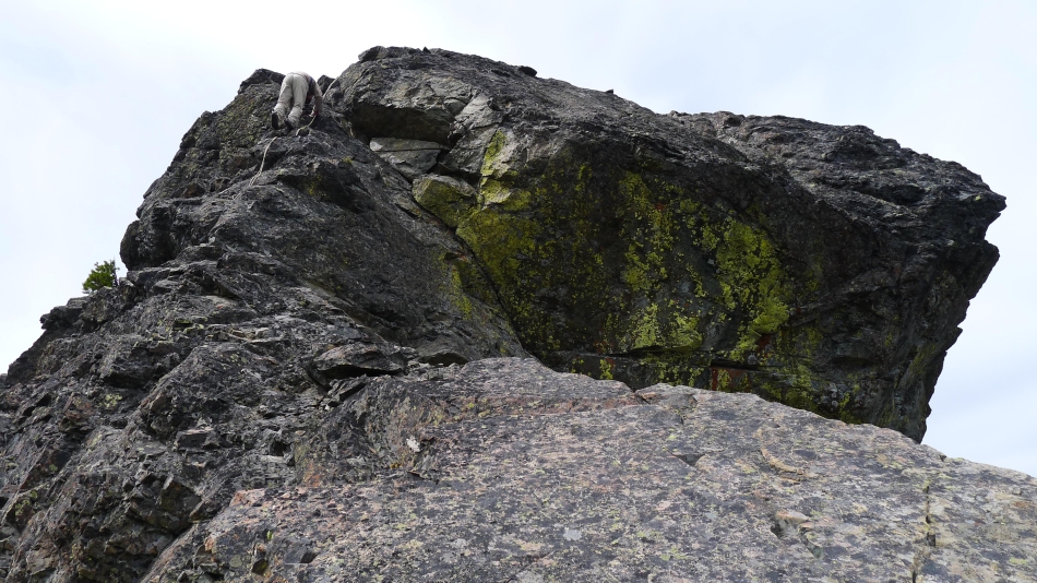
rocman leads the way... rock climbing shoes were very helpful.
|
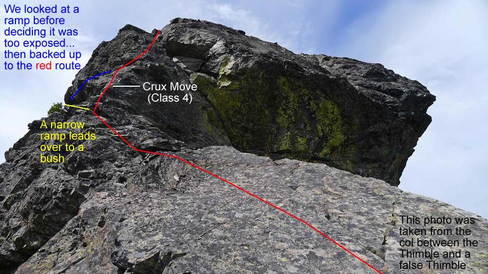
rocman on the narrow ramp to see if it will work.
|
rocman backing down the ramp after deciding he didn't like the exposure.
|
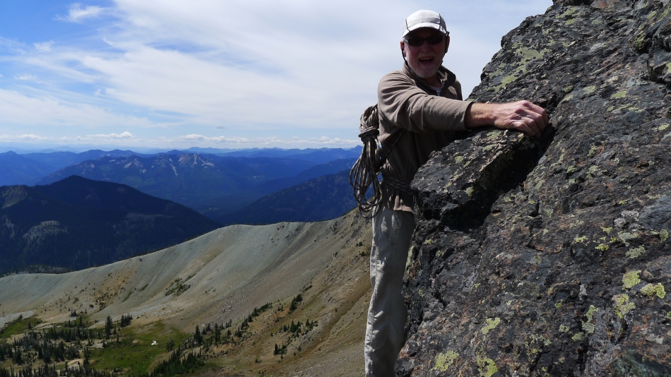
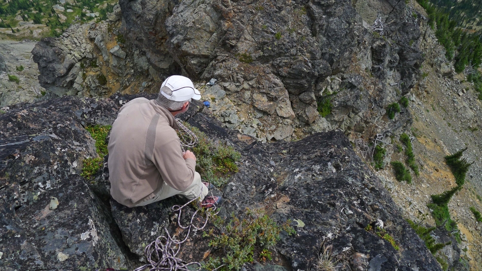
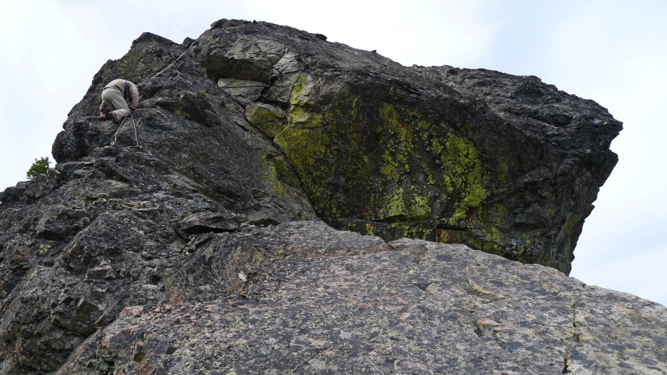
rocman above the one Class 4 crux move... taking our 'panic rope' to the summit... which he will rig to assist me on the way up.
|
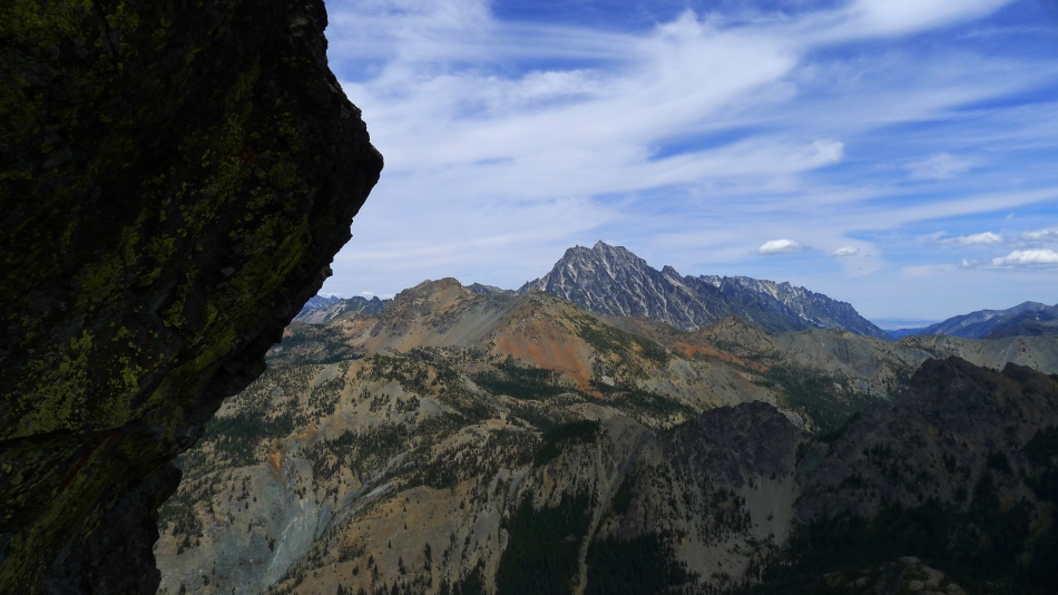
While rocman was rigging our 'panic rope' I took this photo looking across Fortune Creek Pass to Ingalls Peak, Fortune Peak and the Stuart Range.
|

The false Thimble was behind me.
|
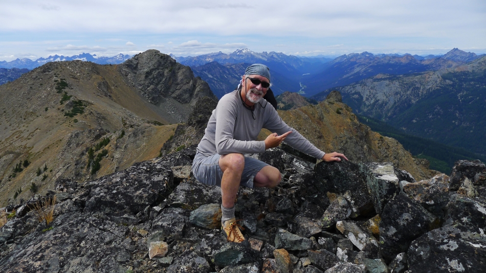
On the Hawkins Thimble summit (7080')... with Gallagher Head Lake below at the foot of Esmeralda Peak.
|
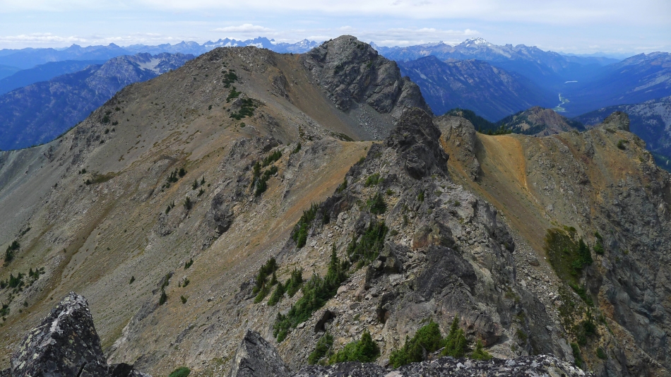
The main summit of Hawkins Mountain in the foreground.
|
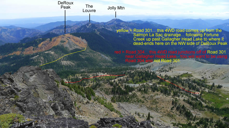
The basin on the south side of Hawkins Mountain and some info on the 4WD roads in the area... your friend here is Road 304... and not Road 301.
|
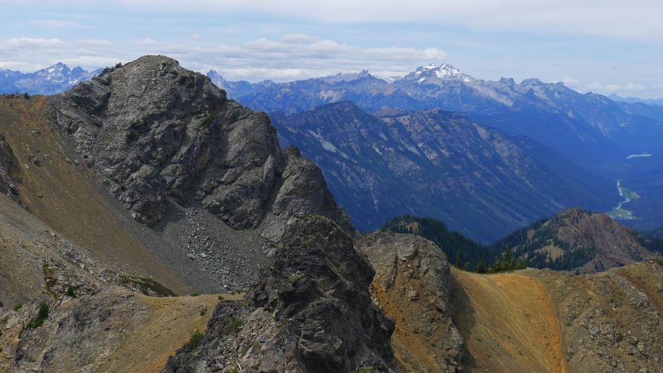
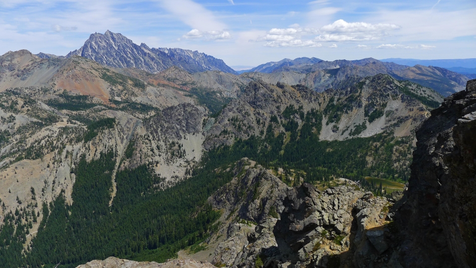
The main summit of Hawkins Mountain in the left foreground... with Summit Chief Mountain on the far left... and Mt. Hinman and Mt. Daniel in the right-center.
|
Looking across Fortune Creek Pass to Ingalls Peak and Fortune Peak with the Stuart Range behind... Hi-Jack Mountain, Eightmile Mountain and Cashmere Mountain on the left horizon... with Three Brothers on the right horizon.
|
Me on the Hawkins Thimble summit... looking up valley to Hyas Lake in one of the valleys that separates the Home Court peaks (left) from the Back Court peaks.
|
Looking down on Gallagher Head Lake at the foot of Esmeralda Peak... rocman has rigged our 'panic rope' off of two double slings.
|
rocman gets ready to toss our 'panic rope' down the route we will down climb to get back to our packs.
|
rocman prepares the 'panic rope' for his descent.
|
Coming down... the lower end of the rope is near the Class 4 crux move.
|
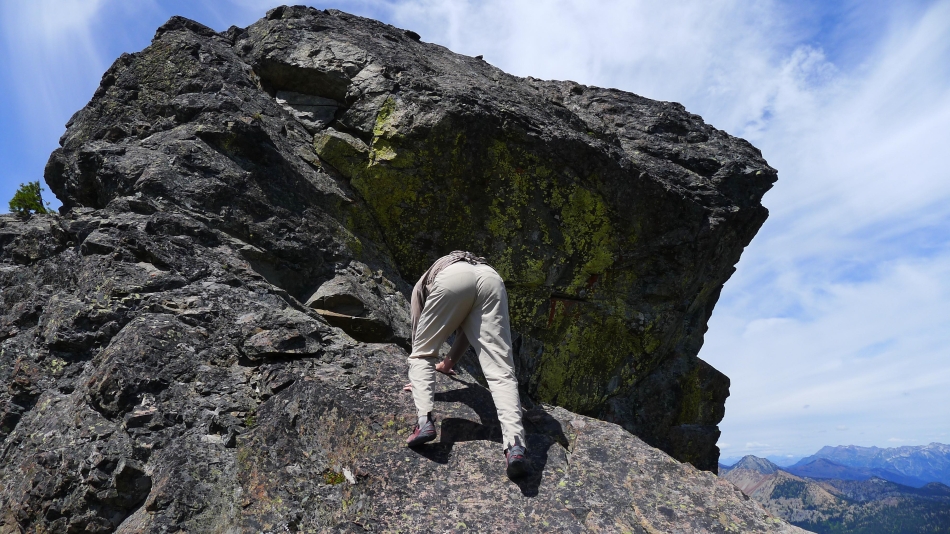
Working the Class 4 crux move.
|
Heading down from the col.
|
Descending from the col... with the true summit of Hawkins Mountain in the distance.
|
Looking back up at Hawkins Thimble as we descend.
|
Still working our way down the loose scree.
|
On a bench at ~6400 feet... as we traverse around the south side of the Thimble.
|
Looking back at the main summit of Hawkins Mountain as we continue to traverse around the south side of the Thimble.
|
Ugh... back on some loose scree... our short cut probably saved a half-mile of distance... but may have taken longer than if we had gone back the same way we came up.
|
Still wrapping around the south side of the Thimble as we make a descending traverse... Mt. Stuart appears on the left... almost down to easier terrain.
|
On easier terrain now... and will be back on Road 304 very shortly... leaving a 4.5 mile road and trail hike back to our car.
|
