Navaho Peak and Three Brothers - 8.25.2015
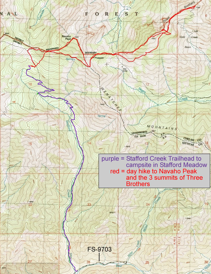
A photo of the GPS track of our 3 day and 2 night backpack trip to do Navaho Peak and all 3 summits of Three Brothers... 20 miles roundtrip, gaining 7420 feet of elevation.
|
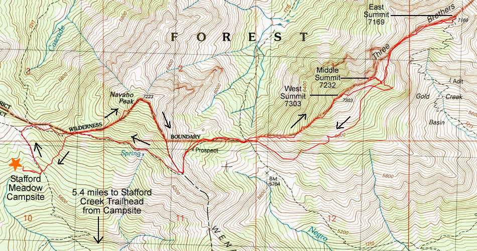
A photo of the GPS track showing the hike/scramble to Navaho Peak and Three Brothers that we did on the second day of our three day trip... 9.3 miles roundtrip, gaining 4590 feet of elevation.
|
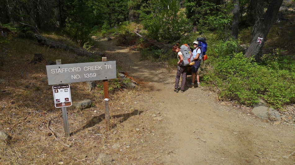
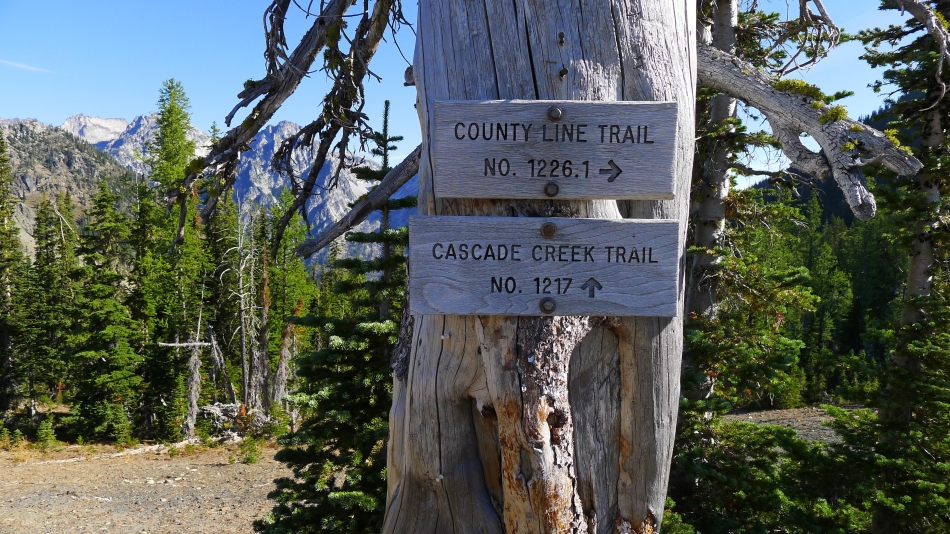
Starting from the Stafford Creek Trailhead (~3050')... using Trail #1359.
|
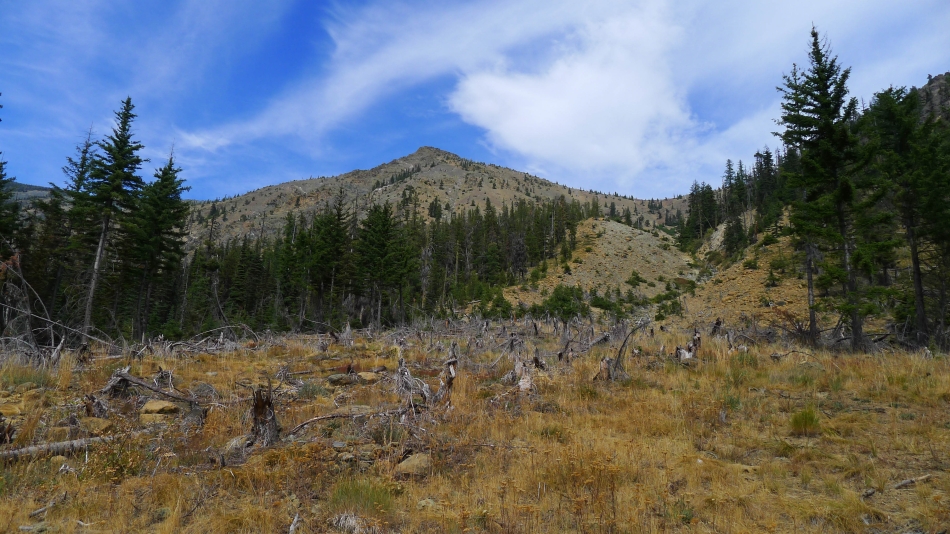
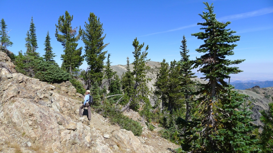
Trail 1359 passes underneath Little Navaho (aka Freedom Peak) on the way to Stafford Meadow.
|
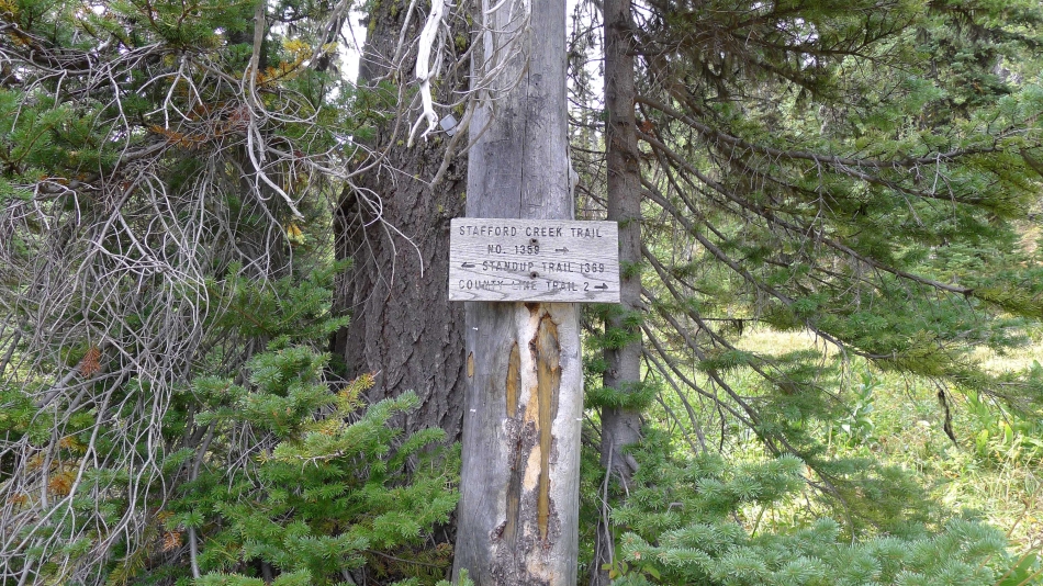
After hiking for a little more than 4 miles we reached a junction with the Standup Trail... but we will continue on the Stafford Creek Trail.
|
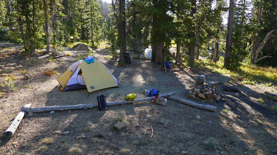
Our campsite at Stafford Meadow (~5660') after hiking a total of 5.4 miles.
|
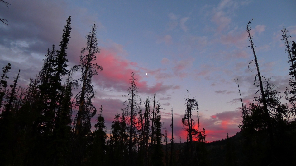
Moon and red sky at sunset from our campsite.
|
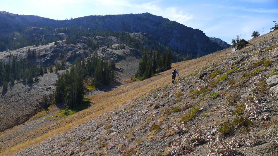
Day hiking from our campsite at Stafford Meadow on the second day of our trip... still on the Stafford Creek Trail... heading for Navaho Pass.
|
We have reached Navaho Pass (~6040') and will head east on the County Line Trail... part of the Stuart Range in the distance.
|
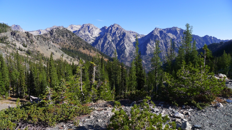
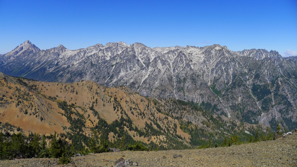
Part of the Stuart Range from Navaho Pass... with Argonaut Peak on the far left to McClellan Peak on the right... Colchuck, Dragontail and Little Annapurna in between.
|
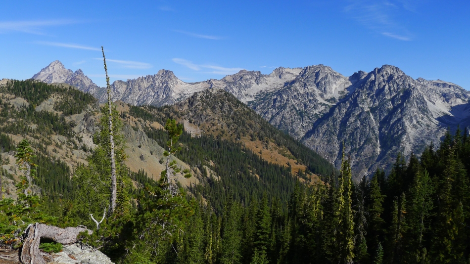
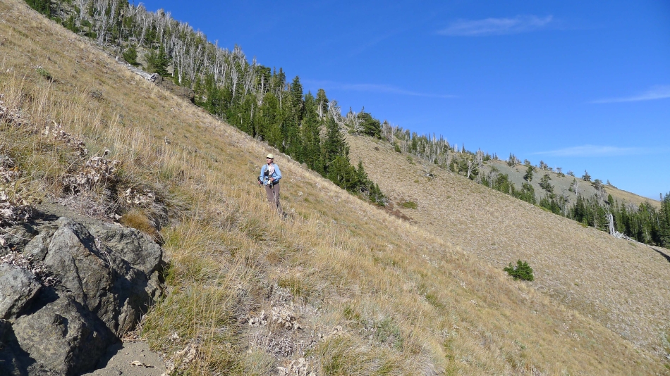
Gaining elevation on the County Line Trail above Navaho Pass... Mt. Stuart and Sherpa Peak on the far left... Enchantment Peak on the far right.
|
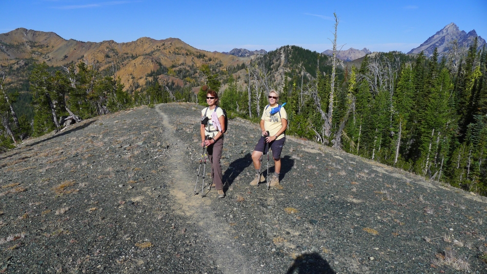
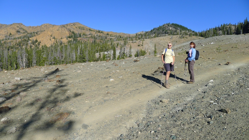
BarbE and Denali Girl on the County Line Trail... Earl Peak on the far left... Mt. Stuart and Sherpa Peak on the far right.
|
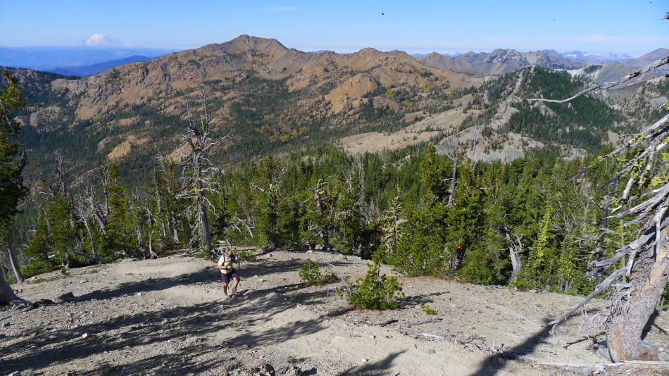
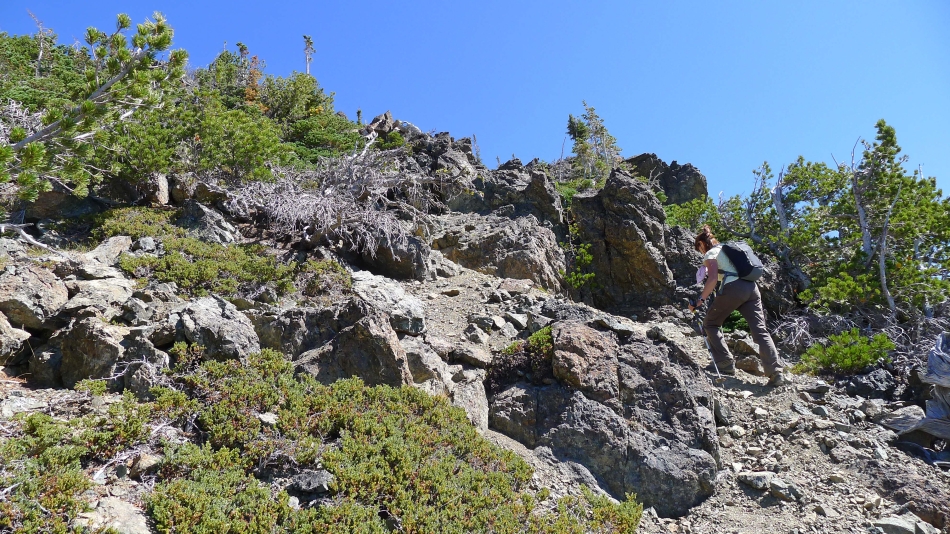
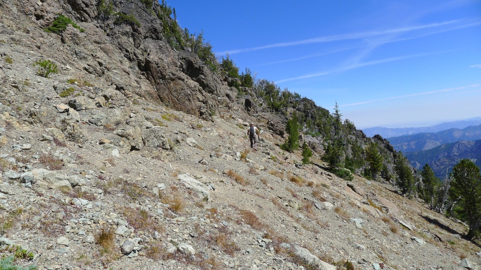
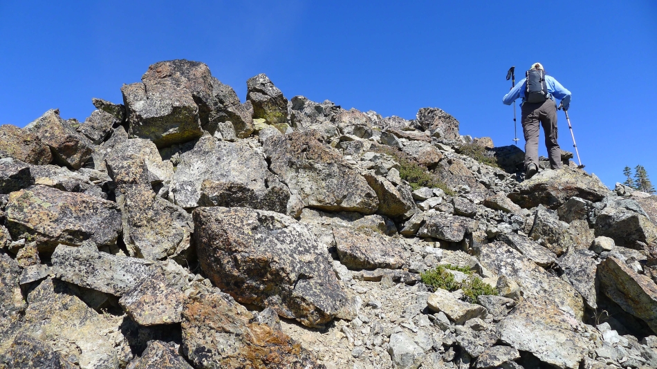
Denali Girl is off of the County Line Trail now and heading up to Navaho Peak on a really obvious boot path... in fact, this path is in better shape than the County Line Trail.
|
BarbE nears the summit of Navaho Peak.
|

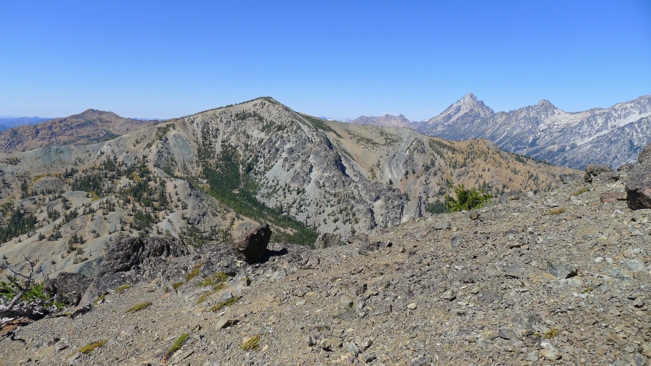
The Stuart Range from just below Navaho Peak.
|
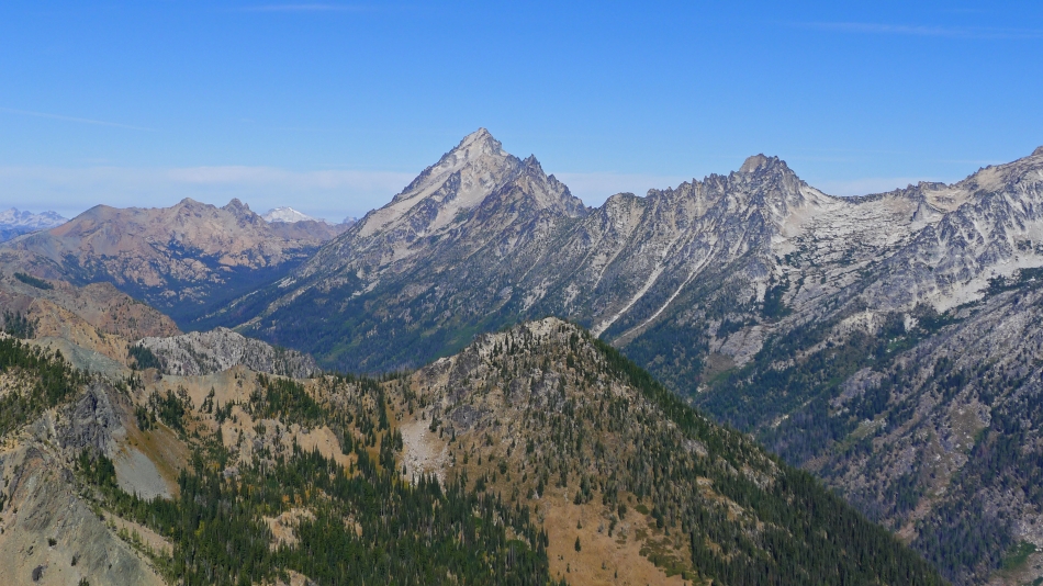
Mt. Stuart and Sherpa Peak look like one mountain in the center of the photo... Argonaut Peak on the right... with Fortune Peak and the three summits of Ingalls Peak on the left... Summit Chief on the far left horizon... with Mt. Daniel between Ingalls and Stuart.
|
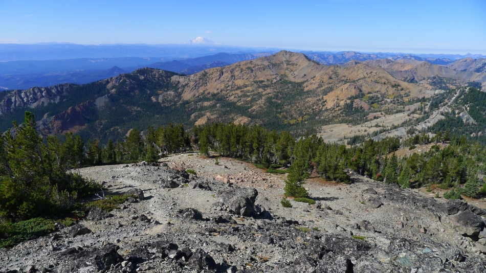
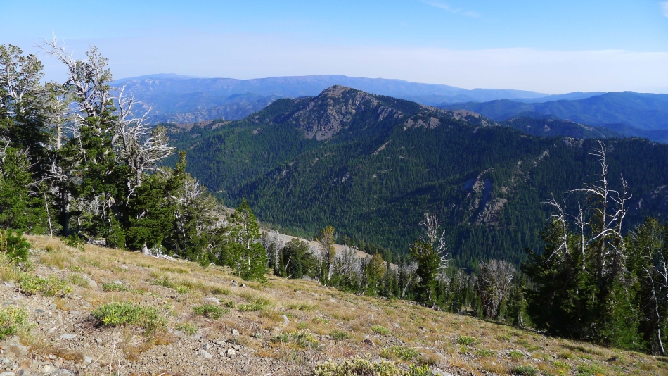
Earl Peak in the foreground... with Mt. Rainier to the left... lots of Teanaway Peaks on the right.
|
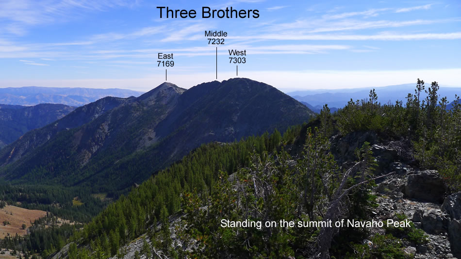
After a short stay on the summit of Navaho Peak we will be heading for the three summits of Three Brothers.
|

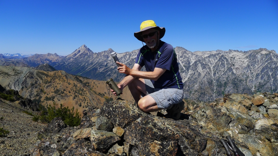
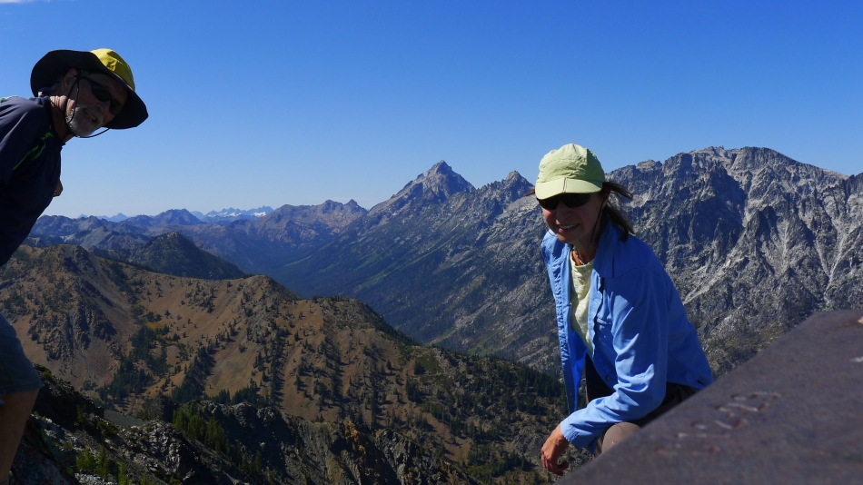
Group shot on the summit (7223') of Navaho Peak... BarbE, Denali Girl and ragman.
|
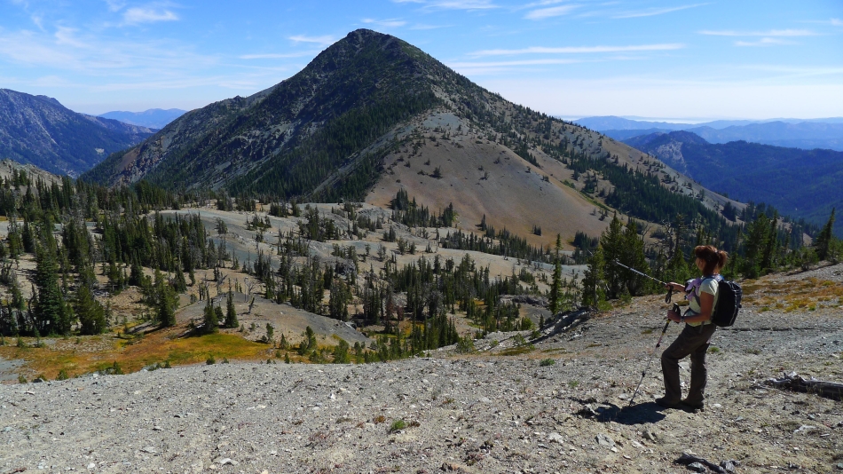
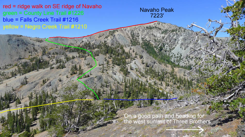
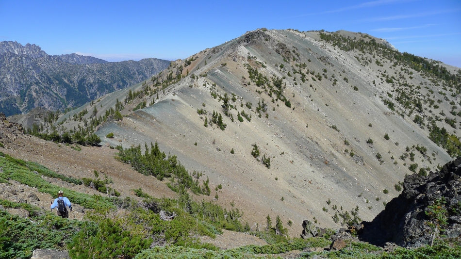
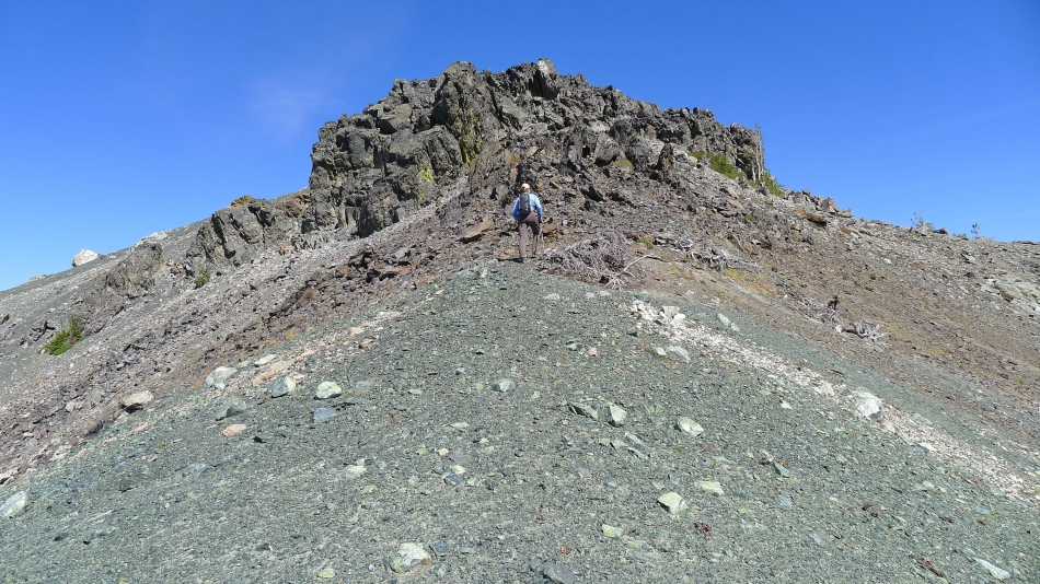
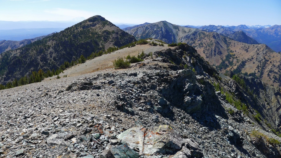
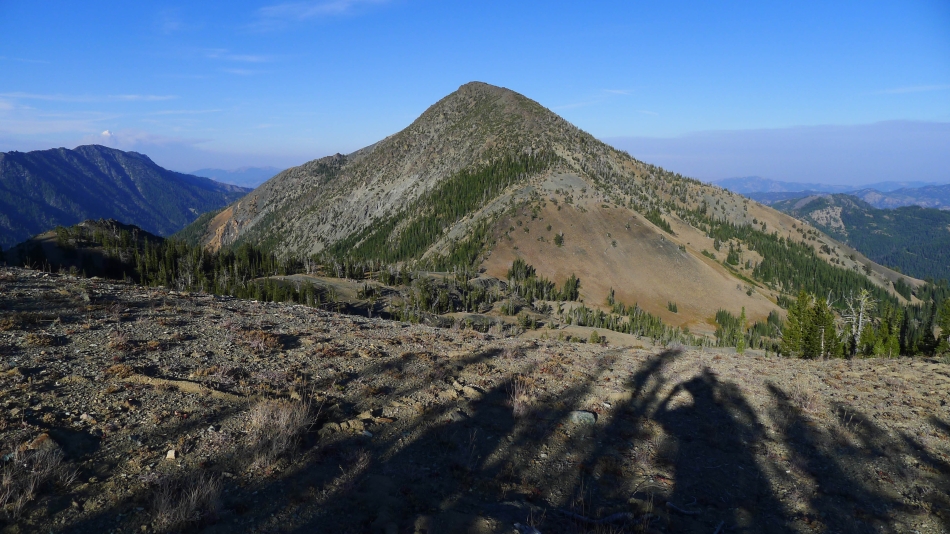
Denali Girl decided to hang out on Navaho as BarbE and I continued down Navaho's SE ridge to where it connects to the County Line Trail... the west summit of Three Brothers is in our face.
|
BarbE starts the painful elevation loss that is required to reach the Three Brothers... Navaho Peak is on the left... McClellan Peak and Temple Ridge on the right.
|
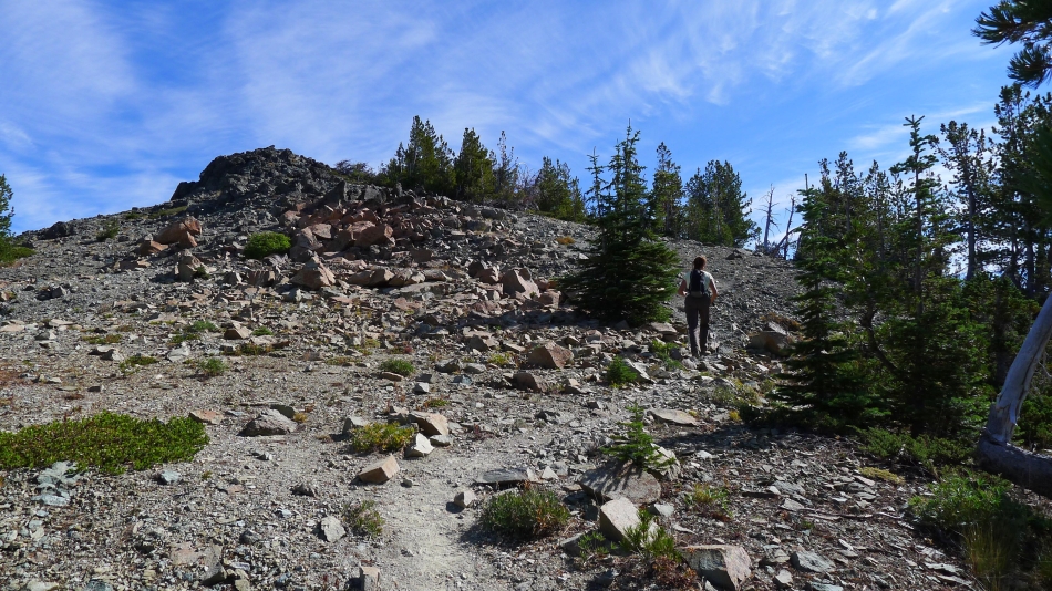
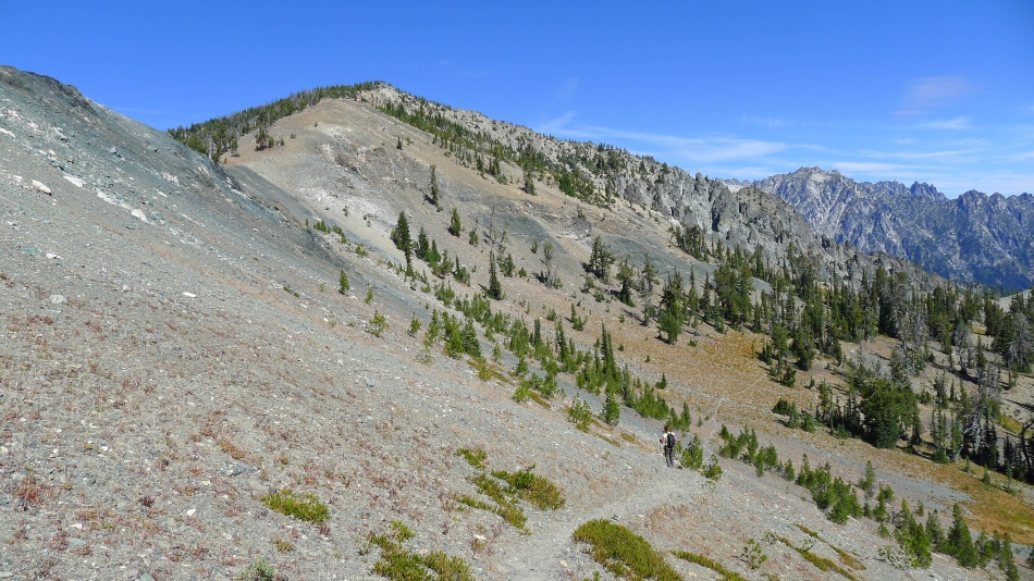
We followed the County Line Trail down from Navaho's SE ridge to a junction with the Falls Creek Trail and Negro Creek Trail... and have left the junction and are on a good path that will take us up to the west summit of Three Brothers.
|
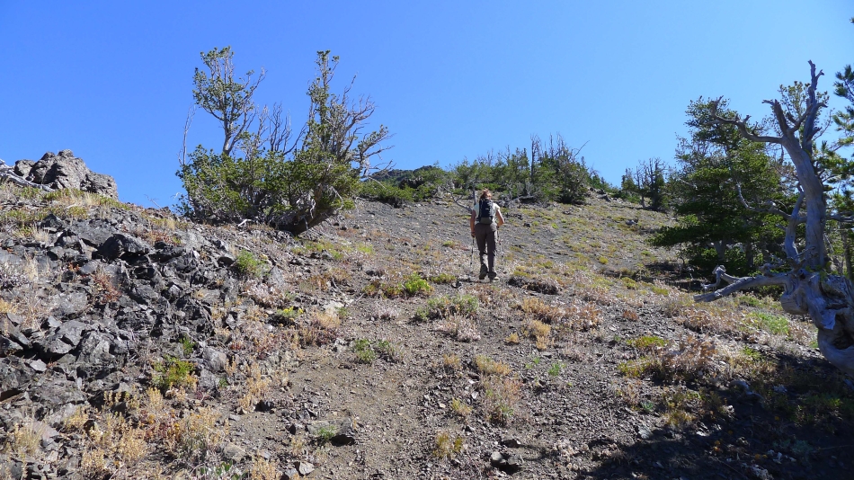
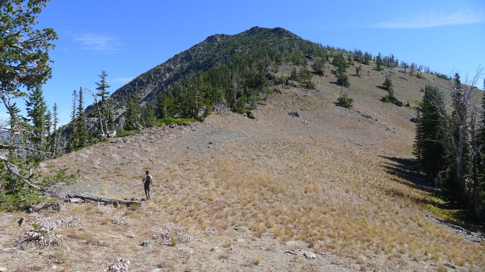
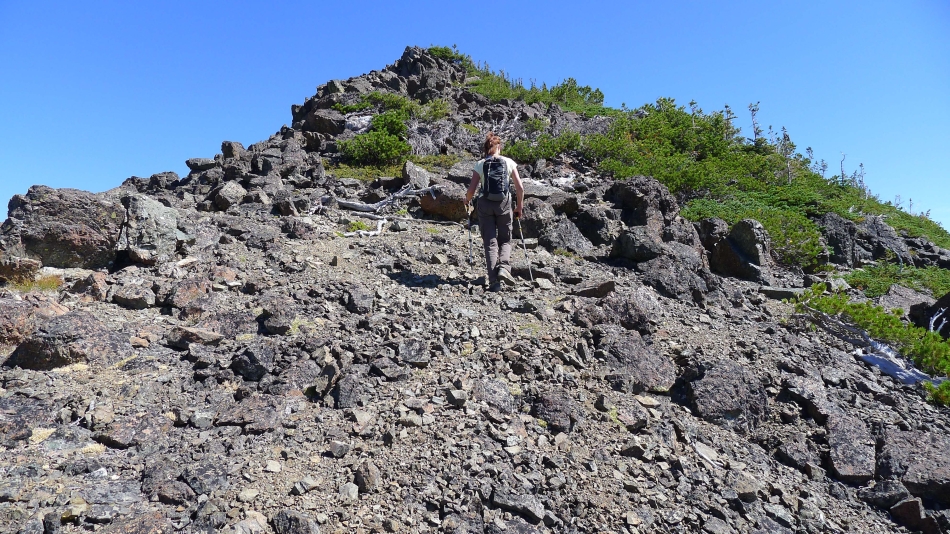
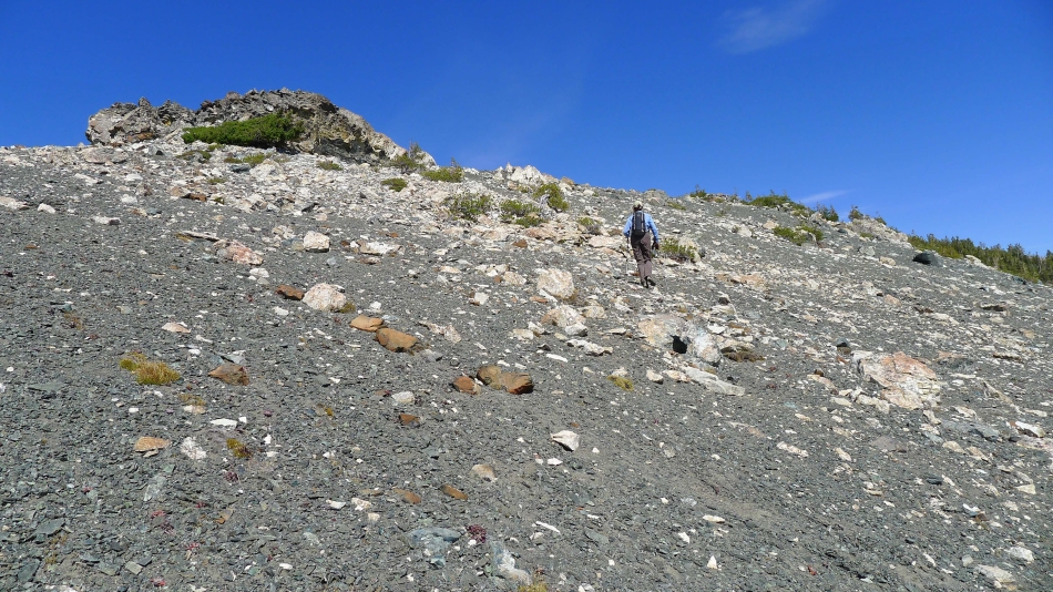
BarbE heading for the west summit of Three Brothers on a good path.
|
Contining toward the west summit of Three Brothers... looking back at our route from Navaho Peak.
|
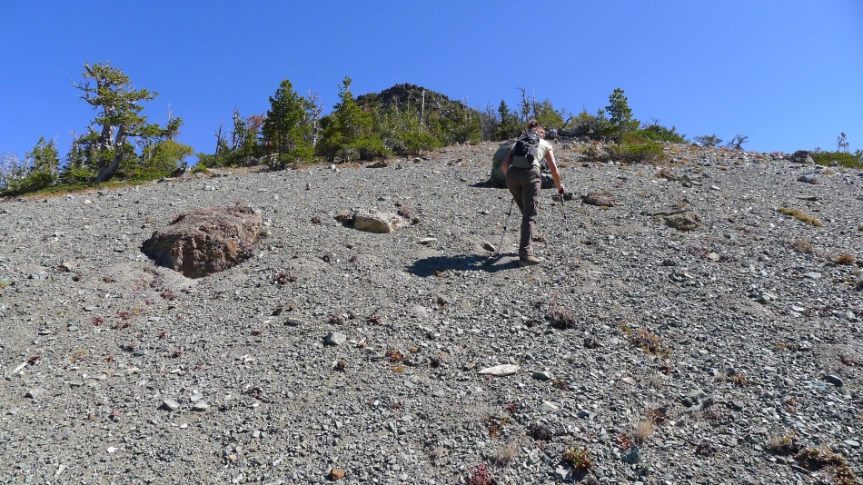
Continuing up toward the west summit of Three Brothers.
|
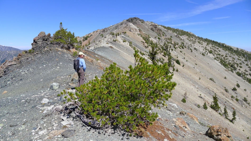
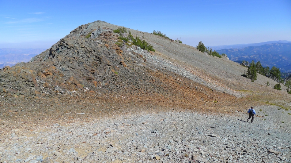
On the path leading to the west summit of Three Brothers... Navaho Peak on the left... with part of the Stuart Range on the right.
|
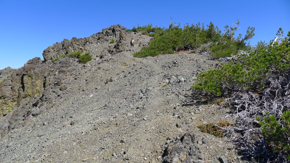
Continuing up... will it ever end?
|
High enough now to see Earl Peak on the far left.
|
BarbE continues... this summit just keeps on teasing.
|
Finally... um, no.
|
On and on.
|
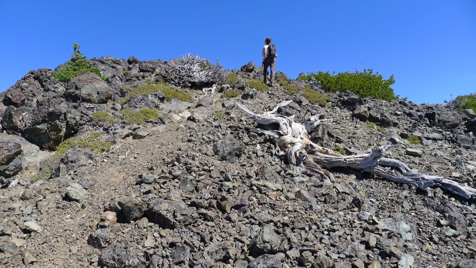
Surely BarbE is getting ready to step on the summit.
|
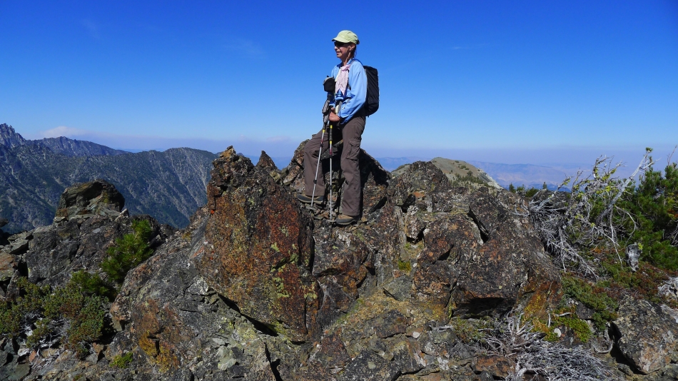
Finally... BarbE is ready to step on the west summit of Three Brothers.
|
ragman on the west summit (7303') of Three Brothers... looks like I'm ready to play the drums.
|
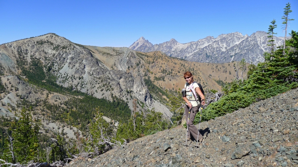
The Stuart Range from the west summit of Three Brothers.
|
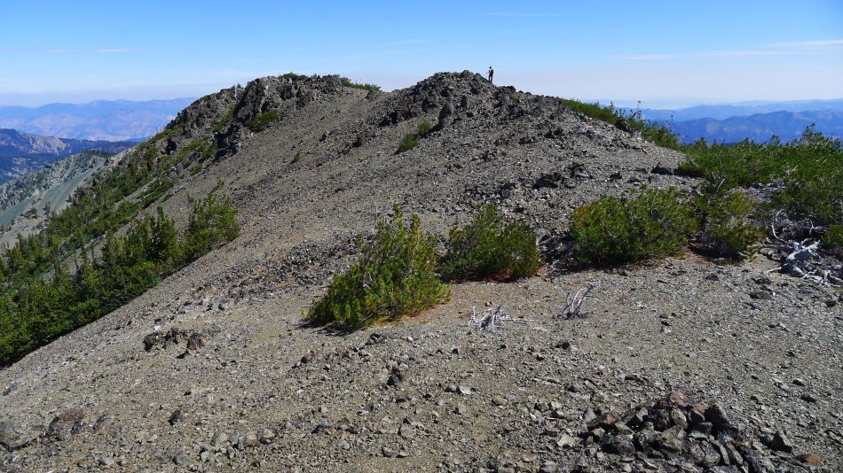
BarbE is side-hilling from the west summit over toward the middle summit of Three Brothers.
|
Looking for the best route to get around the middle summit... we will skip the middle summit for now and go on over to the east summit... then get the middle summit on our way back if time permits.
|
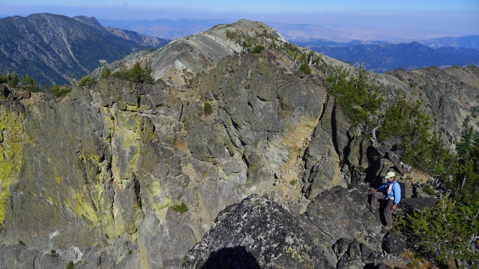
BarbE works her way around the cliffs on the south side of the middle summit.
|
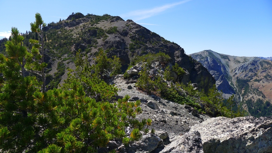
Almost around the middle summit now... with the east summit in the distance.
|
BarbE heading down toward the col that separates the middle and east summits.
|
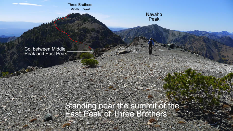
At the col that separates the middle summit and east summit... time for a ridge walk to get us up to the east summit.
|
We are on the ridge that will take us to the east summit... looking back at the middle summit... with Navaho Peak in the distance on the right.
|
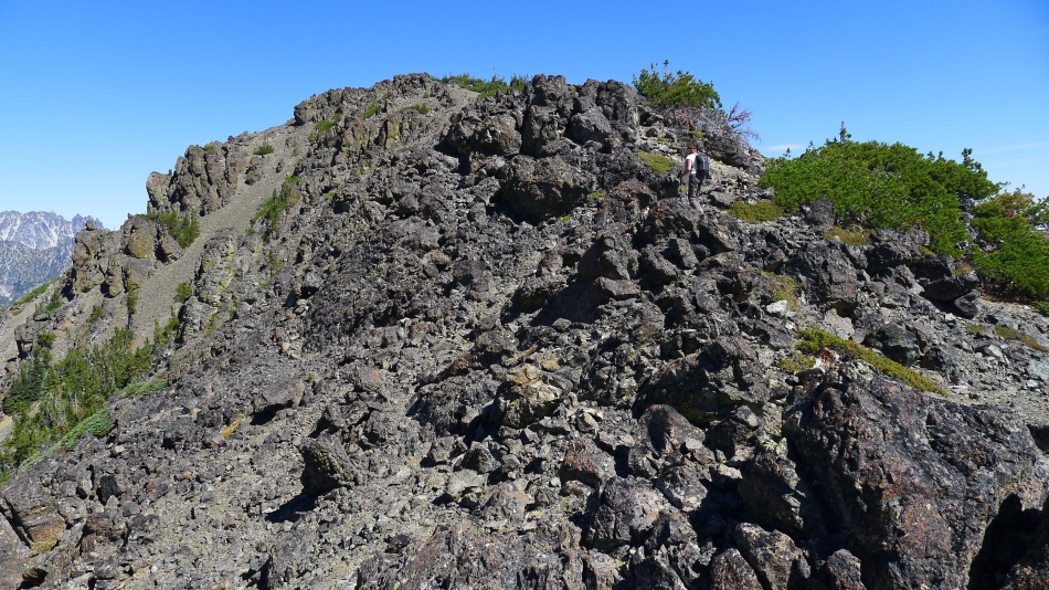
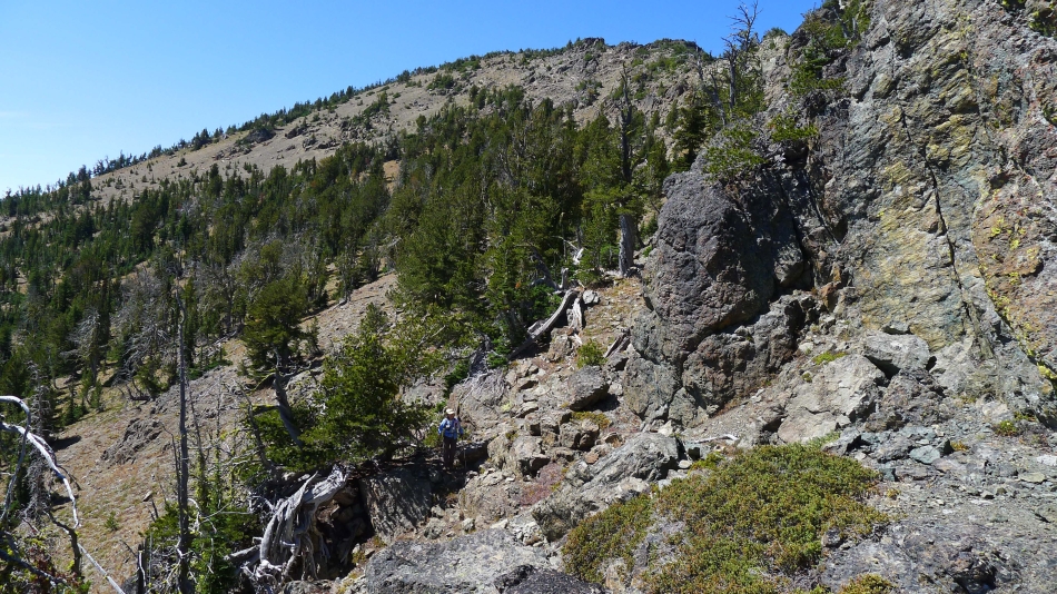
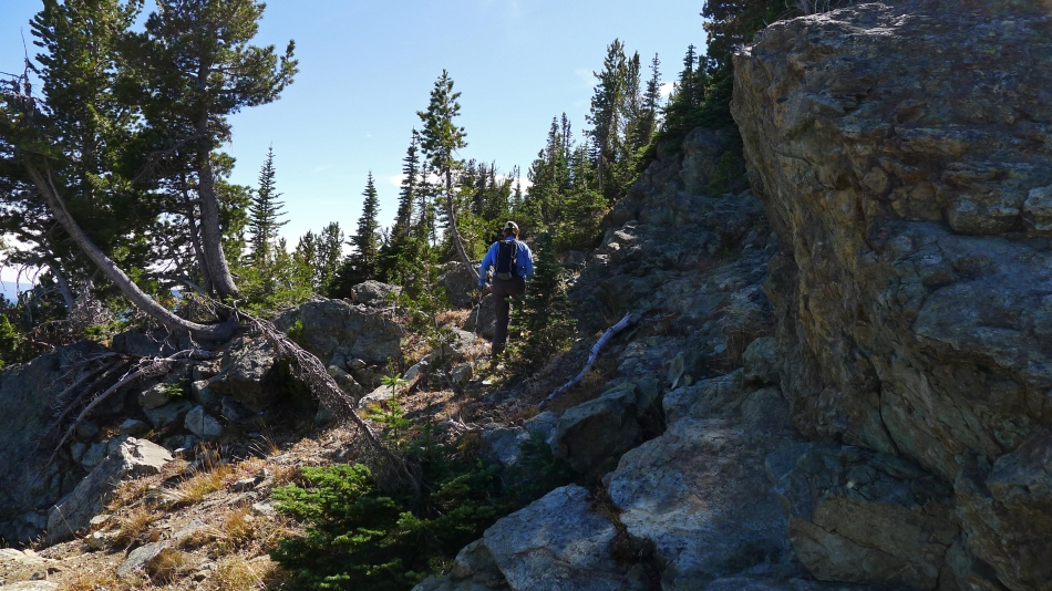
There are several rock outcroppings along the ridge that connects the middle summit to the east summit.
|
Still on the ridge leading to the east summit of Three Brothers... we will go to the right around this rock outcropping.
|
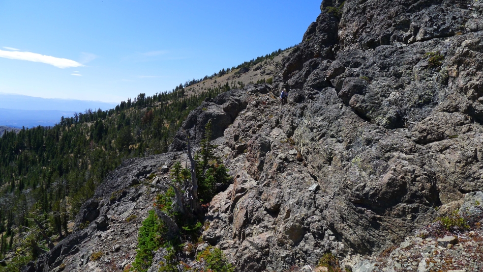
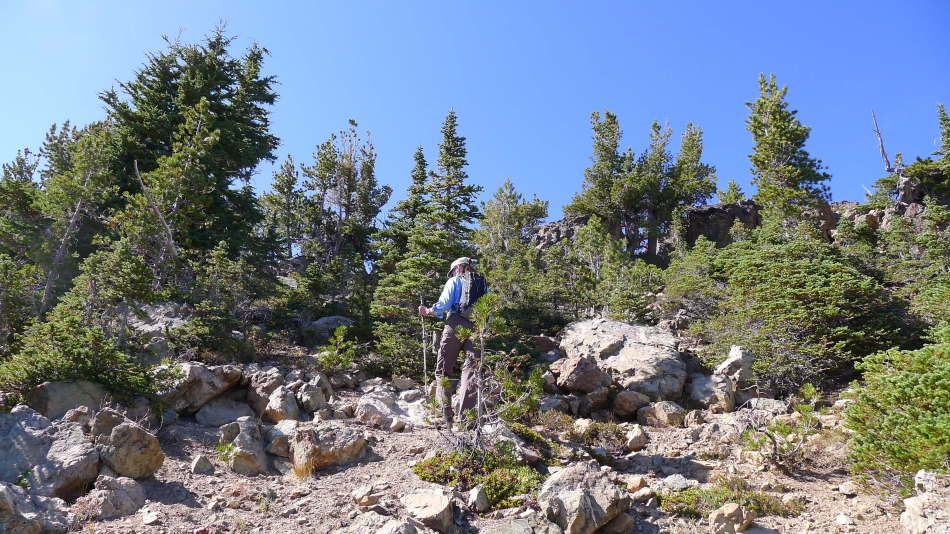
Still looking for the east summit of Three Brothers.
|
Finally the east summit is close.
|
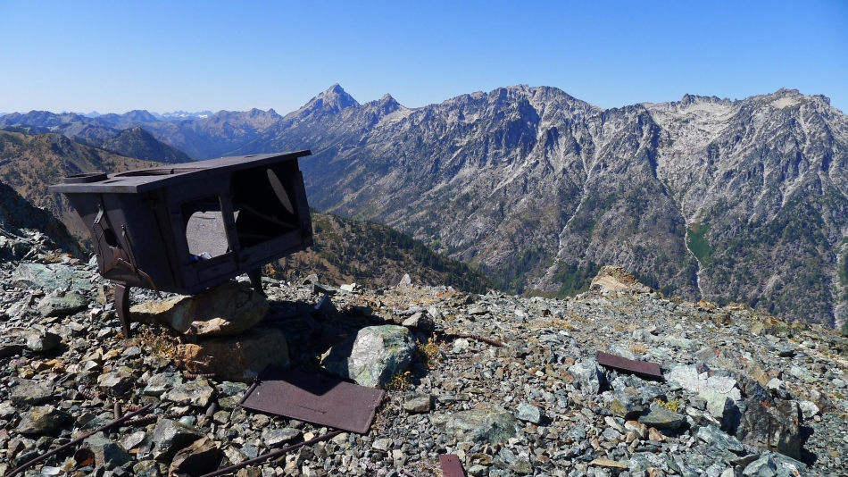
The stove on the east summit (7169') seems out of place.
|
Looking back at the middle summit of Three Brothers in the left foreground... with Navaho Peak in the distance in the center of the photo.
|
ragman and BarbE on the east summit of Three Brothers.
|
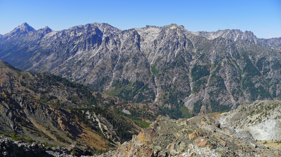
The Stuart Range from the east summit of Three Brothers.
|
Time to head back and see if we can't find a good route up to the middle summit of Three Brothers.
|
Now we are on the east side of the middle summit... approximately 200 feet below the summit.
|
BarbE has found a route that looks like it will go.
|
BarbE is just below the middle summit... with the east summit in the distance.
|
BarbE on the summit (7232') of the middle peak of Three Brothers.
|
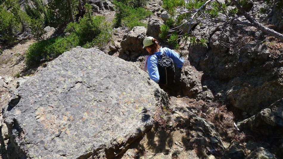
Time to get off of the middle summit... some Class 2/3 climbing here.
|
On the SE side of the west summit... side-hilling our way back toward Navaho... Miller Peak in the center of the photo.
|
Side-hilling several hundred feet below the west summit of Three Brothers... I would not wish this side-hilling experience on my worst enemy.
|
BarbE is almost back to where we can pick up the County Line Trail and use it to get back up to Navaho's SE ridge on the far left.
|
We have reached Navaho's SE ridge (~6600')... looking over at the west summit of Three Brothers... the smoke in the distance is from the Chelan Complex Fire and Okanogan Complex Fire... from here we will use the County Line Trail to take us to the junction with the good path up to Navaho Peak... where we will leave the trail and go cross country back down to our campsite in Stafford Meadow... and a well deserved night's sleep before hiking out the next morning.
|
