Crystal Peak, Point 6706 and Chinook Peak - 7.26.2016
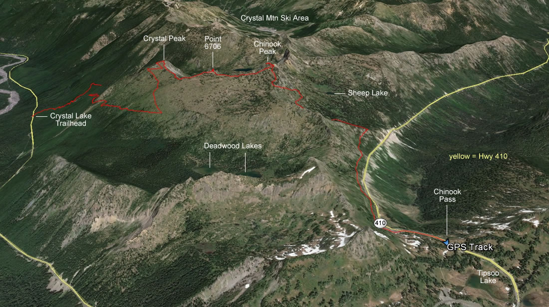
A google earth look at our thru-hike from the Crystal Peak Trailhead to Chinook Pass... 8 miles roundtrip, gaining 3965 feet of elevation.
|
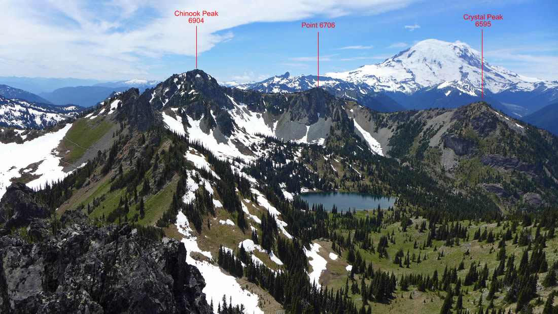
This photo was taken 4 weeks earlier from the summit of Three Way Peak... looking at the three summits we did on this trip.
|
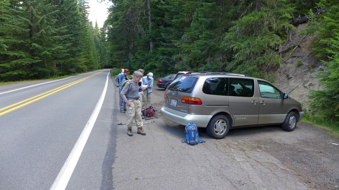
The trailhead (~3540') is located on the east side of Highway 410. Coming from the north (driving south) it is located a short distance before the turnoff for the White River entrance to Mt. Rainier National Park. There is parking on both sides of the road, but no visible trailhead sign from the highway.
|
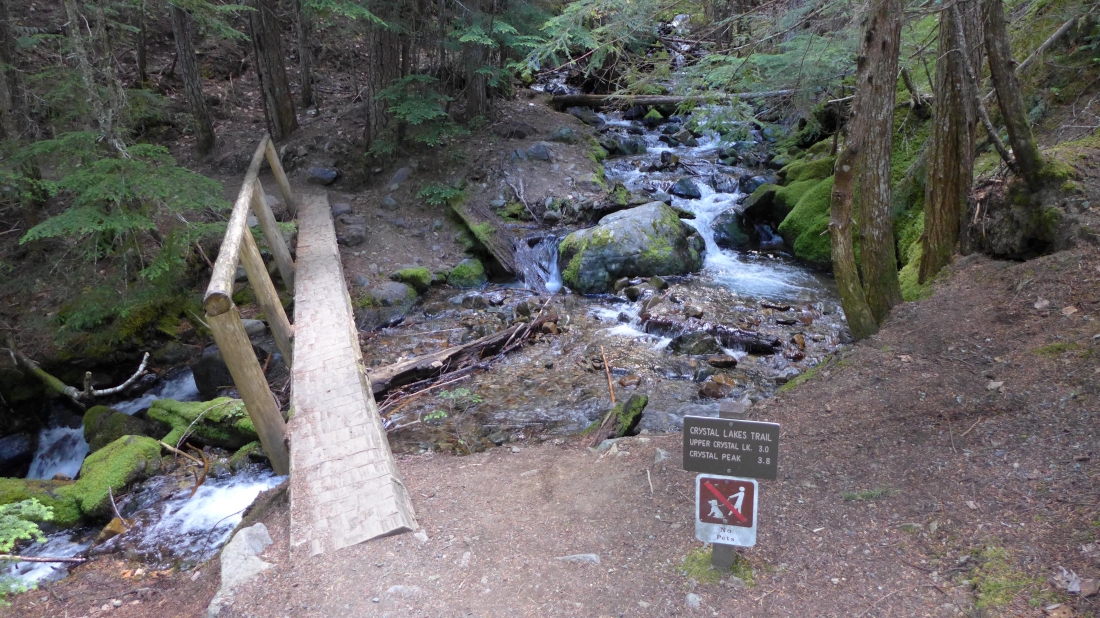
The trailhead sign is only a stone's throw from the parking area, however, you cannot see the sign from the highway.
|
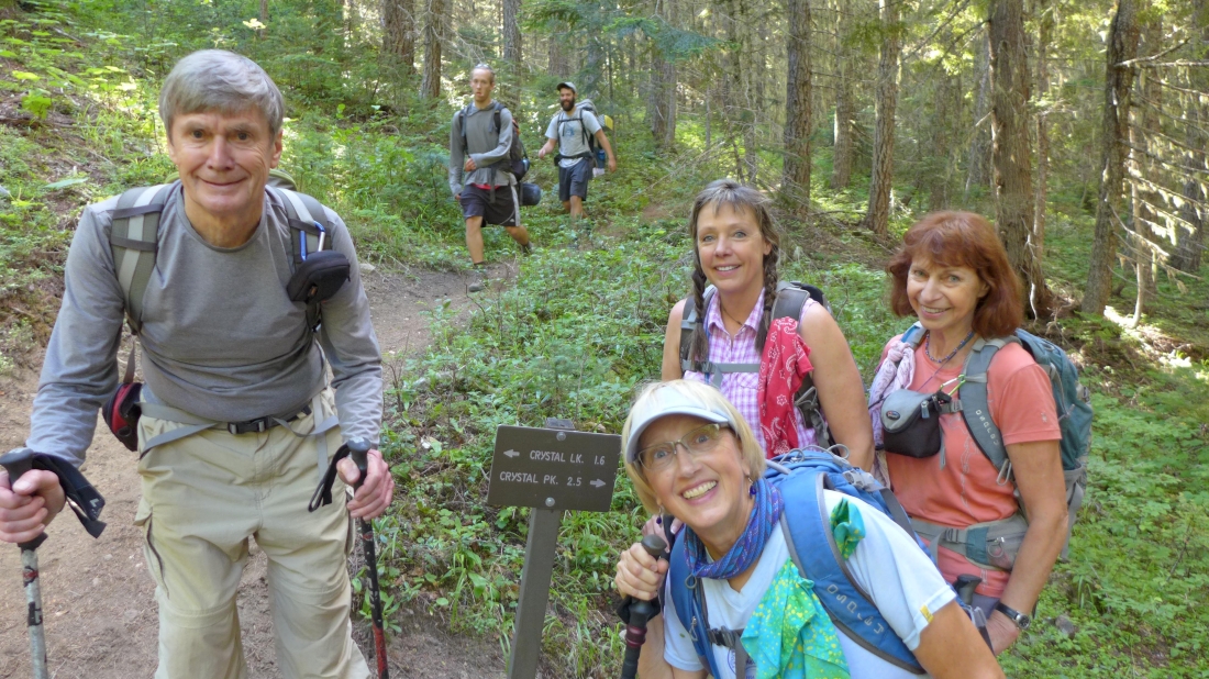
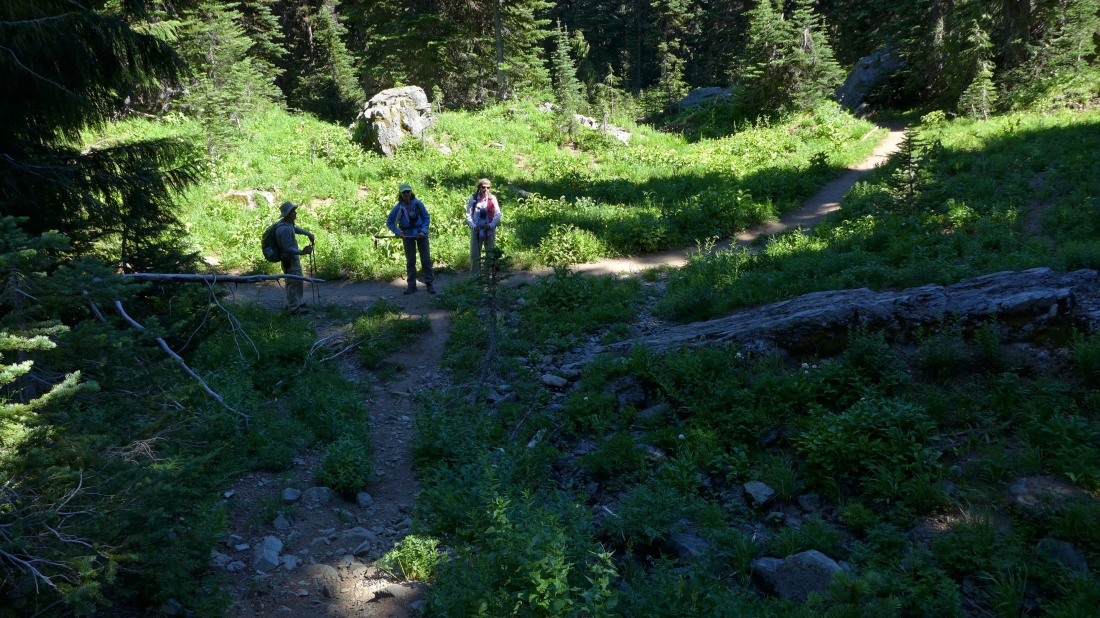
After hiking 1.3 miles we have reached the junction (~4600') of the lake and peak trails.
|
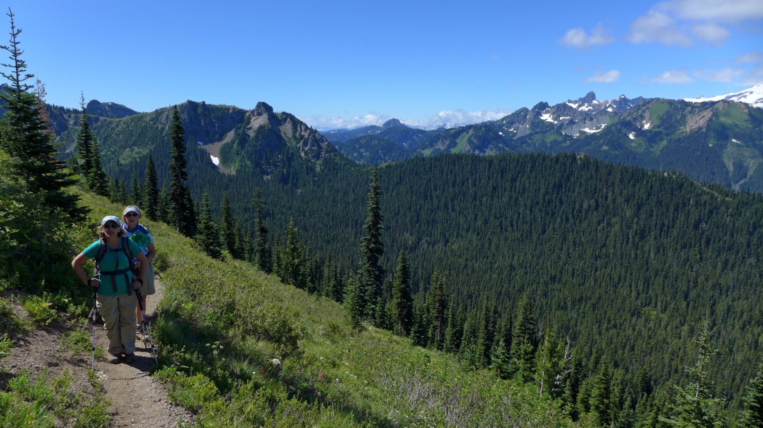
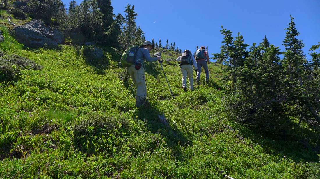
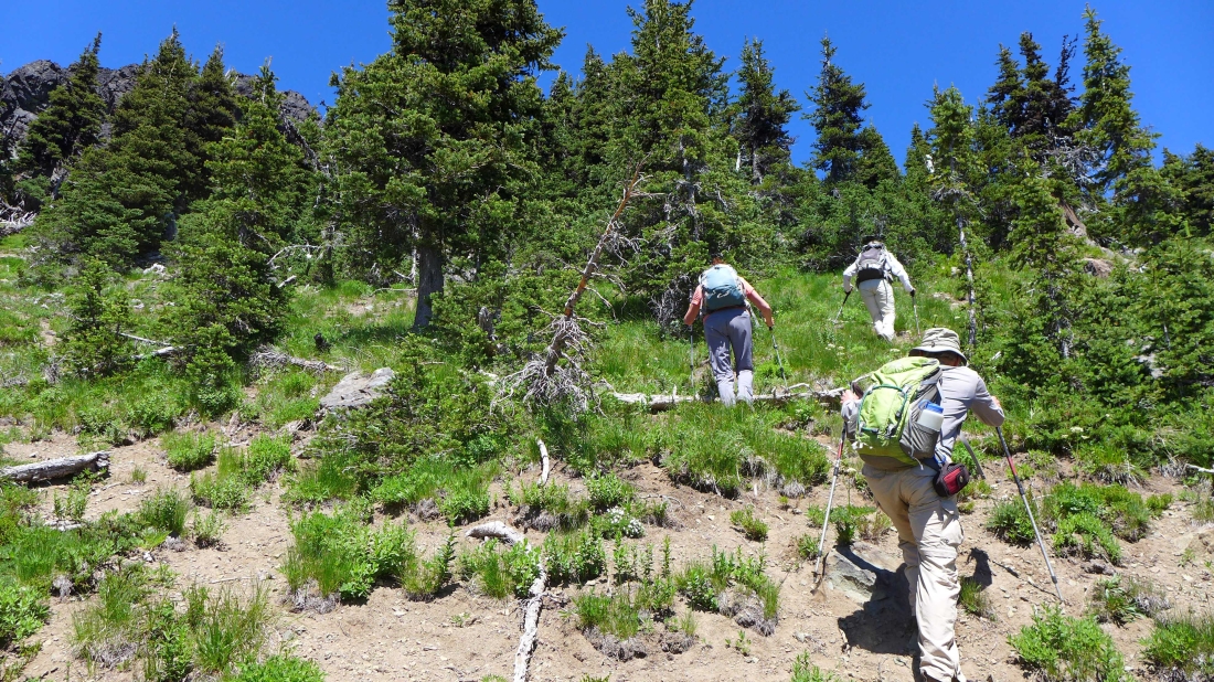
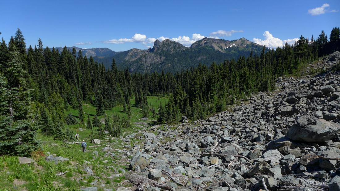
At ~5400 feet the trail comes out of the trees... and the views broaden with every step up.
|
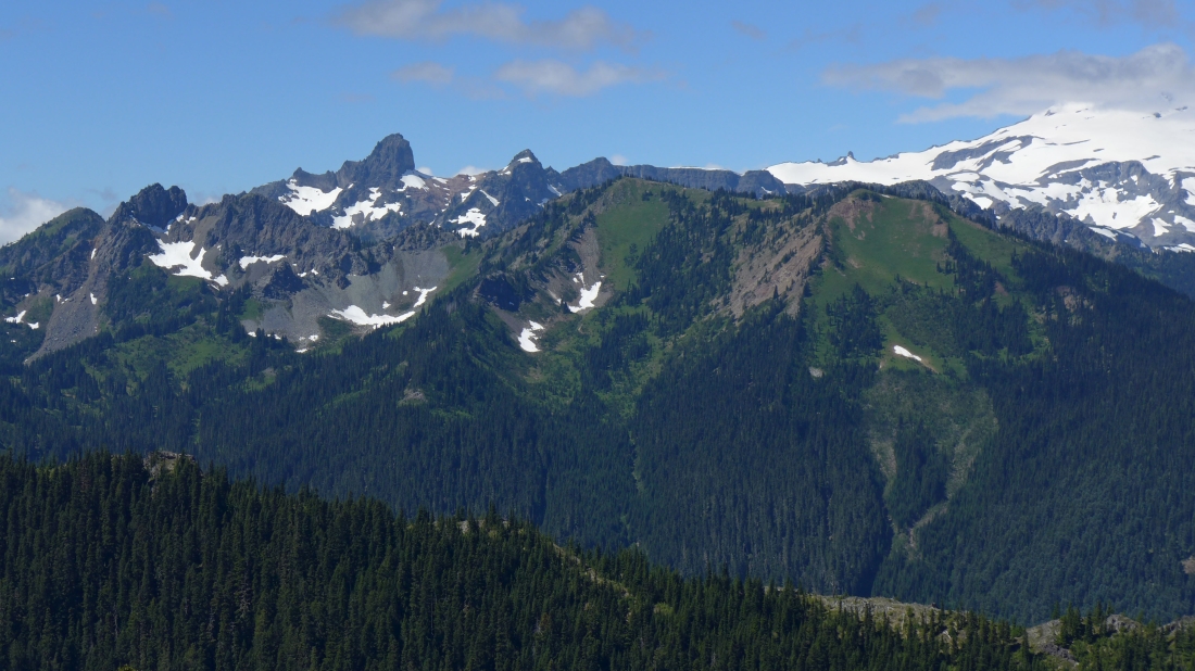
Looking across Govenors Ridge to the Cowlitz Chimneys and Banshee Peak.
|
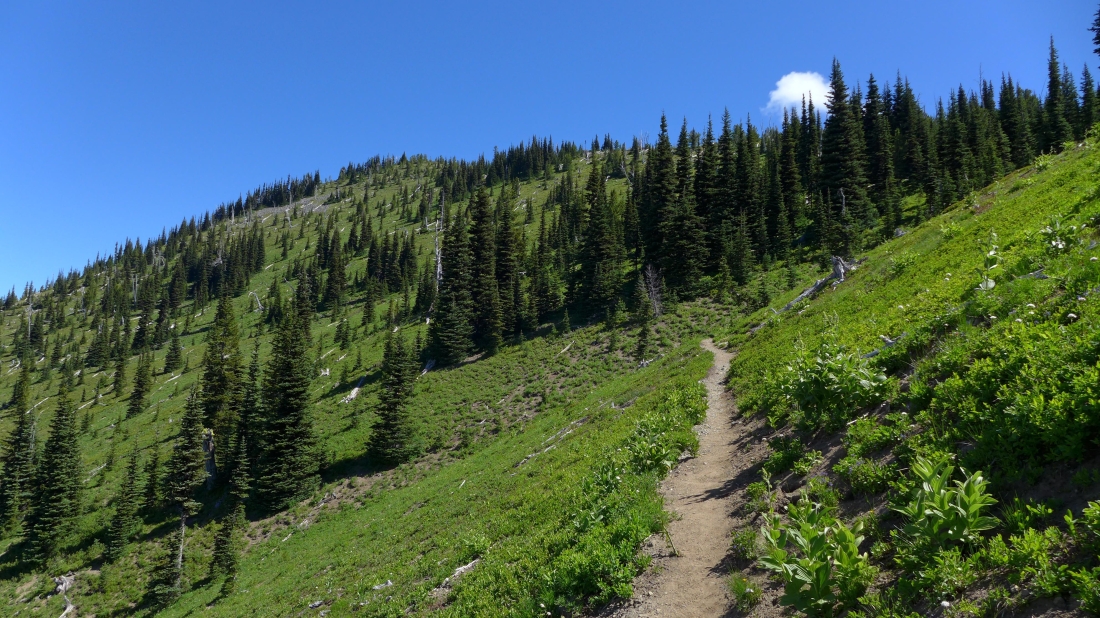
Crystal Peak is up there on the left... the trail has been this nice for every step of the way.
|
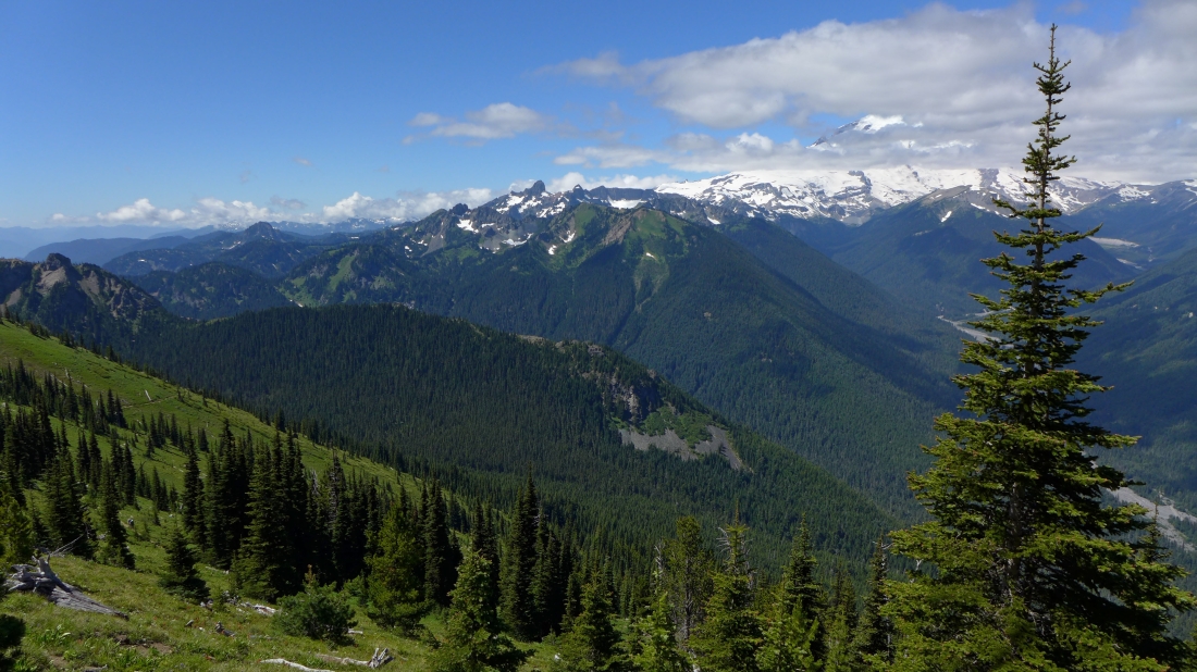
Broken clouds around Mt. Rainier... a piece of the trail is visible on the left side of the photo.
|
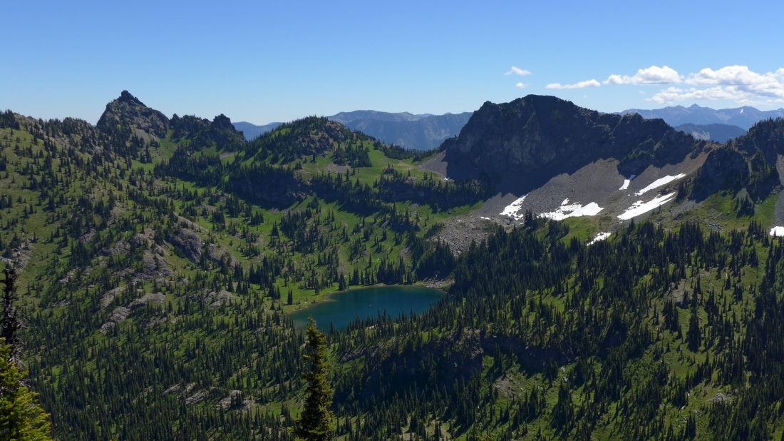
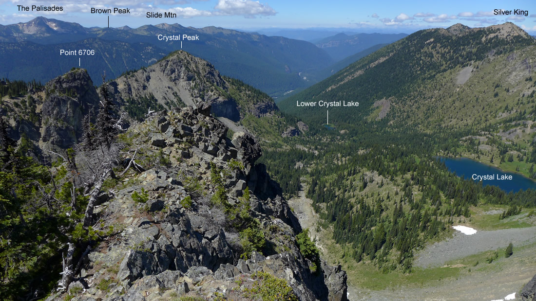
On the Crystal Peak summit (6595')... looking down on Crystal Lake... with Three Way Peak on the left... and Point 6408 on the right.
|
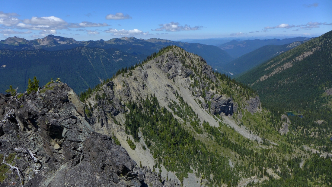
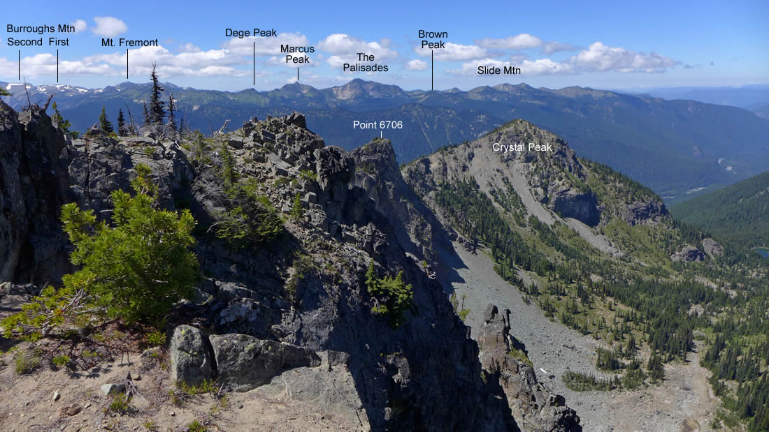
When we leave the Crystal Peak summit we will follow the ridge over to Point 6706 and Chinook Peak in the center of the photo.
|
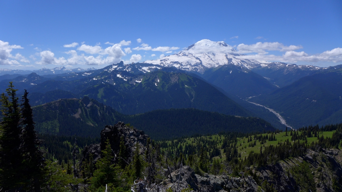
Looking across Goat Island Mountain to Mt. Rainier from the summit of Crystal Peak.
|
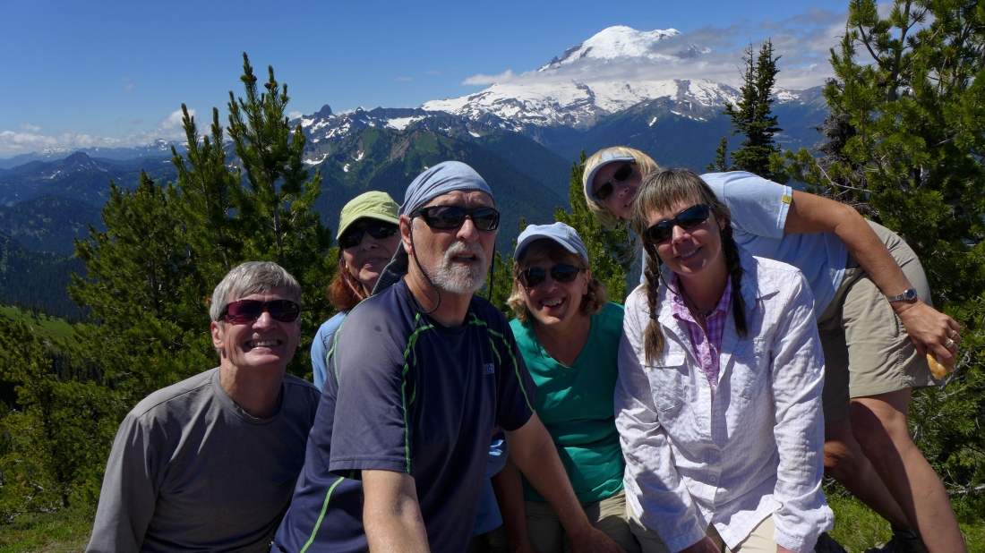
A group shot from the summit of Crystal Peak... left to right... rodman, BarbE, ragman, Nanda, Denali Girl and Snowdog.
|
Leaving the Crystal Peak summit and heading for Point 6706 on the far left. Nanda and Denali Girl will stay on Crystal Peak for awhile... then go back down to the car and shuttle it over to Chinook Pass to pick up the rest of us later in the day.
|
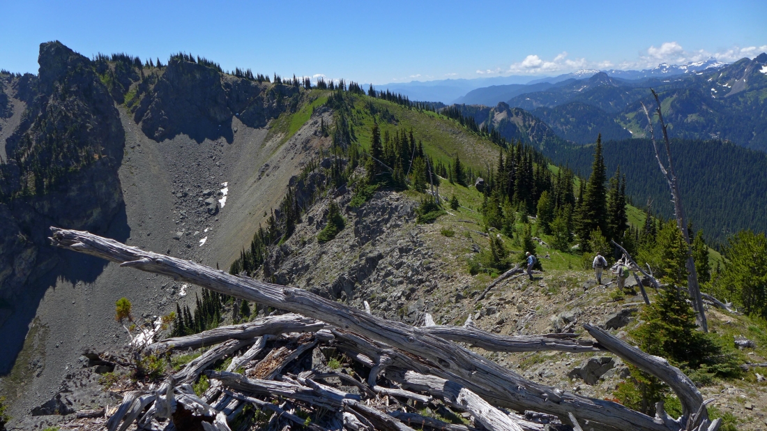
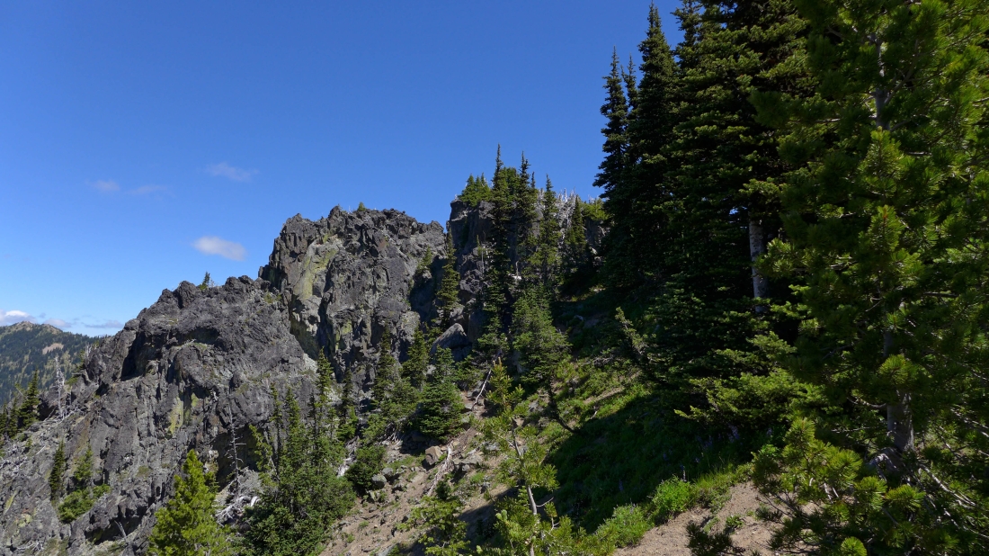
Following a decent path between Crystal Peak and Point 6706.
|
Looking back at Crystal Peak as we near Point 6706... Marcus Peak and The Palisades are the two on the left skyline.
|
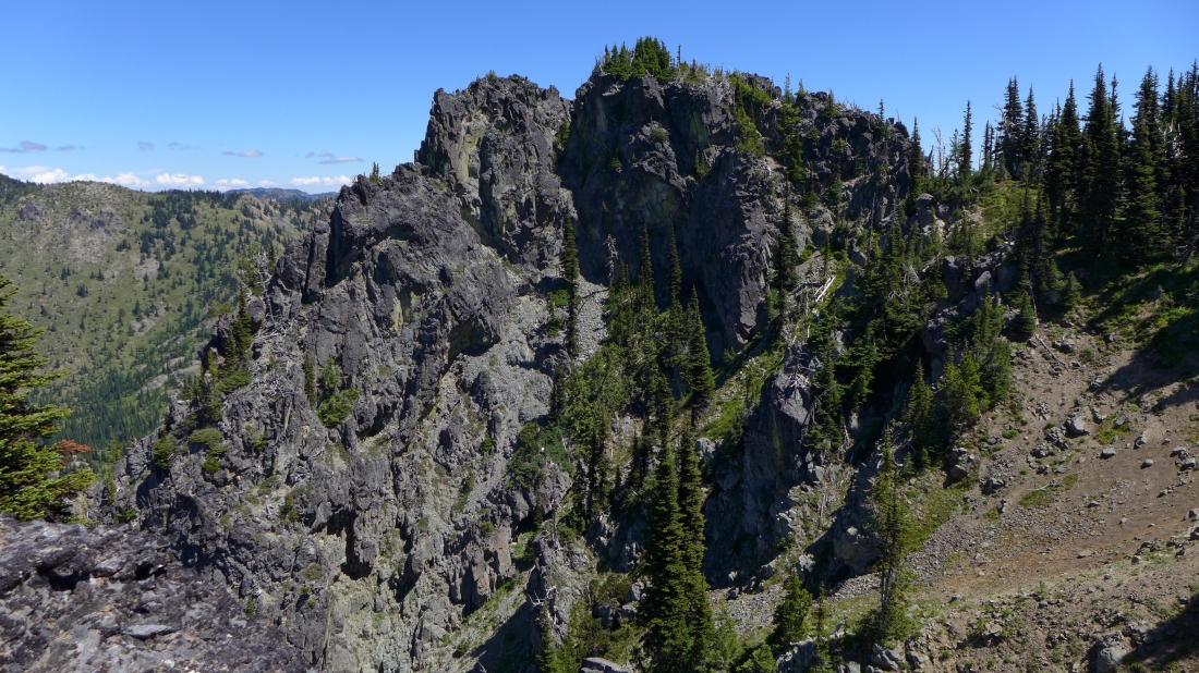
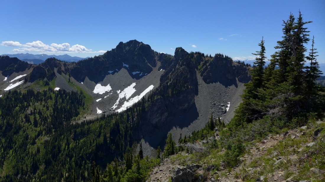
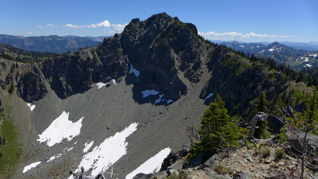
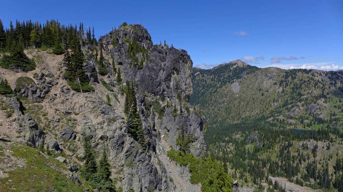
The closer we get to Point 6706, the more gnarly it looks.
|
The actual summit of Point 6706 is the tree covered high point in the center of this photo.
|
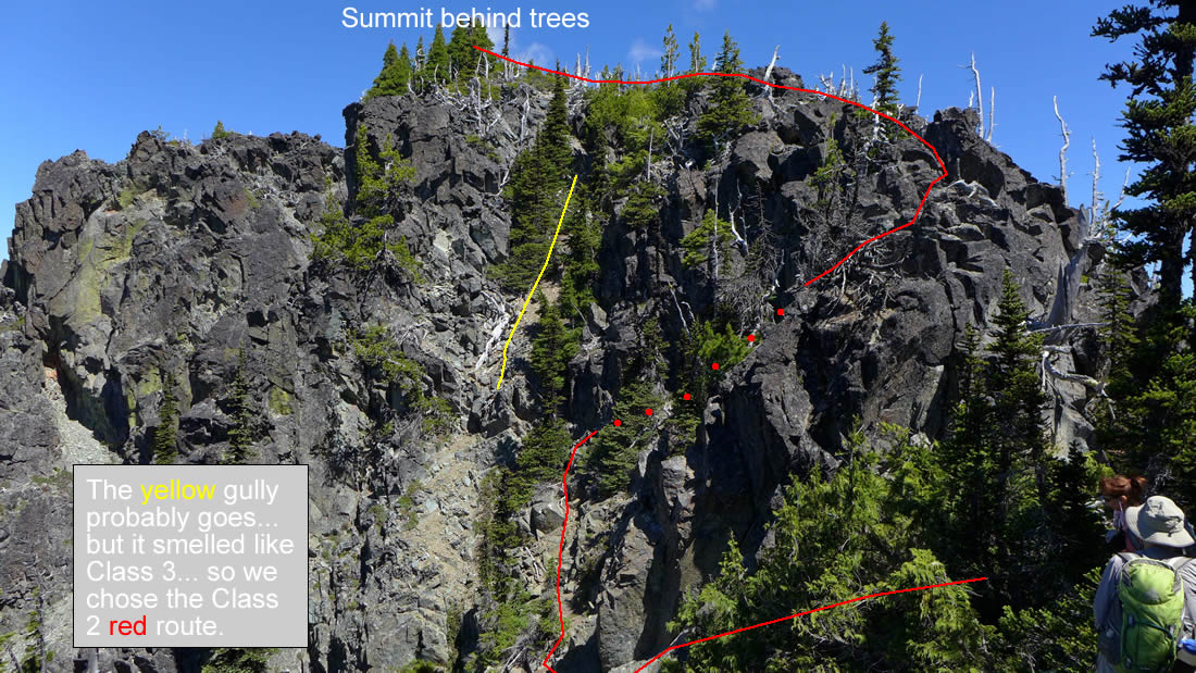
The approximate route that we took to reach the summit of Point 6706.
|
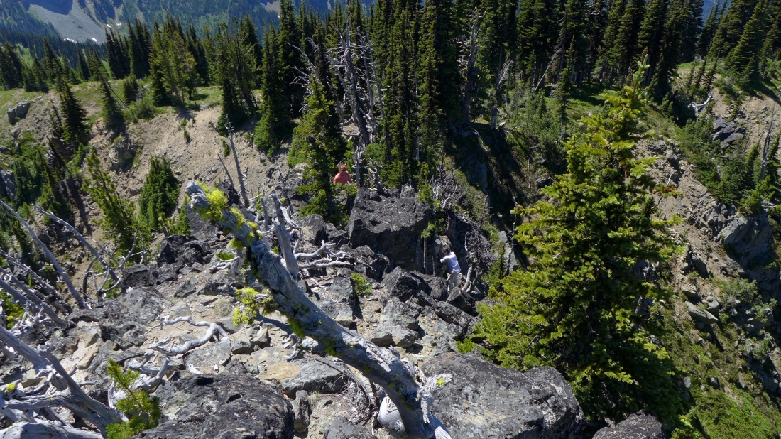
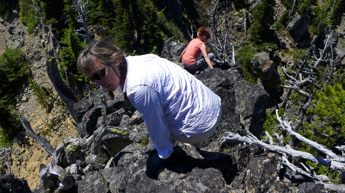
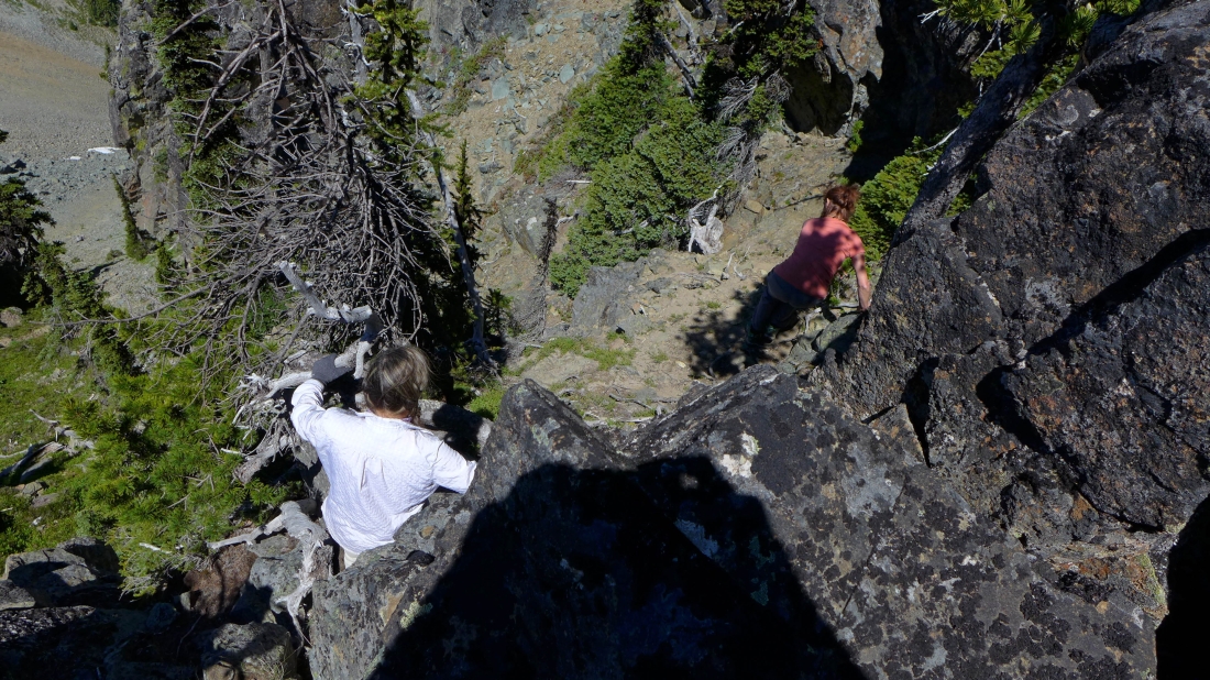
Class 2 scrambling on the last 100 feet of elevation gain to the summit of Point 6706.
|
Crystal Peak from Point 6706.
|
Chinook Peak from Point 6706... we are heading there next.
|
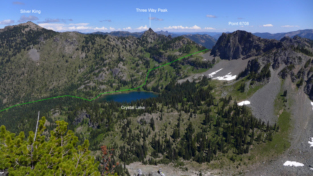
Peak identification from Point 6706... the green line shows the approximate route that the Crystal Lake Trail takes up and through the gap... where it quickly connects with the Pacific Crest Trail that comes over from Sourdough Gap.
|
Time to get down from Point 6706... Class 2 climbing.
|
Almost back to easier terrain.
|
Looking back at Point 6706 as we head for Chinook Peak... Crystal Lake below... and Silver King on the horizon.
|
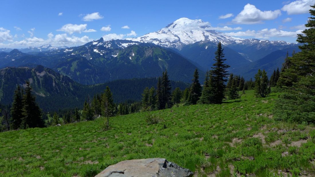
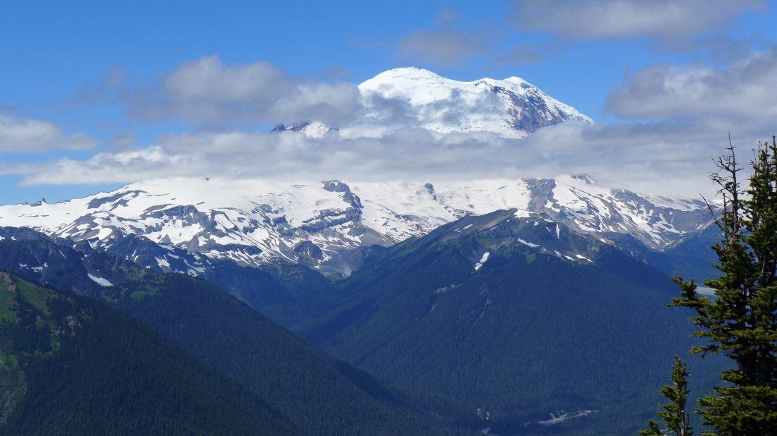
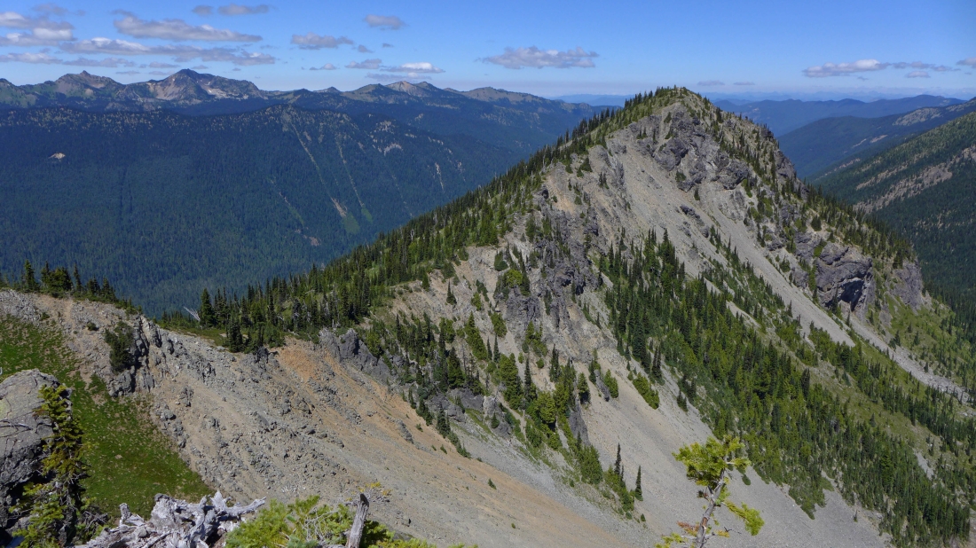
Easy travel from Point 6706 over to Chinook Peak... and if you happen to get bored, Mt. Rainier is always there to perk you up.
|
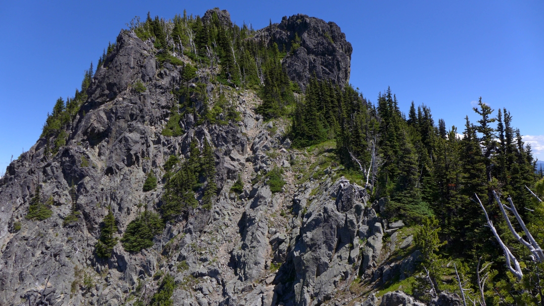
Nearing Chinook Peak... we will stay to the right of the buttress in the center of the photo and work our way up and over to Chinook's SE ridge.
|
Heading up to the SE ridge of Chinook Peak.
|

On the SE ridge of Chinook Peak... a good path will take us to the summit.
|
Peak identification taken from near the summit of Chinook Peak.
|
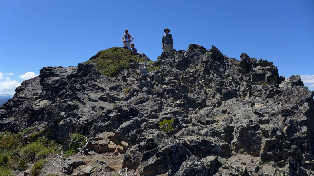
Snowdog, BarbE and rodman on the Chinook Peak summit (6904').
|
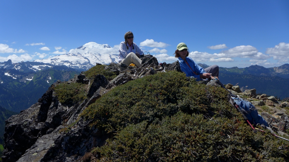
A nice view of Mt. Rainier from the Chinook summit.
|
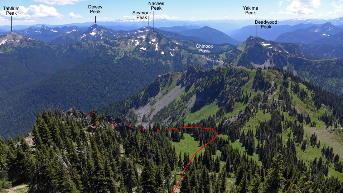
More peak identification from the summit of Chinook Peak... and the approximate route that will take us down to the Pacific Crest Trail... the red dots indicate that the route is on the other side of those rocky outcroppings in the photo.
|
More peak identification from Chinook Peak.
|
Getting ready to leave the summit of Chinook Peak.
|
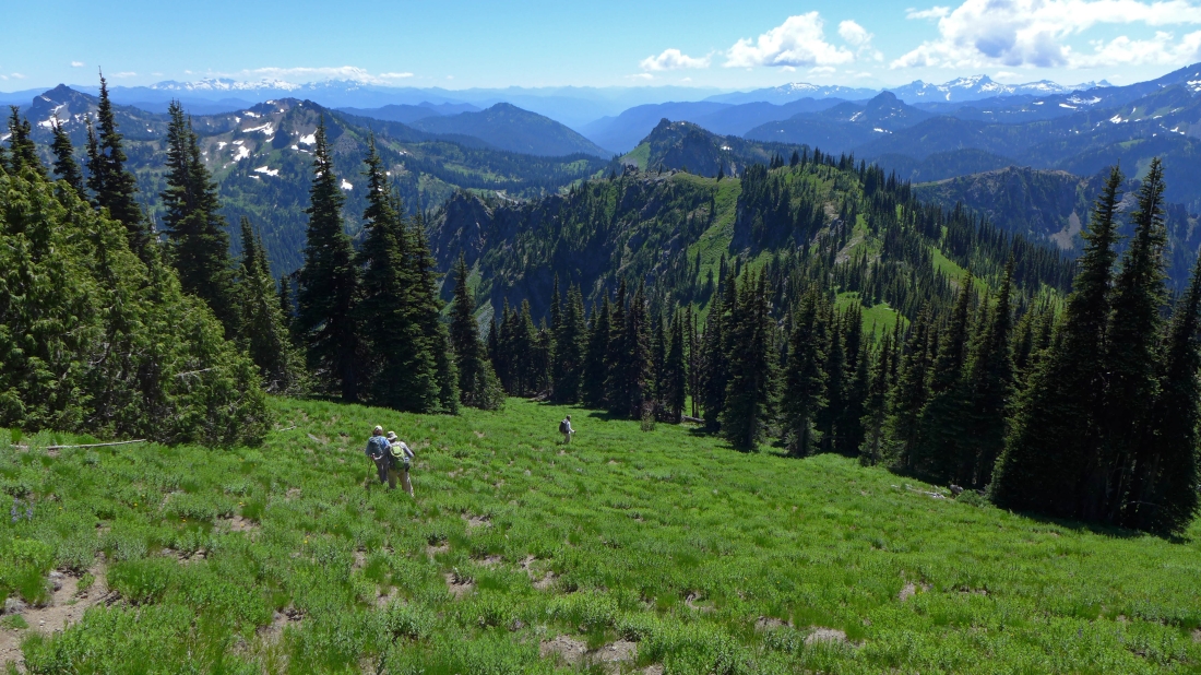
Heading down... the objective is to find the easiest route down to a meadow at ~5500 feet... a quarter-mile or so SW of Sheep Lake.
|
Looking down on the meadow that is a quarter-mile SW of Sheep Lake... where we will quickly find the PCT.
|
We found the PCT... leaving less than 1.5 miles to get to our car at Chinook Pass.
|
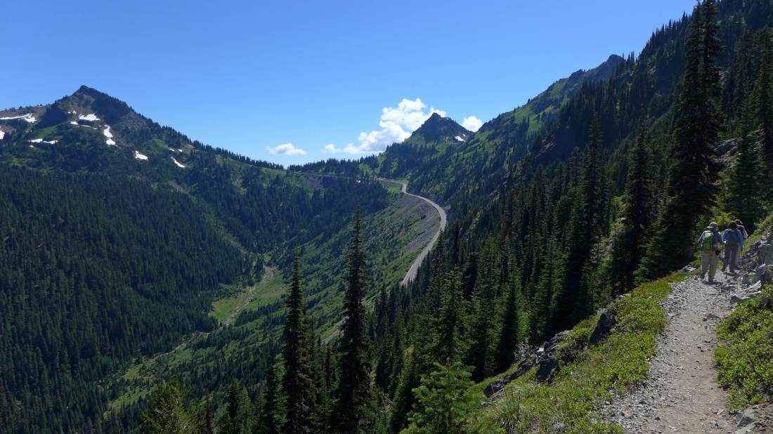
On the PCT... where the trail parallels Highway 410 as it crosses over Chinook Pass... Naches Peak to the left of the pass... with Yakima Peak to the right of the pass.
|
