Johnson Mtn - 6.21.2008
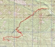
rodman's GPS route for Johnson Mtn... 8 miles roundtrip, gaining 2361 feet of elevation.
|

rodman and Nanda taking a break on the way to Johnson Mtn.
|
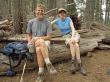
larman and Denali Girl taking a break on the way to Johnson Mtn.
|
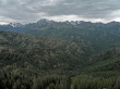
Fortune Peak, Ingalls Peak and the Stuart Range from the Johnson Mtn summit (5220')... Teanaway peaks in front are the east peaks of Esmerelda Peaks, Teanaway Peak, Iron Peak, Mary Peak, Judy Peak, and Earl Peak.
|
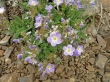
Western Sky Pilot on the Johnson Mtn summit.
|
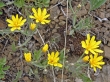
Looks like a daisy to me??
|
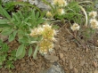
Waterleaf, maybe??
|
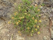
?????????
|
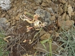
???????
|
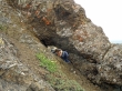
Denali Girl is caving on the Johnson Mtn summit.
|
