Red Top Mountain - 3.26.2009
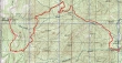
rodman's GPS route of our snowshoe trip to Red Top Mtn... 14 miles roundtrip, gaining 2722 feet of elevation.
|
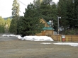
We parked at the Mineral Springs Restaurant (2680')... crossed the road into the Mineral Springs campground... stayed on the main road for ~1 mile... crossed Blue Creek and connected with FS 9738 which we walked for ~2 miles... then turned onto FS 9702.
|
After walking ~2miles on FS9702, we left the road (~4400') and headed uphill.
|
By leaving FS9702 we saved more than a mile of road walking.
|
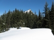
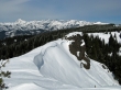
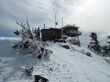
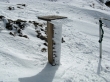
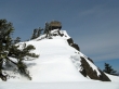
We reconnected with FS 9702 and after ~1 mile we got this view of the lookout on Red Top Mtn.
|
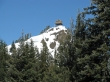
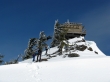
A closeup of the Red Top Mtn lookout.
|
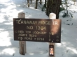
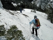
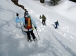
We've reached the trailhead for Red Top Mtn... only a .5 mile hike to the summit.
|
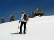
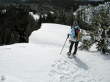
BarbE heading for the summit.
|
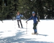
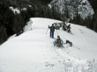
rdyhiker and ragman are close to the summit.
|
An icy tree near the summit... with a cap forming on Mt. Rainier in the distance.
|
rodman, rdyhiker and BarbE very near the summit.
|
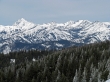
A pano shot... from Hawkins Mtn on the left to Three Brothers and The Temple on the right.
|
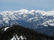
A pano shot of The Stuart Range behind Earl, Navaho and the west summit of Three Brothers.
|
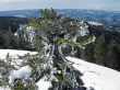
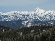
The corniced north ridge of Red Top Mtn... with the Stuart Range in the distance... Miller Peak on the far right.
|
rdyhiker, BarbE and rodman on the Red Top Mtn summit (5361').
|
A zoom shot of Stuart, Sherpa, Argonaut, Colchuck, Dragontail and Little Annapurna.
|
A zoom shot of Hawkins Mtn and Esmerelda Peaks.
|
A zoom shot of Ingalls Peak, Stuart and Sherpa.
|
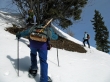
Very cold on top when the sun isn't shining.
|
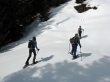
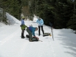
Leaving the summit... reversing the route we used on the way up.
|
BarbE showing technique.
|
BarbE looking at the edge of the corniced south ridge.
|
Looking back at the summit.
|
Cutting the 180 degree switchback of FS 9702.
|
Back to the well-groomed FS 9702... leaving a little more than 5 miles of road walking to get back to the car.
|
