Red Mountain - 4.16.2009
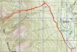
Drive thru Roslyn and continue on the Salmon La Sac road... just beyond the Cle Elum River Campground we parked (2320') and started walking on Road 46 towards Cooper Lake.
|
Shortly after parking we crossed the bridge over the Cle Elum River.
|
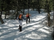
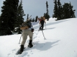
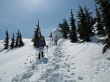
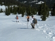
After booting Road 46 for 2 miles (2680'), we put on our snowshoes and the Sherpani Chicks started setting the steps towards Red Mtn.
|
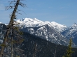
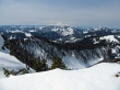
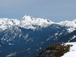
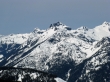
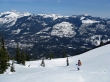
At ~4500' we started getting some nice views... Mt. Daniel and Cathedral Rock.
|
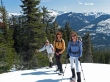
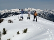
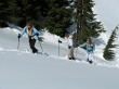
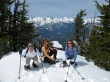
rodman, BarbE and rdyhiker... with the Stuart Range in the distance.
|
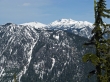
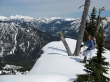
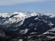
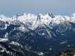
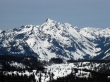
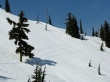
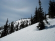
The terrain was steep in places... a nice view of Three Queens, Lemah, Chimney Rock, Overcoat and Summit Chief.
|
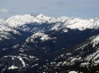
Mt. Hinman and Mt. Daniel.
|
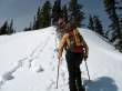
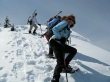
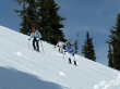
rdyhiker, rodman and BarbE working hard... the photographer lingers at the back... using the steps of others.
|
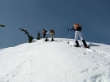
rodman and BarbE... up, up and more up.
|
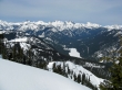
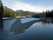
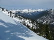
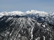
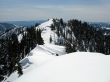
Looking down on Cooper Lake... with Hibox and Three Queens on the left to Bears Breast on the right.
|
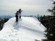
rdyhiker takes a break just below the false summit of Red Mtn... don't get too close to the edge.
|
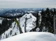
BarbE, rodman and rdyhiker get ready to step onto the false summit (~5804').
|
Mt. Rainier from the false summit.
|
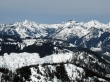
The Stuart Range in the distance.
|
A closeup of Bears Breast, Hinman, Daniel, Glacier Peak and Cathedral Rock.
|
A closeup of Hibox and Three Queens.
|
rdyhiker, rodman and BarbE party down on the false summit of Red Mtn.
|
A closeup of the north and south summits of Granite Mtn in the upper left center of the photo... and maybe Sherpani Peak in the upper right center of the photo.
|
A closeup of the three summits of Summit Chief Mtn.
|
A closup of the 5 summits of Lemah, Overcoat and Chimney Rock.
|
A closeup of Hibox Mtn.
|
A closeup of Three Queens.
|
From the false summit we are looking south Red's true summit... we will head on over there, but the views are best from the false summit.
|
We will use our ice axes to get off of the false summit... lowering ~100 feet...
|
then traversing across the slope...
|
and starting back up towards Red's true summit.
|
The Sherpani Chicks step onto the Red Mtn summit (~5815').
|
From the summit we are looking at south ridge of Red Mtn.
|
rodman, BarbE, Cooper Lake and rdyhiker near the Red Mtn summit.
|
Time to head down.
|
Our traverse tracks from the false summit to the true summit.
|
rdyhiker has a nice view of the Stuart Range as she heads down hill.
|
rdyhiker, BarbE and rodman continue down Red Mtn.
|
Looking back at the shining mountain... it want take long to get back to the road... and the two mile walk back to the car.
|
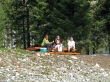
Back at the car I had a glass of milk while everyone else drank the beverage of their choice... 9 miles roundtrip, gaining 3698 feet of elevation.
|
