Evergreen Mountain - 4.21.2009
|
From Hwy 2 we drove the Beckler River Road (FS 65) for ~6.5 miles and parked (1400') just before a bridge crosses the Rapid River... at the convergence of roads 65, 6520 and 6530.
|
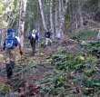
Immediately after crossing the bridge over the Rapid River, rdyhiker started leading us uphill through the brush.
|
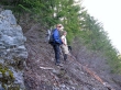
In addition to the bushwhacking, rdyhiker can vouch for the fact that the route was cliffy in places.
|
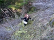
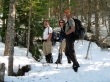
madman and larman are looking at me as though I have lost my mind.
|
I can barely see my hiking partners through the dense-at-times brush.
|
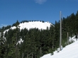
Finally... between 2500' and 3000' we find the snow line that will cover the dreaded brush.
|
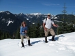
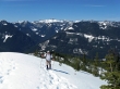
madman, rdyhiker and larman start getting good views at ~3900 feet.
|
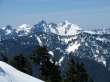
rdyhiker standing between Columbia Peak and Kyes Peak.
|
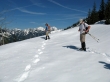
At ~4200 feet we are nearing where the summer trailhead starts at 4300 feet... we will follow the ridge line along the two bumps in the foreground and then go over to the ridge in the distance on the left.
|
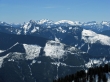
A nice view of Mt. Fernow.
|
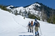
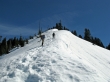
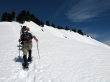
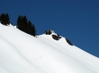
larman working his way up the first open ridge... with the views getting better with every step up.
|
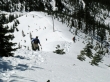
madman and rdyhiker heading up the first open ridge.
|
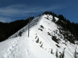
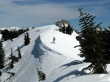
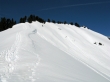
Still not to the high point on the first open ridge.
|
Near the top of the first open ridge we get a good look at the ridge that has the Evergreen Mtn lookout on the far right of the ridge.
|
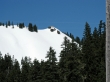
A closeup of the Evergreen Mtn lookout.
|
We've made it through the trees and have started towards the ridge that houses the lookout.
|
rdyhiker is almost to the Evergreen Mtn lookout.
|
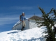
rdyhiker on the Evergreen Mtn summit (5587').
|

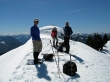
Three retired guys on the summit... one old and two young... Glacier Peak in the distance.
|
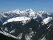
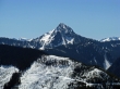
Columbia Peak, Kyes Peak and Sloan Peak.
|
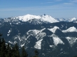
Not sure on this one... perhaps Spire Mtn?
|
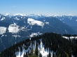
Looking south to Fernow, Daniel, Hinman, Summit Chief, Rainier and others.
|
Not sure on these either... possibly in the neighborhood of Baring, Merchant and Gunn.
|
Cathedral Rock, Fernow, Daniel, Hinman and Summit Chief.
|
larman, rdyhiker and madman just before leaving the Evergreen Mtn summit.
|
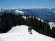
Heading down from Evergreen.
|
Looking back at the Evergreen Mtn lookout.
|
A closeup of the Evergreen Mtn lookout.
|
larman and rdyhiker heading down the first open ridge.
|
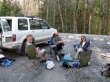
larman, madman and rdyhiker relaxing at the trailhead after a hard day at the office... 6.5 miles roundtrip, gaining 4370 feet of elevation.
|
