Rock Mountain - 5.1.2009
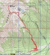
Drive 8.2 miles east of Stevens Pass... turn north on the unsigned dirt road and park at the trailhead (2683')... ~9 miles roundtrip, gaining 4269 feet of elevation.
|
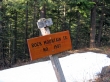
After walking the dirt road for .25 miles, follow this sign when the road branches.
|
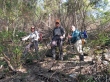
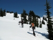
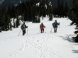
It looks brushy... however, rdyhiker, madman and rodman show their happiness in being on a real trail.
|
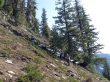
The terrain is steep, but the trail is nicely switch-backed.
|
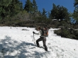
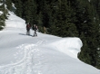
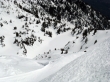
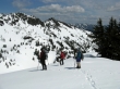
At ~4200 feet rdyhiker finds the first large patches of snow.
|
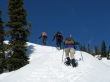
At ~4600 feet we found continuous snow... rdyhiker, madman and rodman still going up.
|
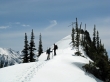
At ~5700 feet rodman watches madman and rdyhiker start their way around a rock outcropping.
|
rodman got this shot of ragman, rdyhiker and madman crossing the rock outcropping.
|
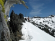
rdyhiker at the end of the rock cropping.
|
madman and rdyhiker take a break after crossing the rock outcropping.
|
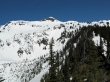
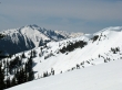
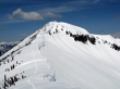
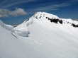
Our first good look at the Rock Mtn summit... right-center of the photo.
|
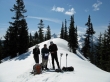
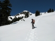
The GPS and map committee are always working.
|
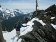
Only 400 feet of elevation left to reach the ridge that is SW of Rock Lake.
|
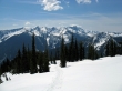
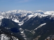
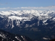
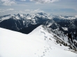
Looking back on the Chiwaukum Mtns and Arrowhead Mtn in the right foreground.
|
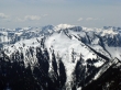
Mt. Daniel and Mt. Hinman appear in the distance to the right of Jim Hill Mtn.
|
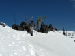
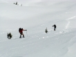
rdyhiker, rodman and madman near the ridge SW of Rock Lake.
|
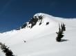
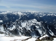
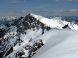
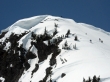
Our first good look at the route we will take up to the end of Rock Mtn's south ridge... the corniced ridge will not permit any short cuts.
|
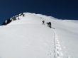
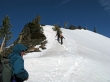
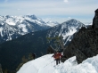
rdyhiker, rodman and madman are heading for the end of Rock Mtn's south ridge.
|
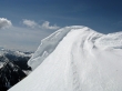
The top of Rock Mtn's south ridge (~6640')
|
On the Rock Mtn summit (6852') after a quarter mile ridge walk from the end of Rock Mtn's south ridge... views of Galcier Peak and others.
|
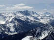
The Monte Cristo peaks and Sloan Peak.
|
Jim Hill, Daniel and Hinman dominate.
|
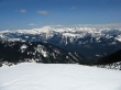
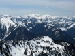
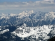
Looking south from the Rock Mtn summit.
|
Rock Lake... a 1000 feet below the summit.
|
A closeup of the Chiwaukum Mtns, Mt. Stuart in the distance and Arrowhead Mtn in the lower right corner.
|
A closeup... looking across Jim Hill Mtn to distant peaks.
|
A closeup of the Ten Peak Range east of Glacier Peak.
|
Seven Fingered Jack and Mt. Maude.
|
Mt. Howard (7063') from the Rock Mtn summit.
|
Time to walk the ridge back down to the end of the south ridge.
|
Looking at the summit route from the end of Rock Mtn's south ridge.
|
It's getting crowded... ragman will wait for two skiers to reach the south ridge before he starts down.
|
rodman got this shot of ragman on the ridge as he waits for the skiers to ascend.
|
Looking back on Rock Mtn's corniced south ridge.
|
madman, rdyhiker and rodman above Rock Lake.
|
Heading for the car.
|
rodman and madman prepare to cross the rock outcropping.
|
rodman and madman working across the rock outcropping... Big Chiwaukum Mtn stands out in the distance.
|
madman, rodman and rdyhiker are almost past the rock outcropping... Arrowhead Mtn in the right foreground.
|

Perhaps we should have worn our snowshoes on the way home?
|
