Navaho Peak - 5.21.2009
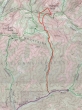
This is a map of our general route to Navaho Peak and not a GPS route... 10.5 miles roundtrip, gaining 4200 feet of elevation.
|
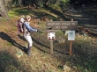
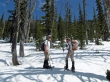
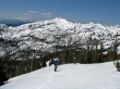
rdyhiker helps to get us started in the right direction.
|
After a major stream crossing at ~4800 feet, we leave the summer trail and head north for the ridge above.
|
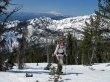
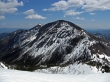
rdyhiker and larman take a break... with Little Navaho behind.
|
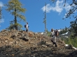
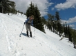
larman and rdyhiker... still heading for the ridge.
|
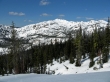
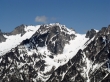
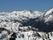
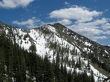
The higher we climb... the better the view of Earl Peak.
|
At ~6400 feet we are at the same elevation as the top of Little Navaho.
|
rdyhiker reaches Navaho's SE ridge... with Mt. Rainier in the distance.
|
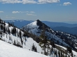
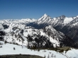
Three Brothers from Navaho's SE ridge.
|
Looking back down Navaho's SE ridge to Little Navaho.
|
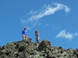
rdyhiker is charging for the summit on Navaho's SE ridge.
|

rdyhiker finds the summit register on Navaho Peak (7223').
|

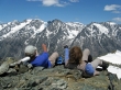
larman shares the summit with rdyhiker.
|

ragman found the summit also.
|
A closeup of Dragontail Peak... with the Witches Tower showing thru the gap on the right.
|
|
Looking SW to NW from the Navaho summit... so many peaks, so little time.
|
The Stuart Range from the Navaho Peak summit.
|
A closeup of Fortune Peak and Ingalls Peak... with Summit Chief Mtn. on the left and Mt. Daniel on the right.
|
Fortune, Ingalls, Daniel, Stuart, Sherpa and Argonaut.
|
larman and rdyhiker on the Navaho summit.
|

Life is good!!!!!!!!!!
|
Peak identification is in progress.
|
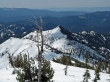
larman takes a break on the way down... with Earl Peak behind.
|
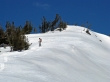
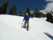
rdyhiker shows us how to boot-ski.
|
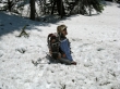
larman shows what can happen if a boot sinks too much while boot-skiing.
|
Say what?
|
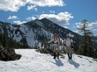
Little Navaho on our way back down to the creek crossing.
|
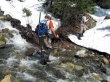
larman crossing the creek at ~4800 feet.
|
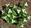
Trillium clump.
|
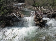
Stafford Creek is running at full throttle... almost back to the car now.
|
