Red Mountain - 5.27.2009
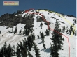
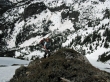
This photo was taken near Red Pond... showing our general route up and down.
|
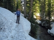
Still two feet of snow at the PCT trailhead (3000') at Snoqualmie Pass.
|
rdyhiker in Commonwealth Basin.
|
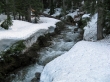
Commonwealth Creek is running hard.
|
rdyhiker crossing Commonwealth Creek.
|
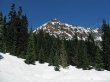
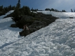
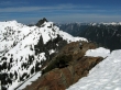
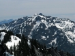
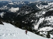
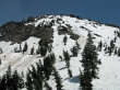
Our first good look at Red Mtn from Commonwealth Basin.
|
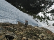
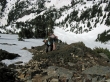
Crossing the avalanche chute just before coming to Red Pond.
|
rdyhiker is already above Red Pond... with Mt. Rainier and Guye Peak behind.
|
rdyhiker is ready to get on some rock and dirt.
|
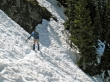
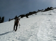
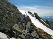
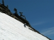
rdyhiker continues up on fairly steep terrain.
|
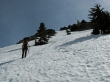
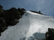
Back on the snow and heading for more rock.
|
Almost to some rock.
|
rdyhiker continuing up on rock and dirt... old avalanche debris down near Red Pond.
|
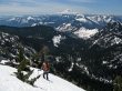
ragman takes a break near Red's NNW ridge.
|
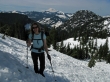
Still some work left to reach the summit.
|
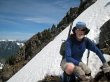
rdyhiker snapping photos... Mt. Rainier in the distance.
|
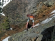
rdyhiker still climbing on rock.
|
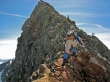
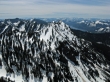
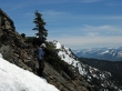
ragman on Red's NNW ridge.
|
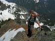
rdyhiker on Red's NNW ridge... Red Pass is just out of view on the left... with the Middle Fork Snoqualmie below.
|
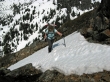
rdyhiker crossing a small patch of snow near the summit.
|
ragman can see the summit.
|
Cat Woman.
|
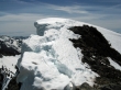
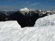
Cornices on the Red Mtn summit (5890').
|
Mt. Thomson in the foreground.
|
rdyhiker strolling towards the summit... with Lundin Peak behind.
|
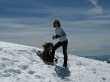
rdyhiker and her sandwich on the Red Mtn summit.
|
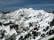
Kendall Peak and Keechelus Lake... Rampart Ridge in the distance on the far left.
|
Mt. Stuart, Three Queens, Alta and Hibox... with the beginning of the Kendall Katwalk in the right foreground.
|
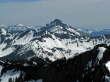
Snoqualmie Mtn.
|
A closeup of Three Queens.
|
A closeup of Alta Mtn and Hibox Mtn.
|
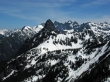
Big Snow Mtn... with Glacier Peak in the distance.
|
rdyhiker starting down the summer boot-path route.
|
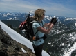
rdyhiker traversing... with Mt. Rainier in the distance.
|
Back on rock... Kendall Peak in the distance.
|
Back on snow for the final descent to Red Pond.
|
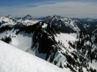
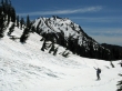
Looking up at Red Mtn from near Red Pond.
|
rdyhiker points toward Red Mtn... Kendall Peak in the distance.
|
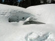
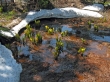
Red Pond... or should it be Red Puddle.
|
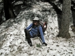
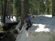
There were several post-holing events.
|
rdyhiker buries her ice axe... using it as an anchor while dropping down to the creek.
|
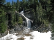
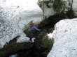
A nice waterfall flowing into Commonwealth Basin.
|
Skunk Cabbage near the car... the only flower we saw all day.
|
