Jack Ridge (a.k.a Hi-Jack Peak) - 5.31.2009
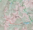
This is our general route to Jack Ridge and not a GPS route... from the west end of Eightmile Lake there is no trail.
|
Start from the Eightmile Lake trailhead (3300').
|
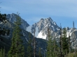
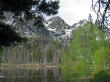
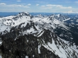
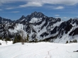
Within the first half-mile we got this view of Dragontail Peak on the left and Colchuck Peak on the right.
|
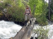
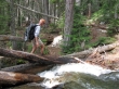
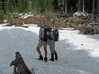
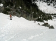
rdyhiker crossing Pioneer Creek.. don't slip here.
|
After hiking 2.8 miles we came to Little Eightmile Lake.
|
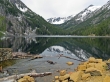
Another half-mile brought us to Eightmile Lake... we will go along the north shoreline to the other end of the lake.
|
madman at the west end of Eightmile Lake... no more trail from here to the summit.
|
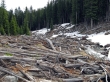
Tons and tons of down trees to negotiate.
|
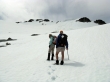
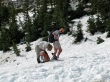
madman and rdyhiker hold a map and compass class.
|
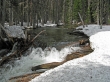
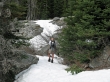
The creek is flowing fast.
|
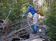
ragman dealing with some of the down trees.
|
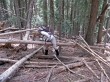
rdyhiker joins in on the down tree fun.
|
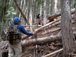
ragman and madman working through the down tree maze.
|
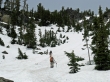
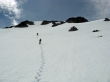
Finally out of the down trees and into post-holing terrain.
|
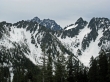
As we gain elevation Mt. Stuart starts coming into view.
|
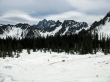
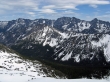
We've reached the 6000 foot basin and continuous snow... Mt. Stuart in the distance.
|
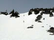
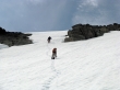
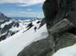
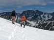
madman and rdyhiker turn north and start kicking steps up hill.
|
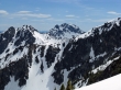
Every step higher gives a better view of Mt. Stuart and surrounding peaks.
|
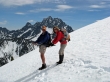
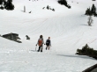
madman and rdyhiker continue up.
|
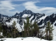
A pano shot of Cannon Mtn, Enchantment Peak, Aasgard Pass, Dragontail Peak, Colchuck Peak, Argonaut Peak, Sherpa Peak and Mt. Stuart.
|
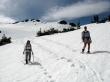
rdyhiker and madman can see the summit now.
|
Getting closer to the Jack Ridge summit.
|
Very close to the summit now.
|
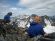
ragman and madman relax on the Jack Ridge summit (7828').
|
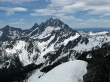
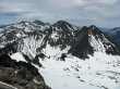
Argonaut Peak, Sherpa Peak and Mt. Stuart from Jack Ridge.
|
Cashmere Mtn in the distance on the left... Eightmile Mtn in the center of the photo.
|
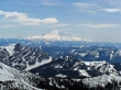
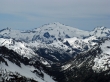
Mt. Rainier... with Hawkins Mtn in the left foreground.
|
Jolly Mtn between Ingalls Peak on the left and Hawkins Mtn on the right.
|
Cannon Mtn, Enchantment Peak, Aasgard Pass, Dragontail Peak, Colchuck Peak and Agornaut Peak.
|
Cathedral Rock and Mt. Daniel in the distance... the sunlit ridge has Paddy-Go-South, Paddy-Go-Easy Pass, Paddy-Go-North and Sherpani Peak.
|
madman getting ready to head down... Ingalls Peak in the distance.
|
madman and rdyhiker... on guard!!
|
Looking across Jack Ridge to Ingalls Peak.
|
So many peaks... so little time.
|
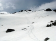
Our tracks up to and down from the summit.
|
rdyhiker and madman heading for the barn.
|
Heading down!
|
Sherpa Peak and Mt. Stuart as we head down to the 6000 foot basin.
|
rdyhiker and madman getting closer to the 6000 foot basin.
|
Packing up at the basin... only 6 miles left to reach the car... 14 miles roundtrip, gaining 4728 feet of elevation.
|
