Mount Howard - 6.19.2009
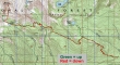
rodman's GPS route of our hike to Mt. Howard... starting from the Merritt Lake trailhead (3080').
|
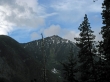
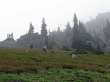
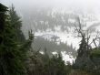
Arrowhead Mtn from the Merritt Lake trailhead.
|
At the trail junction (4840') of trails 1588 and 1583 we turned left and started up hill.
|
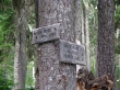
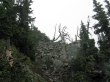
rdyhiker shows where the Mt. Mastiff turnoff sign (5420') used to be.
|
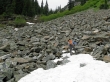
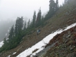
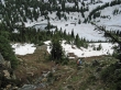
We continued on Trail 1583... where rodman and rdyhiker started giving back 400 feet of elevation on the way to Royal Creek.
|
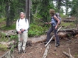
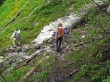
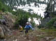
rdyhiker gets ready to do some boulder work above Royal Creek.
|
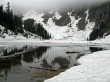
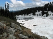
One and a half miles beyond Royal Creek we arrived at Crescent Lake (5400').
|
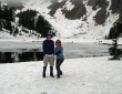
ragman and rdyhiker (a.k.a. Kung Fu Hiker) chill at Crescent Lake.
|
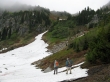
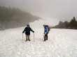
rdyhiker and rodman heading west of the lake with their eyes on the snow field leading up to the ridge.
|
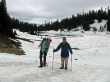
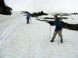
rdyhiker and rodman at the west end of the lake.
|
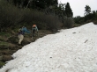
rodman and rdyhiker heading for the ridge.
|
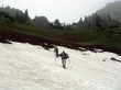
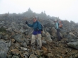
rdyhiker and rodman at ~6000 feet... nearing the 6200 foot low point on the ridge.
|
rdyhiker and rodman are seriously close to the 6200 foot low point on the ridge.
|
The 6200 foot low point on the ridge did not give a clear route to the summit... so we decided to traverse back to the east in search of a good route.
|
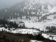
Looking down on Crescent Lake as we traverse to the east.
|
Almost due north of Crescent Lake we found a gully that would get us above a cliff band.
|
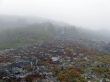
From above the cliff band we are losing visibility on Crescent Lake.
|
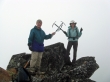
rodman and rdyhiker are ~100 feet below the Mt. Howard summit.
|
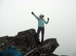
rodman and rdyhiker on the Mt. Howard summit (7063').
|
rdyhiker's tribute to EastKing.
|
rodman checks out the Mt. Howard summit register.
|
rdyhiker on the way down... a couple hundred feet below the Mt. Howard summit.
|
rodman and rdyhiker getting ready to drop into the abyss.
|
We had a nice stretch of boot-skiing... rdyhiker uses the 'one flap up and one flap down' technique.
|
ragman and rdyhiker start down the gully towards Crescent Lake.
|
rdyhiker is heading back down to Crescent Lake.
|

rdyhiker and ragman fight through a short stretch of slide alder.
|
Almost back to Crescent Lake... with weather to the east looking a lot better.
|
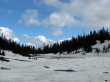
Looking east from the west end of Crescent Lake.
|
A pano shot from the east end of Crescent Lake... only 5.5 miles of hiking is left to get back to the car... total trip was 15 miles, gaining ~5600 feet of elevation.
|
