Big Jim Mountain - 6.27.2009
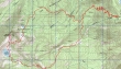
rodman's GPS route of our hike to Big Jim Mtn... 16.5 miles roundtrip, gaining 6199 feet of elevation.
|
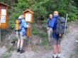
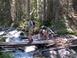
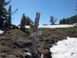
Denali Girl signs us in at the Hatchery Creek Trailhead (~2800').
|
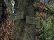
After hiking 2.8 miles we will take the Badlands Trail.
|
Resting at the Hatchery Creek/Badlands trail junction.
|
We had to give back 500 feet of elevation to cross the Battle Canyon Creek.
|
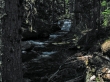
Part of the Battle Canyon Creek.
|
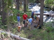
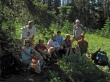
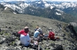
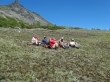
Refueling before heading up towards Big Jim Mtn Lakes.
|
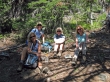
Sahale, Denali Girl, Jannu and rdyhiker.
|
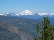
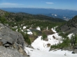
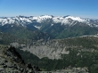
Glacier Peak from The Badlands.
|
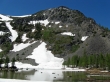
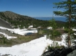
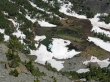
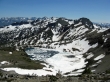
Big Jim Mtn and the higher of the Big Jim Mtn Lakes.
|
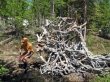
madman finds a back scratcher at upper Big Jim Mtn Lake.
|
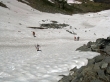
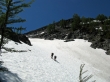
Starting up a snowfield on the south side of Big Jim Mtn.
|
Looking back on upper Big Jim Mtn Lake as we gain elevation.
|
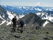
madman and Sahale gaining elevation.
|
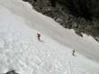
iraman and rdyhiker on the snowfield.
|
Upper Big Jim Mtn Lake from the top of the snowfield.
|
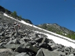
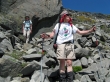
Traversing across a boulder field towards Big Jim Mtn on the right.
|
A closeup of Upper Big Jim Mtn Lake.
|
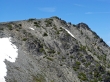
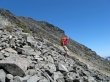
madman is on the ridge line near the Big Jim Mtn summit.
|
The group on the Big Jim Mtn summit (7763').
|
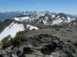
Ladies Peak, Snowgrass Mtn and Big Chiwaukum.
|
Cashmere Mtn in the center... with the Stuart Range beyond... Big Lou Mtn in the right foreground.
|
Upper Big Jim Mtn Lake from the summit.
|
madman and Sahale heading down towards Lake Augusta... Mt. Rainier in the distance.
|
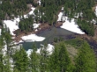
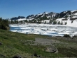
Lake Augusta is thawing... Cashmere Mtn and the Stuart Range in the distance.
|
rdyhiker and rodman descend towards Lake Augusta.
|
iraman on the way to Lake Augusta.
|
Lake Augusta.
|
Resting at Lake Augusta.
|
After hiking 3 miles from Lake Augusta we will take the Hatchery Creek Trail back to the car.
|
