Harding Mountain - 7.16.2009
|
rodman's GPS route for Harding Mtn... 12.5 miles roundtrip, gaining 5448 feet of elevation.
|
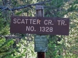
Just before crossing the bridge into Salmon La Sac, turn right on FS 4330 and drive several miles to the Scatter Creek trailhead (3300').
|
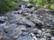
After hiking ~1.5 miles we came to the first stream crossing.
|
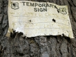
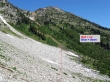
Another half-mile of hiking brought us to the temporary sign at the junction for Scatter Creek/County Line trail.
|
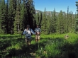
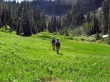
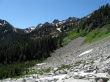
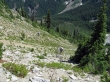
After crossing Scatter Creek, the trail is very difficult to follow in overgrown meadows.
|
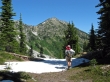
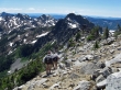
larman and rodman in the last meadow before reaching Fish Eagle Pass.
|
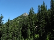
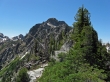
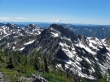
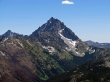
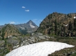
Fish Eagle Peak as we near Fish Eagle Pass.
|
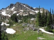
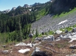
Taking a break at Fish Eagle Pass (~6100')... Scatter Peaks in the background.
|
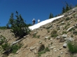
We found a boot path near Fish Eagle Pass that takes us down and underneath the cliffs on the east side of Fish Eagle Peak (a.k.a Solomon Peak).
|
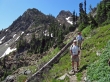
rodman checks out the route to the Harding Mtn summit.
|
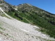
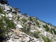
We've reached the boulder field just south of Harding Mtn.
|
Our route to the Harding Mtn summit... on the way down we gave up 100 feet of elevation to take the easier route along the base of the boulder field.
|
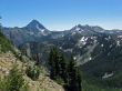
Mt. Stuart from the north end of the boulder field.
|
Looking south across the boulder field that we just crossed... Scatter Peaks in the distance.
|
larman and rodman at the saddle (~6500') between Fish Eagle Peak and Harding Mtn.
|
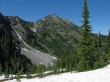
The NE side of Fish Eagle Peak from the saddle between Fish Eagle and Harding.
|
Mt. Stuart, Ingalls Peak and Fortune Peak from the Fish Eagle/Harding saddle.
|
rodman and ragman heading for the Harding Mtn summit.
|
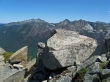
Pano shot from the summit of Hibox and Three Queens on the left to The Cradle on the right.
|
Cashmere Mtn, Eightmile Mtn and Hi-Jack Peak from the Mt. Harding summit.
|
Hawkins Mtn, Scatter Peaks and Fish Eagle Peak... with Mt. Rainier in the distance.
|
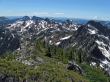
Looking across Jack Ridge on the left to The Stuart Range... Ingalls Peak and Fortune Peak on the right.
|
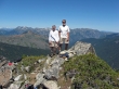
rodman and larman on the Mt. Harding summit (7173').
|
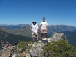
ragman and larman on the Harding summit.
|
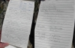
The summit register was placed in August, 2002... and there are only two pages with signatures.
|
Looking across Fish Eagle Peak to Mt. Rainier... Scatter Peaks on the left.
|
Looking across Paddy-Go-Easy Pass to Mt. Daniel and Cathedral Rock... Bears Breast Mtn and The Citadel are left of Daniel.
|
Looking across Nursery Peak to The Cradle... the south and north summits of Granite Mtn are on the left.
|
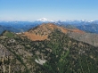
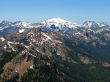
Looking across Highchair Mtn to Glacier Peak.
|
A closeup of Argonaut Peak and Mt. Stuart.
|
rodman and larman start down from the Harding summit.
|
rodman and larman head down for the boulder field below the Fish Eagle/Harding saddle.
|
rodman and larman near the boulder field... we will give back another 100 feet of elevation and go underneath the boulder field on the way back to Fish Eagle Pass.
|
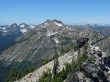
Looking back on Harding Mtn as we continue towards Fish Eagle Pass.
|
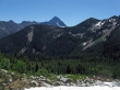
Mt. Stuart from Fish Eagle Pass... 4.75 miles left to get back to the car.
|
