Switzerland - Bryndli - 9.6.2009
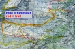
Ride the Funicular railway from Murren (1638m) to Allmendhubel (1907m)... hike down to the Sonnenberg Pension restaurant (1852m)... over to the Schiltalp Hut (1946m)... up the Schilttal valley to a high point of 2315m... then over to Wasenegg Ridge (2051m)... then to Bryndli (2133m) at the east end of Wasenegg Ridge... ~5 miles roundtrip, gaining 1683 feet of elevation.
|
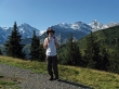
aceman after getting off of the Funicular railway at Allmendhubel... Breithorn and Gspaltenhorn in the distance.
|
Birg from Allmendhubel.
|
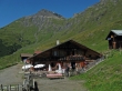
The Sonnenberg Pension restaurant is the largest building on the right... Gspaltenhorn in the distance.
|
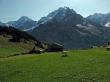
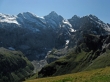
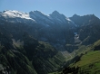
Monch, Junfrau and Gletscherhorn from the Bluemental valley near the Sonnenberg Pension restaurant.
|
Paraglider in front of Eiger.
|
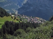
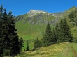
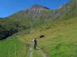
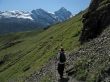
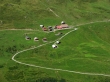
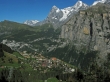
Looking down on Murren on the way to the Schiltalp Hut.
|
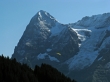
Breithorn.
|
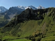
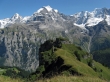
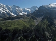
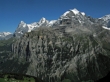
Looking across Wasenegg Ridge to Gspaltenhorn... the two bumps on the left end of the ridge is Bryndli.
|
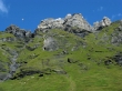
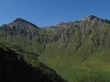
A closeup of Bryndli on Wasenegg Ridge.
|
The Schiltalp Hut... with Schilthorn in the distance.
|
aceman heading towards the Schilthorn.
|
Gondola leaving Birg for Schilthorn.
|
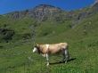
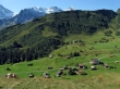
Moo... nice necklace... Schilthorn is above.
|
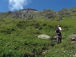
aceman starts gaining elevation towards Schilthorn.
|
Looking down the Schilttal valley to the Schiltalp Hut on the left and the small village of Gimmela on the right... Eiger, Monch, Jungfrau and Gletscherhorn in the distance.
|
aceman has reached our high point (2315m) for the day... now it is time to walk over to Wasenegg Ridge.
|
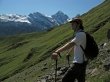
aceman hiking towards Wasenegg Ridge... Gspaltenhorn in the distance.
|
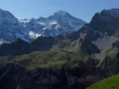
Looking up the Sefinental valley from Wasenegg Ridge... Gspaltenhorn at the end of the valley.
|
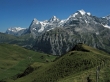
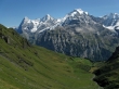
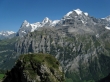
Wetterhorn, Eiger, Monch and Jungfrau from Wasenegg Ridge.
|
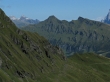
From Wasenegg Ridge... the high pryamid in the distance on the left is Schwarzhorn... the two high points on the ridge in the foreground are Tschuggen and Lauberhorn.
|
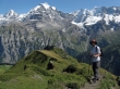
aceman acknowledges the siting of Bryndli (two bumps at the end of the ridge)... Monch, Jungfrau, Gletscherhorn, and Abeni Flue in the distance.
|
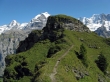
Getting closer to Bryndli.
|
Pretty obvious that the first bump is higher than the second... but the trail goes around the first bump and up to the second.
|
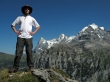
aceman and I scrambled up the first bump... Eiger, Monch and Jungfrau in the distance.
|
Looking down on the second bump from the first bump... Wetterhorn, Eiger, Monch and Jungfrau in the distance.
|
Looking up the Sefinental valley from Bryndli to Gspaltenhorn.
|
Grosshorn and Breithorn.
|
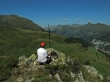
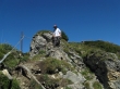
aceman signs the Bryndli summit register which is located on the second bump.
|
Eiger, Monch and Jungfrau from Bryndli.
|
|
Pano shot from Bryndli... Wetterhorn, Eiger, Monch, Jungfrau, Gletscherhorn, Abeni Flue, Mittaghorn, Grosshorn, and Breithorn.
|
Schilthorn and Birg from Bryndli.
|
aceman uses the handline on the way down from Bryndli.
|
Heading back down to the Schiltalp Hut.
|
Still more than a mile left to get back down to Murren.
|
