Humpback Mountain - 2.18.2010
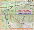
rodman's GPS route of our hike to Humpback Mtn... access from I-90 via Exit 42 or Exit 47... then drive road 55 and road 5510 to the unsigned trailhead... 4.5 miles roundtrip, gaining 2306 feet of elevation.
|
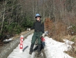
Road 5510 was snowfree to this gate at ~2840 feet... where we parked.
|
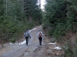
rodman and BarbE on the road that we walked for ~.75 miles.
|
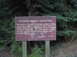
Good thing we weren't here to collect minerals because we didn't have a permit.
|
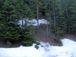
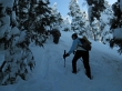
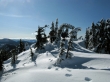
~.75 miles from the gate the unsigned trail heads steeply uphill.
|
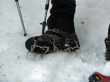
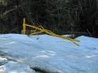
At ~3900 feet rodman put on his circa 1967 crampons.
|
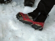
BarbE and I used circa 2009 Microspikes.
|
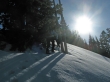
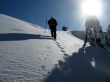
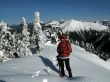
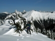
BarbE and rodman heading for the summit.
|
Nearing the summit.
|
BarbE on the summit... and rodman is close.
|
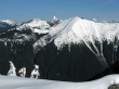
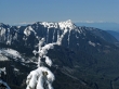
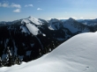
Kaleetan Peak between the west and true summits of Granite Mtn.
|
Pano shot from Preacher Mtn on the left to Mt. Stuart on the right.
|
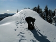
rodman preparing to walk over to the summit.
|
A closeup... looking over McClellan Butte to the Olympics.
|
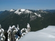
Defiance, Bandera and Pratt are in the foreground.
|
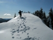
rodman makes his way towards the Humpback Mtn summit.
|
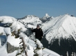
ragman nearing the summit... with Kaleetan and Granite Mtn beyond.
|
Annette Lake... with Silver Peak, Tinkham Peak and Abiel Peak.
|
BarbE and rodman... hiding in the trees to try and get out of the wind.
|
BarbE on the Humpback Mtn summit.
|
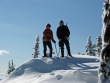
BarbE and ragman on the Humpback Mtn summit (5174').
|
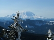
A closeup of Mt. Rainier from the Humpback summit.
|
rodman on the Humpback Mtn summit.
|
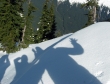
Shadow people on Humpback.
|
Merry Christmas everyone... if you lost your Noel Cone, give me a call.
|
