Yakima Skyline Ridge - 3.11.2011
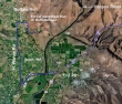
Drive I90 just east of Ellensburg and turn south at Exit 110 (Hwy 82/97)... continue on 97 and take Exit 26... turn right on Hwy 823 (Harrison Rd), cross the Yakima River, and in 4.2 miles, turn right onto N. Wenas Rd... follow Wenas for 4 miles... at the fire station take Gibson for .2 miles... then right on Buffalo Road for .4 miles to the end of pavement.
|
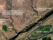
From the end of the paved portion of Buffalo Road, continue 1.5 miles on dirt and cross a cattle guard... then continue .7 miles to the poorly signed trailhead at a hairpin turn in the road... note that if you drive underneath Roza Canal, you need to backtrack a third of a mile.
|
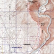
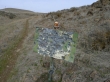
rodman's GPS route of our hike on the Yakima Skyline Ridge Trail... 8.5 miles roundtrip, gaining 2549 feet of elevation.
|
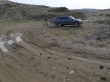
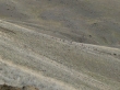
We parked (1300') where the Buffalo Road makes a hairpin turn... .7 miles after crossing a cattle guard.
|
Did I mention that the trailhead is poorly signed.
|
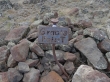
Interesting cairn.
|
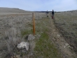
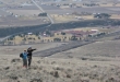
After hiking an eighth of a mile we came to the first of many posts along the trail... we are hiking in the L.T. Murray State Wildlife Recreation Area.
|
Looking across the Yakima River to the Sundown Ranch.
|
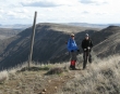
rodman took this photo of Denali Girl and me... as we suggest that he look to his right... so that he...
|
... can get this shot of five bighorn sheep.
|
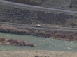
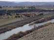
Looking down on someone who has decided to drive on the railroad track instead of Canyon Road.
|
On the hillside just below us, we noticed a grouping of white rocks in the distance...
|
...which turned out to be a herd of 25 to 30 bighorn sheep.
|
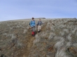
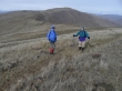
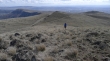
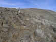
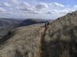
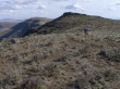
Denali Girl and rodman continue to gain elevation on the Yakima Skyline Ridge Trail... Point 2737 in the distance.
|
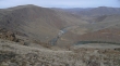
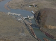
We reached Point 2737 and got this view of Roza Dam... with Point 3208 (Gracie Point) in the distance on the left.
|
Point 2737 is very horse friendly.
|
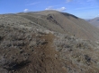
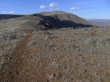
Denali Girl and rodman on the north side of Point 2737... as we give back 500 feet of elevation on our way to Point 3208 in the distance.
|
A closeup of Roza Dam as we head for Point 3208... Roza Canal just to the left of the Yakima River.
|
Denali Girl and ragman above Roza Dam.
|
Denali Girl heading for Point 3208.
|
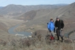
rodman looking down on Roza Dam... with Point 2737 in the distance.
|
Looking back on Point 2737 as we make our way over to Point 3208.
|
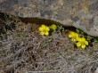
Sagebrush Buttercups show that spring is coming.
|
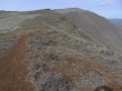
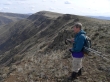
Denali Girl coming up towards Point 3208... broad views now... Point 2737 on the left.
|
rodman checking his GPS just below Point 3208.
|
Point 3208... a.k.a Gracie Point.
|
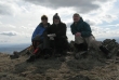
rodman's summit shot... Denali Girl, ragman and rodman.
|
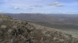
Point 2737 (left) and the route we took over to Point 3208.
|
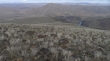
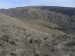
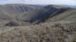
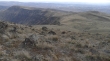
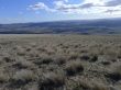
Looking north from Point 3208.
|
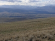
Looking northwest to Umtanum Ridge.
|
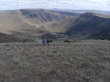
Denali Girl and rodman below Point 3208 as we head back towards Point 2737.
|
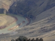
A closeup looking down at the Yakima River where the Roza Canal tunnels into the hillside.
|
Denali Girl and rodman on the Yakima Skyline Ridge Trail... heading back to Point 2737.
|
Denali Girl and ragman... with Point 2737 in the distance.
|
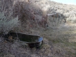
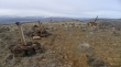
A horse camp along the trail.
|
Looking back on Gracie Point.
|
Heading for Point 2737.
|
Looking back on Gracie Point.
|
Denali Girl and rodman heading back to the car.
|
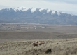
Six deer in the left center of the photo... on a clear day Mt. Adams and Mt. Rainier would be visible.
|
