Kendall Peak Lakes - 3.19.2011
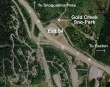
Just east of Snoqualmie Pass, take Exit 54 off of I90 and find the Gold Creek Sno-park on the north side of the freeway.
|
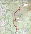
rodman's 2008 GPS route... altered for our trip today... ~8.5 miles roundtrip, gaining ~1700 feet of elevation.
|
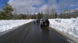
Denali Girl at the Gold Creek Sno-park... over-flow parking is on the old highway that parallels I90.
|
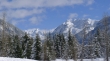
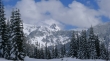
Chikamin Peak and Alta Mountain from the sno-park.
|
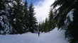
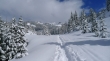
Denali Girl heading up in the trench... several inches of new snow this morning.
|
The trench gets deeper as we gain elevation.
|
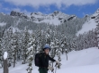
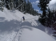
Denali Girl on skis.
|
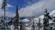
Looking across I90 to the Snoqualmie Pass Ski Area, Granite Mtn, Low Mtn and Denny Mtn.
|
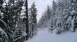
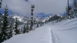
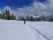
We've skied for two miles and have turned NE towards Kendall Peak in the distance.
|
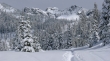
The trench is 8 to 10 inches deep as we ski towards Kendall Peak.
|
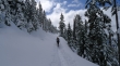
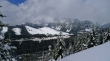
Denali Girl nearing the ridge (4250') that will give us a view of Rampart Ridge.
|
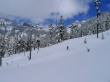
Looking towards the Snoqualmie Pass Ski Area.
|
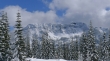
A closeup of Hibox Mtn from the ridge.
|
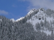
A closeup of Rampart Ridge from the ridge at 4250 feet.
|
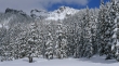
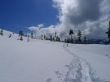
Getting closer to the lakes below Kendall Peak.
|
The true summit of Kendall Peak is on the left (I think).
|
ragman below Kendall Peak.
|
Denali Girl is getting really close to the first Kendall Peak Lake.
|
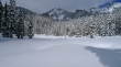
The first of the Kendall Peak Lakes.
|
Blue and white.
|
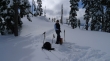
A camp robber joins Denali Girl for lunch.
|
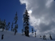
The clouds are starting to win.
|
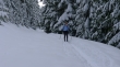
Heading back... the trench is a foot deep now... Silver Peak in the distance on the right.
|
Denali Girl back at the ridge... Hibox Mtn and Rampart Ridge behind.
|
Denali Girl skiing down from the ridge... 3.5 miles left to get back to the car.
|
