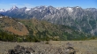
Three Brothers (west summit) - 7.1.2014
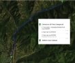
Directions from the entrance to 29 Pines Campground to the Stafford Creek Trailhead.
|
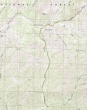
rodman's GPS track of our May 2007 trip to the west summit of Three Brothers... the same route we used on this trip... 11.5 miles roundtrip, gaining 5300 feet of elevation.
|
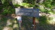
The Stafford Creek Trailhead starts at 3100 feet.
|
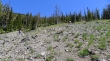
After hiking the Stafford Creek Trail for ~3 miles (4800'), we crossed a creek, left the main trail and headed steeply uphill.
|
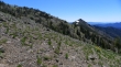
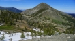
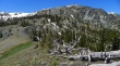
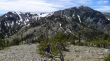
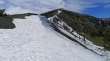
Off trail on steep terrain... Earl Peak in the distance.
|
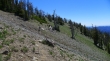
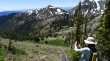
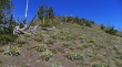
Continuing off trail and gaining elevation.
|
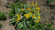
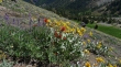
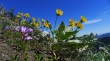
Lots of balsam root on this hike.
|

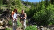
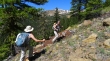
Izzy takes a break in a patch of shooting stars.
|
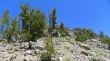
Still ascending on our way to Navaho Peak's SE ridge.
|
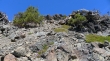
Still ascending for Navaho Peak's SE ridge... looking over at Little Navaho (aka Freedom Peak).
|
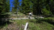
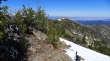
At ~6400 feet we found the County Line Trail... and will follow it over to the SE ridge of Navaho Peak.
|
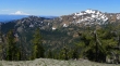
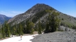
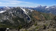
Mt. Rainier and Earl Peak from the SE ridge of Navaho Peak.
|
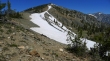
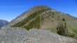
Looking at Navaho Peak from the SE ridge.
|
Looking over to the west summit of Three Brothers from the SE ridge of Navaho Peak... looks like we will have to give back 500 feet of elevation to get over there... ugh!
|
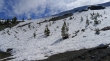
Snowdog on the way to Three Brothers.
|
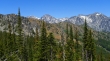
As we ascend Three Brothers, more and more of The Stuart Range is visible... Dragontail Peak, Little Annapurna and McClellan Peak.
|
Impressive flower field on Three Brothers.
|
Looking back at Navaho Peak as we ascend Three Brothers... we crossed over the ridge on the far left.
|
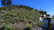
BarbE shoots the flower field on Three Brothers... Little Navaho in the distance.
|
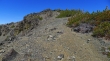
Continuing up.
|
More up.
|
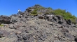
Will we ever get there... several false summits along the way.
|
Still more up.
|
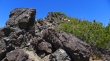
The final bit of up to reach the summit.
|

Supporting the U.S. soccer team from the west summit (7303') of Three Brothers... but alas, it didn't help... Argonaut Peak, Colchuck Peak, Dragontail Peak and Little Annapurna are behind us.
|
Looking at the east summit of Three Brothers from the west summit.
|
The Stuart Range from the west summit of Three Brothers.
|
Navho Peak in the foreground... Earl Peak on the far left... Ingalls Peak, Mt. Stuart, Argonaut Peak and Colchuck Peak on the right.
|
Almost back to the saddle between Three Brothers and Navaho Peak.
|
Ah... back to the flower field.
|
More flowers.
|
Artist at work.
|
Looking back at the west summit of Three Brothers as we work our way back up to the SE ridge of Navaho Peak.
|
Looking up at the SE ridge of Navaho Peak... the last of the uphill for the day.
|
Back on the SE ridge of Navaho Peak... still have at least a 4 mile hike to get back to the car.
|
