Wahpenayo Peak - 7.21.2014
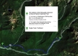
Directions from the fee station at the Nisqually entrance to Mt. Rainier National Park to the Eagle Peak Trailhead... where we started our trip to Wahpenayo Peak.
|
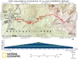
rodman's GPS track of our trip to Wahpenayo Peak... 7.8 miles roundtrip, gaining 3438 feet of elevation.
|
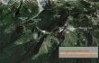
A google earth look at the terrain around Wahpenayo Peak.
|
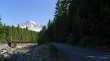
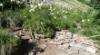
We have driven through the housing area at Longmire... then drove over the Nisqually River on the bridge in the photo... and parked across the road from the Eagle Peak Trailhead.
|
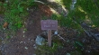
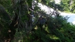
The Eagle Peak Trailhead starts at an elevation of 2800 feet.
|
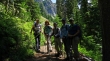
Irmi (left) hiked with us for the first 3 miles... she is from Germany... and she gave BarbE a chance to freshen up on her German along the way.
|
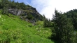
After hiking ~3 miles, the Eagle Peak Trail comes out of the trees and switchbacks to the left... here, Irmi continued to the left and headed for Eagle Peak... we crossed over the pile of boulders and wood in the photo and continued on the path heading toward the Chutla/Wahpenayo saddle.
|
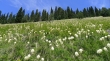
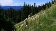
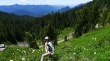
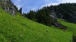
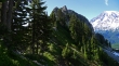
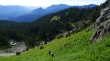
There was a ton of beargrass on the south slope of Eagle Peak.
|
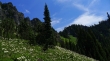
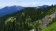
Continuing on the path leading to the Chutla/Wahpenayo saddle in the center of the photo.
|
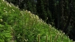
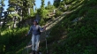
tomman, Denali Girl and BarbE in the tall beargrass.
|
Where is rodman?
|
Getting closer to the Chutla/Wahpenayo saddle in the center of the photo.
|
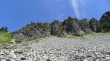
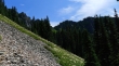
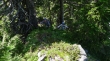
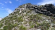
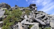
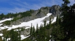
The boulder field on the south side of Chutla Peak.
|
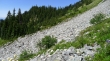
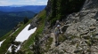
tomman, Denali Girl, BarbE and rodman crossing the boulder field on the south side of Chutla Peak.
|
rodman continues up toward the Chutla/Wahpenayo saddle.
|
BarbE, tomman and Denali Girl coming up toward the Chutla/Wahpenayo saddle.
|
rodman and BarbE nearing the Chutla/Wahpenayo saddle.
|
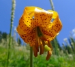
Looking up from underneath a Tiger Lily.
|

Looking up from underneath a French Columbine.
|
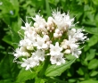
Sitka Valerian
|

Looking up from underneath an avalanche lily.
|
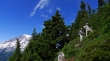
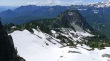
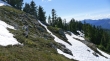
Nearing the Chutla/Wahpenayo saddle... we have come from the switchback (lower left corner of photo) on the Eagle Peak Trail... Mt. Wow on the left... and Mt. Ararat on the far right.
|
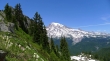
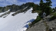
Mt. Rainier from the Chutla/Wahpenayo saddle (~5600')... Chutla Peak in the left foreground.
|
BarbE has left the Chutla/Wahpenayo saddle and heading for Wahpenayo Peak on steep terrain.
|
rodman continuing up along Wahpenayo's NW ridge.
|
Still gaining elevation on Wahpenayo's NW ridge... the summit is on the far right.
|
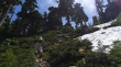
Some bushwhacking on Wahpenayo's NW ridge.
|
Bushwhacking is fun... not.
|
Still continuing along the NW ridge.
|
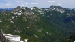
Looking back at the Chutla/Wahpenayo saddle (lower left)... with Chutla Peak in the center of the photo.
|
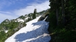
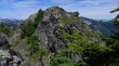
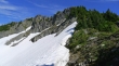
Getting closer to the Wahpenayo summit in the center of the photo.
|
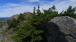
False summit on the left... we will use rock to get up to the NW ridge.
|
rodman coming up to the NW ridge.
|
Mt. Rainier from Wahpenayo's NW ridge.
|
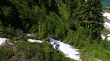
We will be able to avoid the steep snow field on the way to the false summit.
|
Nearing Wahpenayo's false summit... Mt. Rainier in the distance.
|
Almost on Wahpenayo's false summit.
|
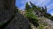
We have left Wahpenayo's false summit and are on a pretty good path on the south side of the summit area.
|
Traversing on the south side of the summit area.
|
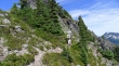
Steep terrain on the south side of the summit area is forcing us up... will this be the summit?
|
Continuing up on steep terrain.
|
Arg... we still aren't quite on the summit yet... surely it will just be a stroll over to it from here.
|
Well... it won't be a simple stroll over to the summit... going to have to give back a little elevation to get over there.
|
Veggie belay anyone? rodman and BarbE giving back a bit of hard earned elevation.
|
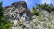
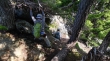
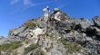
A bit of Class 3 climbing just below the Wahpenayo summit.
|
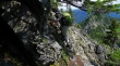
rodman nears the summit on easier terrain.
|
On the Wahpenayo summit looking down on part of our route from the Chutla/Wahpenayo saddle.
|
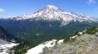
Mt. Rainier from the Wahpenayo Peak summit (6231').
|
Looking at some of the Tatoosh Range from the Wahpenayo Peak summit.
|
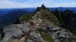
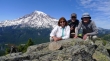
rodman and BarbE on the Wahpenayo Peak summit... with Mt. St. Helens just to the left of them in the distance.
|
Group shot from the Wahpenayo Peak summit... with Mt. Rainier in the background.
|
Back at the false summit as we trace our steps back down.
|
Looking back at Wahpenayo Peak as we continue down.
|
Continuing down.
|
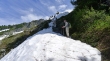
BarbE says to go that way.
|
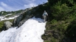
BarbE descending.
|
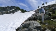
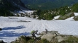
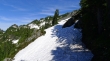
Done with the snow and almost back to the Chutla/Wahpenayo saddle.
|
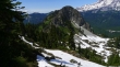
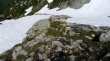
Back at the Chutla/Wahpenayo saddle... with Chutla Peak beyond.
|
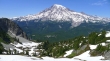
Last look at Wahpenayo Peak from the Chutla/Wahpenayo saddle.
|
BarbE and rodman are descending from the Chutla/Wahpenayo saddle... and are heading for the the Eagle Peak Trail on the open slope in the distance.
|
