Pratt Mountain - 2.28.2008
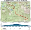
rodman's GPS route for our snowshoe trip to Pratt Mtn... 9.6 miles roundtrip, gaining 3272 feet of elevation.
|
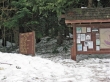
The Pratt Lake/Granite Mtn trailhead (1850') is just off of I-90 at Exit 47.
|
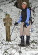
After a mile of hiking and 800' of elevation gain, Nanda stops at the Granite Mtn turnoff... we will continue on the Pratt Lake trail.
|
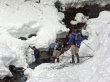
There are at least ten stream crossings in the first 2.5 miles of the trip... and we got to recross them on our return trip.
|
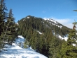
From Ollalie Lake (3800'), we gained a steep 500' of elevation to the ridge and our first look at Pratt Mtn on the right.
|
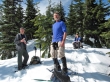
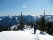
rodman, larman, and Nanda get a well deserved break on the ridge above Ollalie Lake.
|
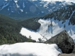
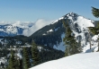
Avalanches from Bandera Mtn slide intoTalapus Lake (3200')... taken from the rock outcropping (4500') along the ridge leading to Pratt Mtn.
|
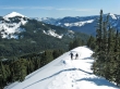
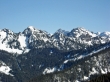
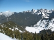
ragman and Nanda are within a quarter mile of the Pratt Mtn summit... Granite Mtn on the left and Silver Peak on the right.
|
ragman and Nanda reach the Pratt Mtn summit (5099').
|
Chair Peak from the Pratt Mtn summit.
|
Chimney Rock in the distance between Bryant Peak on the left and Mt. Snoqualmie on the right.
|
Granite Mtn from the Pratt Mtn summit.
|
McClellan Butte from the Pratt Mtn summit.
|
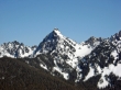
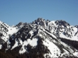
Kaleetan Peak from the Pratt Mtn summit.
|

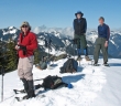
Nanda, larman, Keleetan Peak, and rodman on the Pratt Mtn summit.
|
Nanda, ragman, and rodman on the Pratt Mtn summit.
|
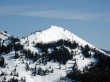
Mt. Defiance from the Pratt Mtn summit.
|
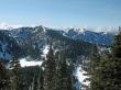
Pratt Lake from the Pratt Mtn summit.
|
Island Lake on the left below Bandera Mtn and Rainbow Lake on the right.
|
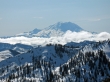
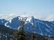
Mt. Rainier from the Pratt Mtn summit.
|
