Earl Peak - 5.30.2008
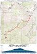
rodman's GPS route for our Earl Peak hike... 6.3 miles roundtrip, gaining 3407 feet of elevation.
|
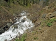
Bean Creek was raging and we couldn't get across it... so we left the trail and bushwhacked our way towards the ridge south of Earl Peak.
|
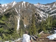
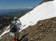
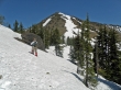
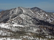
At 5500' rodman takes a look at Judys Peak on the left and Bean Peak on the right.
|
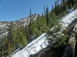
We get our first good look at Earl Peak... instead of traversing towards it, we decide to go straight up to the ridge above.
|
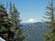
Mt. Rainier to the south.
|
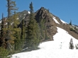
We've reached the ridge (5850') and will traverse the right side of this bump to get over to the saddle between the bump and Earl Peak.
|
rodman takes a shot of Mt. Rainier as we make our way around the bump.
|
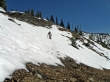
Getting around the bump was slow going.
|
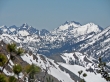
Finally we can see our target... it will have taken an hour to get from our ridge entry point to the saddle below Earl Peak.
|
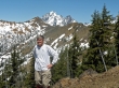
rodman takes a break at the saddle... Bean, Stuart, and Sherpa in the background.
|
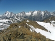
45 minutes later we are on the Earl Peak summit with this view of the Stuart Range.
|
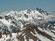
A closeup view of Solomon Mtn, The Cradle, and Harding Mtn... I believe the two peaks in the distance on the far left are the south and main summits of Granite Mtn.
|
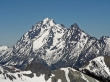
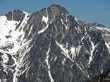
A closeup of Mt. Stuart and Sherpa Peak.
|
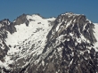
Fortune Peak and the three summits of Ingalls Peak... Mt. Daniel is in the distance on the far left.
|
A closeup of Dragontail Peak.
|
A closeup of Colchuck Peak and Dragontail Peak.
|
A closeup of Little Annapurna.
|
A closeup of Argonaut Peak.
|
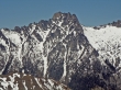
A closeup of Ingalls Peak.
|
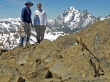
ragman and rodman on Earl Peak.
|
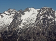
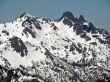
Navaho Peak, the east summit of Three Brothers, and the west summit of Three Brothers.
|
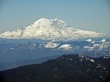
A closeup of Mt. Rainier.
|
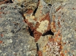
A lady bug colony on the Earl Peak summit.
|
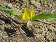
Glacier Lily
|
