Elbow Peak - 6.12.2008
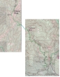
Map showing route to Yellow Hill and Elbow Peak... 10 miles roundtrip, gaining 4000 feet of elevation.
|
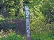
From the parking area (2800'), walk a spur road for 1.5 miles to the actual trailhead (3700') sign in this picture.
|
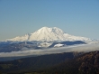
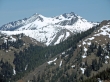
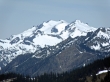
A closeup of Mt. Rainier from Yellow Hill (5527').
|
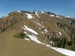
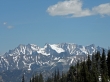
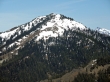
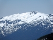
Elbow Peak (5673') taken from the saddle between Yellow Hill and Elbow Peak.
|
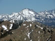
A closeup of the three summits of Summit Chief Mtn.
|
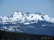
Ingalls Peak and The Stuart Range from Elbow Peak.
|
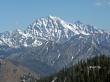
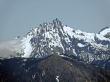
A closeup of Mt. Stuart.
|
A closeup of Argonaut Peak, Colchuck Peak, Dragontail Peak, and Little Annapurna.
|
Jolly Mtn.
|
A closeup of Hawkins Mtn.
|
A closeup of Fortune Peak in front of Ingalls Peak.
|
A closeup of Bears Breast Mtn.
|
A closeup of Mt. Daniel.
|
A closeup of Mt. Hinman.
|
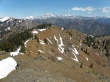
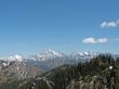
The Stuart Range taken from the north end of the Elbow Peak summit area.
|
