Volcanic Neck, Devils Head, and Bean Peak - 6.19.2008
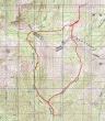
rodman's GPS route of our Volcanic Neck, Devils Head, Bean Peak hike/climb... 9.5 miles roundtrip, gaining 3668 feet of elevation.
|
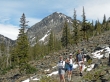
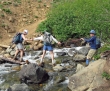
We hiked in via the Beverly Creek trail... rodman heads for the Fourth Creek divide while Janet, Charlie, and larman pose in front of Bill Peak.
|
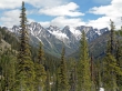
A nice view of Argonaut, Colchuck, Dragontail, and Little Annapurna as we travel on snow covered terrain on the north side of Mary Peak and Bean Peak.
|
larman and rodman take a break before we continue up to the west side of the Volcanic Neck.
|
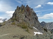
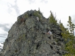
We've reached the west side of the Volcanic Neck... we will hike around and underneath the cliffy section on the south side of the neck to get over to the east side before starting our climb.
|
larman and rodman are starting to go around the south side of the Volcanic Neck.
|
Charlie and Janet are on the south side of the Volcanic Neck and working over to the east side.
|
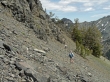
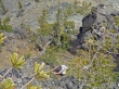
We are on the east side of the Volcanic Neck and taking some nourishment before heading up the gully in the center of the photo.
|
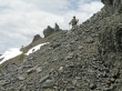
rodman has started up the gully.
|
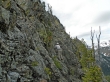
Charlie is out of the first gully and working on rockier terrain.
|
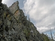
Charlie will avoid the gully on the left and go to the right and up towards the small trees.
|
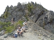
Charlie and larman watch rodman working the rock.
|
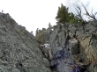
Charlie watches larman and rodman climbing up the last gully.
|
ragman reaches the top of the last gully... now it's only a 40 foot walk to the summit.
|
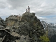
Charlie and larman watch rodman finish the last few steps to the summit (6600').
|
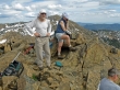
rodman holds the summit register... let the summit party begin.
|
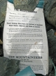
The summit register was placed in 1985 by Bill Maxwell of the Mountaineers.
|
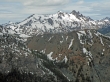
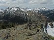
From the summit we look across Devils Head to the Stuart Range.
|
Fortune Peak and Ingalls Peak... with Bears Breast Mtn in the distance on the left.
|
Teanaway Peak on the left... Bill Peak in the center... with Summit Chief Mtn in the distance on the far right.
|
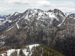
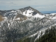
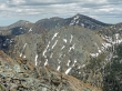
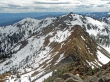
Bean Peak and the ridge leading over to Mary Peak.
|
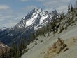
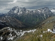
We've left the Volcanic Neck and this is a shot of Mt. Stuart and Sherpa Peak as we head towards Devils Head.
|
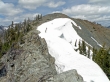
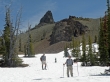
Almost to Devils Head... we found it easier to use the snow.
|
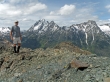
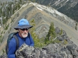
larman on Devils Head (6666')... with Mt. Stuart, Sherpa Peak, and Argonaut Peak.
|
Argonaut, Colchuck, Dragontail, and Little Annapurna from Devils Head.
|
Bill Peak on the left... Fortune Peak and Ingalls Peak on the right.
|
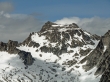
A closeup of Colchuck Peak from Devils Head.
|
A closeup of Little Annapurna from Devils Head.
|
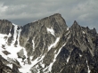
Earl Peak from Devils Head.
|
The Three Brothers and Navaho Peak from Devils Head.
|
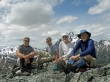
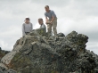
larman, rodman, Charlie, and ragman on Devils Head.
|
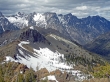
In this shot the Volcanic Neck is blocking our view of Bean Peak... very steep terrain on the Neck's north side.
|
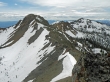
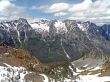
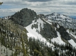
We've come back around the south side of Neck and have climbed up to Bean Peak... the Neck and Devils Head are in alignment with Dragontail.
|
From Bean Peak (6743'), Janet checks on the price of gas to see if we will be able to get home after the hike.
|
From Bean Peak we see the ridge leading to Mary Peak... Judy Peak on the left.
|
Mt. Stuart, Sherpa Peak, and Argonaut Peak from Bean Peak.
|
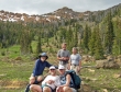
Group photo taken in Bean Creek Basin with Bean Peak in the distance.
|
An easy crossing of Bean Creek... leaving a .75 hike back to the car.
|
