Rock Mountain - 7.17.2008
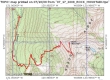
rodman's GPS route for Rock Mtn... 8.5 miles roundtrip, gaining 3263 feet of elevation.
|
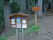
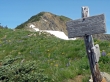
From US 2, drive the Smith-Brook road for 8.5 miles and start at the Snowy Creek trailhead (Trail #1531).
|
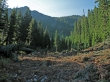
After 1 mile of hiking (3800'), find the trail continuation on the left side of this avalanche debris field.
|
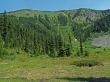
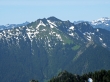
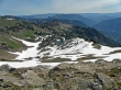
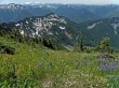
Another .75 miles of hiking brings you to this meadow at 4600'... Rock Mtn is 2250 feet above us... the high point on left side of the ridge.
|
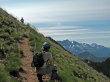
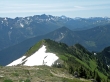
As we switchback up the open slope towards the ridge, we see Jim Hill Mtn to the south.
|
Still switching up to the ridge... ragman takes a look at the Chiwaukum mountains on the left... Stuart in the distance... Arrowhead Mtn is lower right.
|
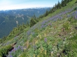
Looking NW from the open slope... lots of flowers.
|
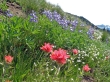
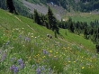
More flowers on the open slope leading to Rock Mtn.
|
Since leaving the meadow, we've hiked 2 more miles and gained 2000' of elevation to reach the ridge at 6600'... only .25 miles and 250' of elevation left to reach the Rock Mtn summit.
|
From the ridge we look down on Rock Lake (5918').
|
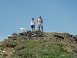
rodman and larman surrender on the Rock Mtn summit (6852').
|
Looking south across Jim Hill Mtn to Mt. Daniel and Mt. Hinman.
|
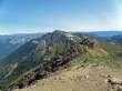
Looking south across Arrowhead Mtn to the Chiwaukum Mtns and Stuart in the distance... note the trail leading down to Rock Lake from the ridge below.
|
A closeup looking across Jim Hill Mtn to Granite Mtn.
|
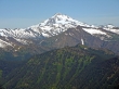
Mt. Howard from the Rock Mtn summit.
|
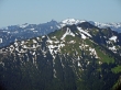
A closeup of Glacier Peak from the Rock Mtn summit.
|
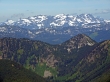
A closeup of peaks... looking NW from the Rock Mtn summit... Mountain Loop Hwy area??
|
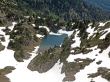
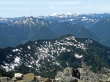
A closeup of Rock Lake taken from the Rock Mtn summit.
|
Starting back down the open slope towards the meadow below... flowers galore.
|
rodman and larman... working the switchbacks back down to the meadow below... from the meadow it won't take long to get back to the car.
|
