Yellow Aster Butte - 7.25.2008
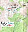
Rough idea of our route to Yellow Aster Butte... good trail all the way to the summit block, then scramble the last 100 feet to the summit (6145')... 9 miles roundtrip, gaining 2800 feet of elevation.
|
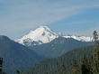
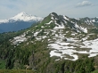
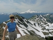
Shortly after starting the hike you get a nice view of Mt. Baker.
|
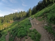
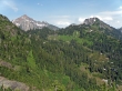
2 miles into the hike we turned left at this trail junction... continue straight if you are going to Gold Run Pass.
|
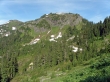
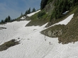
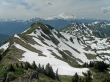
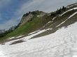
From the trail junction our route will contour underneath the YAB cliffs... the YAB false summit is on the left.
|
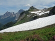
Mt. Shuksan is in the distance.
|
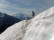
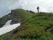
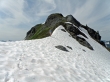
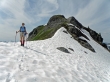
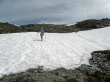
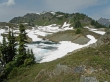
Denali Girl works her way across a snow field.
|
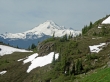
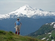
Mt. Baker as we contour below Yellow Aster Butte.
|
Denali Girl checks to see if I'm okay... Mt. Shuksan in the distance.
|
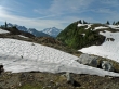
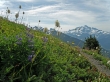
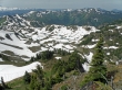
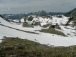
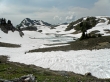
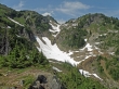
Our first look at some of the YAB tarns... Mt. Baker in the distance.
|
Mt. Shuksan from the trail to YAB... taken near the place where you decide to either drop down to the tarns or continue up to the false summit.
|
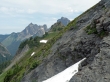
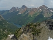
Left to right... Canadian Border Peak, American Border Peak, Yellow Aster Butte, and the top of Mt. Larrabee.
|
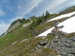
Denali Girl continues up towards the false summit of YAB.
|
Canadian Border Peak on the left... with the YAB summit in front of American Border Peak.
|
From the false summit we see the YAB summit in front of Canadian Border Peak, American Border Peak, and Mt. Larrabee... with The Pleiades to the right of Mt. Larrabee... still some downs and ups left to get over to YAB.
|
Denali Girl on the YAB false summit... Mt. Baker in the background.
|
Leaving the YAB false summit.
|
Denali Girl with the YAB false summit behind.
|
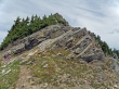
Yellow Aster Butte... time to start scrambling to the summit.
|
The YAB tarns from the YAB summit.
|
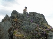
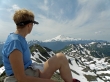
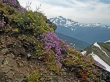
ragman on the YAB summit (6145')... surrounded by purple and gold.
|
Denali Girl on the YAB summit... with Mt. Baker in the background.
|
From the YAB summit... Canadian Border Peak, American Border Peak, Mt. Larrabee and The Pleiades... Tomyhoi Lake below.
|
Tomyhoi Peak from the YAB summit.
|
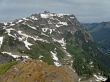
Goat Mtn in the foreground... Shuksan on the right... Mt. Sefrit on the left??
|
Looking SSE from YAB summit.
|
Denali Girl enjoys the YAB tarns and Mt. Baker from the YAB summit.
|
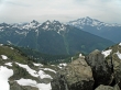
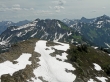
The ridge we traveled to get to the YAB summit.
|
A closeup of the YAB tarns from the YAB summit.
|
Mt. Shuksan from near the YAB summit.
|
On the return trip we decided to drop to the YAB tarns instead of going back up the YAB false summit.
|
Denali Girl is more than half way down to the YAB tarns... the YAB summit is on the left.
|
Almost down to the YAB tarns.
|
Looking back on YAB from near the tarns.
|
We've reached the YAB tarns.
|
From the tarns we see Canadian Border Peak, American Border Peak, Mt. Larrabee, and Yellow Aster Butte.
|
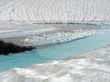
Blue ice!!
|
A last look at YAB before we start our return trip.
|
Two tarns and Tomyhoi Peak.
|
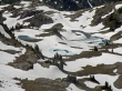
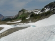
The big snow field that we crossed on our hike into YAB... we didn't realize it on the way in, but YAB is at the top of this gully.
|
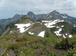
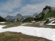
Mt. Larrabee and Winchester Mtn... with the YAB/Gold Run Pass trail junction in the high meadow.
|
