Welldiggers Ass - 3.4.2009
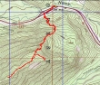
rodman's GPS route of our snowshoe trip to Welldiggers Ass... 5.25 miles roundtrip, gaining 2191 feet of elevation.
|
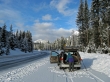
Looks like a beautiful day as we park in the plowed area on the north side of Hwy 2... less than .25 miles east of Smith Brook road.
|
From the parking area we walked west along Hwy 2 to Smith Brook road... and crossed the westbound lanes of Hwy 2 and walked thru the Hwy divide.
|
rodman getting ready to cross the eastbound lanes of Hwy 2.
|
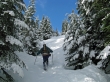
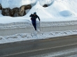
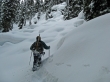
rodman starts making the steps in 9 to 12 inches of fresh snow.
|
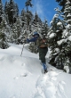
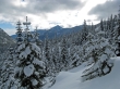
Looking west towards Stevens Pass.
|
ragman made a few of the steps...
|
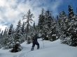
but rodman made most of the steps.
|
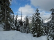
Looking east to Arrowhead Mtn.
|
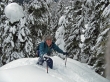
rodman in a sea of marshmellows.
|
rodman at 4700'... only 100 feet of elevation gain left to finish off the steep part of the trip.
|
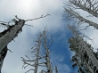
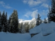
Trees at the Welldiggers Ass summit (5273')...
|
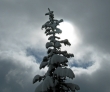
and the weather is changing for the worse.
|
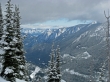
Looks like a nice day in Leavenworth and Wenatchee to the east.
|
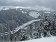
Mill Valley and part of the Stevens Pass Nordic area.
|
