Bean Peak - 5.15.2009
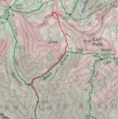
This is a map of our general route to Bean Peak... and not a GPS route... ~8 miles roundtrip, gaining ~3200 feet of elevation.
|
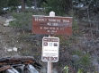
We parked at the Beverly/Bean trailhead (3600').
|
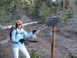
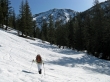
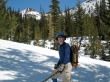
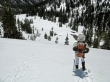
After hiking a half-mile, rdyhiker shows where we need to go.
|
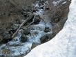
Bean Creek is running pretty fast.
|
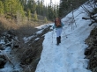
Mostly snow along the shady south side of Bean Creek until the creek crossing.
|
ragman crossing Bean Creek.
|
The second gully crossing.
|
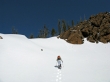
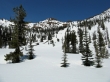
rdyhiker heading towards Earl Peak.
|
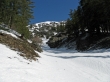
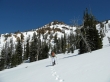
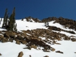
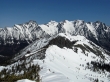
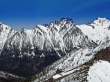
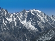
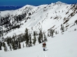
We've turned into Bean Creek Basin and get our first good look at Bean Peak.
|
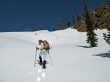
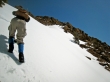
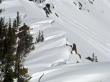
rdyhiker takes a direct line towards Bean Peak.
|
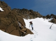
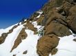
rdyhiker leads on steeper terrain.
|
Looking across the steep slope to Judy's Peak.
|
rdyhiker is really cranking now.
|
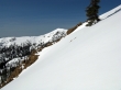
Still a ways to go to reach the summit.
|
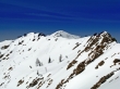
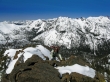
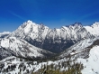
Mary's Peak... and part of the ridge leading to it from Bean Peak.
|
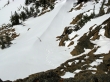
Not a pretty site... but ragman leads on a steep 50 foot section that will put us near Bean's SW ridge.
|
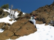
rdyhiker looks for a good spot to get off of the snow and onto rock.
|
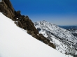
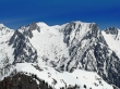
Looking across steep terrain to Earl Peak.
|
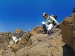
rdyhiker gets off of the snow and onto rock.
|
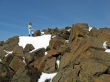
rdyhiker is very near the Bean Peak summit.
|
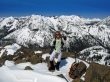
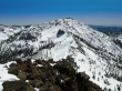
rdyhiker on the Bean Peak summit (6743')... with Teanaway Peak, Bill's Peak, Fortune Peak, and Ingalls Peak the closest ones.
|
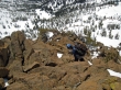
Some of our tracks in the snow.
|
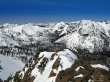
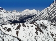
Looking across Volcanic Neck and Devils Head to Argonaut, Colchuck, Dragontail and Little Annapurna.
|
Part of the corniced ridge between Bean Peak and Volcanic Neck.
|
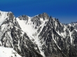
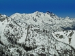
Iron Peak, Teanaway Peak and Bill's Peak in the foreground.
|
Navaho Peak from Bean Peak.
|
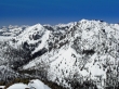
Earl Peak from Bean Peak.
|
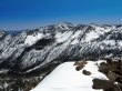
Mt. Stuart, Sherpa Peak and Argonaut Peak.
|
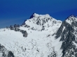
A closeup of Argonaut Peak with Colchuck Peak on the right.
|
A closeup of Colchuck Peak.
|
A closeup of Little Annapurna.
|
A closeup of Dragontail Peak.
|
A closeup of McClellan Peak.
|
A closeup of The Cradle between Fish Eagle (Solomon) Peak and Harding Mtn.
|
A closeup of Fortune Peak and Ingalls Peak.
|
Teanaway Peak and Bill's Peak in the foreground.
|
rdyhiker watches from the summit as I look for a reasonable route down the SE ridge of Bean.
|
ragman searches for a descent route on Bean's SE ridge.
|
rdyhiker down climbs Bean's SE ridge.
|
rdyhiker finishes the rock work and gets back on the snow.
|
rdyhiker on the way down to Bean Creek Basin... with Judy's Peak and Mary's Peak in the distance.
|
rdyhiker looking down on Bean Creek Basin.
|
A last look at Bean Peak before we head for the barn.
|
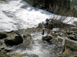
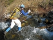
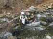
ragman high-stepping across Bean Creek which is running higher than our morning crossing.
|
rdyhiker makes crossing Bean Creek look very simple... picking a much better line than ragman did.
|
