Cashmere Mountain - 6.25.2009
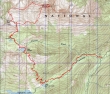
rodman's GPS route of the trip... 16.5 miles roundtrip, gaining 6107 feet of elevation.
|
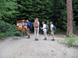
madman signs us in at the Eightmile Lake trailhead (3280').
|
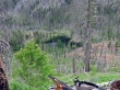
After 2.8 miles of hiking we arrived at Little Eightmile Lake.
|
Shortly after passing the lake we turned right on the Eightmile-Trout Lake Trail.
|
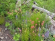
Flowers are in bloom.
|
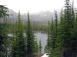
Looking down on Little Eightmile Lake as we gain elevation.
|
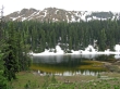
Lake Caroline (6190')... ~2.5 miles from Little Eightmile Lake.
|
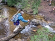
rodman crossing Pioneer Creek between Lake Caroline and Little Caroline Lake.
|
Little Caroline Lake.
|
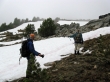
larman, rodman, rdyhiker and madman on the trail to Windy Pass.
|
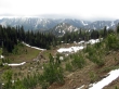
A pretty basin at ~6560'.
|
Walking through Glacier Lilies as we near Windy Pass.
|
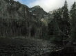
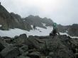
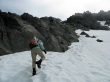
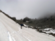
We lost the trail in the snow and hit the ridge north of Windy Pass at ~7400'.
|
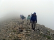
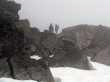
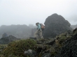
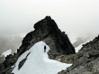
Visibility was poor as we turned east and started walking the ridge towards Cashmere Mtn.
|
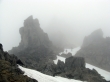
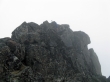
Somewhere between Point 8219 and the summit.
|
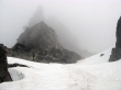
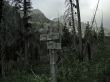
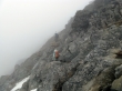
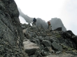
Tricky navigation in the fog.
|
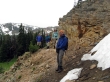
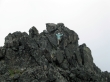
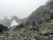
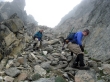
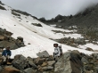
madman and rdyhiker looking for the route.
|
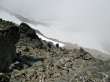
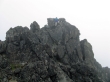
Finally on the north side of Cashmere Mtn and traversing underneath some of the false summits.
|
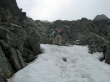
At ~8200' we started up towards the summit.
|
larman and rodman on the way to the summit.
|
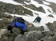
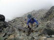
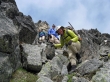
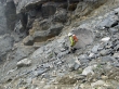
madman and rdyhiker are climbing.
|
larman and rodman climbing.
|
madman and rdyhiker less than 150 feet from the summit.
|
madman and rdyhiker near the Cashmere summit as the sun tries to come out.
|
rdyhiker starts the final push to the summit.
|
larman and rodman near the summit.
|
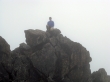
madman on the Cashmere Mtn summit (8501').
|
rdyhiker near the Cashmere Mtn summit.
|
larman on the Cashmere Mtn summit.
|
rodman on the Cashmere Mtn summit.
|
madman starts down a gully on the south side of Cashmere.
|
rodman, larman and rdyhiker on the way down from the summit.
|
madman has found where we will turn west and traverse underneath the summit block.
|
rodman and larman on loose rock.
|
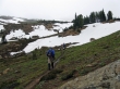
rdyhiker continues down.
|
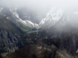
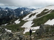
We can see Colchuck Lake across the valley.
|
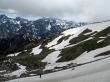
At ~7400 feet we are below the clouds.
|
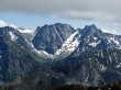
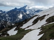
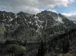
Colchuck Peak, Argonaut Peak, Sherpa Peak and Mt. Stuart.
|
Little Annapurna, Witches Tower, Dragontail Peak and Colchuck Peak... with Colchuck Lake below.
|
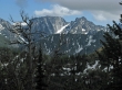
Mt. Stuart is almost out of the clouds.
|
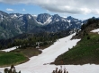
Taking a break after doing some boot skiing.
|
We can finally see the Mt. Stuart summit.
|
Enchantment Peak, Little Annapurna above Aasgard Pass, Dragontail, Colchuck, Argonaut and Sherpa.
|
Dragontail Peak and Colchuck Peak across the valley from Lake Caroline.
|
Eightmile Lake as we make our way back down from Lake Caroline.
|
