Esmeralda Peak - 7.18.2009
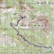
rodman's GPS route from 2004... today, we went up and down via the same route... 8.5 miles roundtrip, gaining 3092 feet of elevation.
|
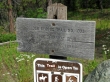
Find the trailhead (3800') for Trail #1392 at the north end of the DeRoux Campground.
|
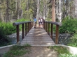
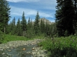
In a quarter mile cross the N. Fork Teanaway River.
|
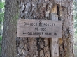
At 1.6 miles (4160'), the trail junctions with trail 1392.1 which goes to the Middle Fork Teanaway valley... keep going on trail #1392 towards Gallagher Head Lake.
|
At ~3 miles (5000'), cross DeRoux Creek... Hawkins Mtn in the distance.
|
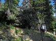
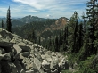
At ~3.5 miles (5440') there is a huge boulder at the end of a switchback... leave the trail here and head uphill on steep terrain.
|
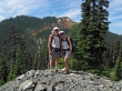
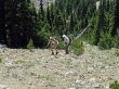
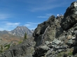
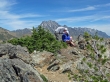
rocman and Jannu shortly after leaving the trail... DeRoux Peak in the distance.
|
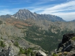
Hawkins Mtn as we continue towards Esmeralda Peak.
|
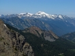
We are high enough to see Mt. Rainier between The Louvre and DeRoux Peak.
|
Denali Girl and rocman near the Esmeralda Peak summit.
|
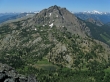
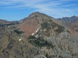
Hawkins Mtn and Gallagher Head Lake from the Esmeralda Peak summit (6765').
|
Mt. Daniel from the Esmeralda summit.
|
Looking into the basin surrounded by Scatter Peaks... The Cradle behind Scatter Peaks... Harding Mtn in front of Glacier Peak.
|
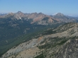
Looking across Ingalls Pass to Mt. Stuart... and the Stuart Range.
|
rocman and Jannu on the Esmeralda summit... with Mt. Stuart on the left.
|
Fortune Peak in front of South Ingalls.
|
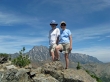
ragman and Denali Girl on the Esmeralda summit.
|
rocman and Jannu check out the Esmeralda Peak summit register... with the Stuart Range behind.
|
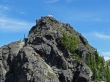
rocman, Jannu and Denali Girl on the false summit just east of the true summit.
|
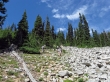
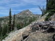
Almost back down to some real trail... 3.5 miles left to get back to the car.
|
