Pyramid Peak - 7.22.2009
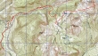
rodman's GPS route for Pyramid Peak in Mt. Rainier Nat Park... 14.5 miles roundtrip, gaining 4511 feet of elevation.
|
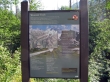
Drive a short distance beyond the Longmire entrance to the park... turn left on the Westside road and drive ~3 miles to where the road is gated (2880').
|
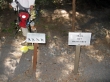
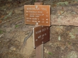
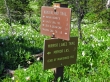
Walk the road for 1.1 miles... at the first hairpin turn in the road (3200'), enter the woods on the right side of the road and look for these signs.
|
In an eighth of a mile come out of the woods and follow red ribbons for the next eighth of a mile.
|
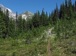
This is where you reenter the woods... if you lose track of the red ribbons, backtrack and look harder for them.
|
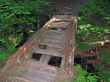
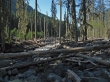
The foot bridges have definitely not been maintained... but the trail is in good shape for being in the "unmaintained" category.
|
At 3.3 miles, reach the junction with the Wonderland Trail... continue towards Indian Henry's Hunting Ground.
|
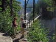
A short walk on the Wonderland Trail brought us to the suspension bridge (4200')... BarbE and rodman discuss who should cross it first.
|
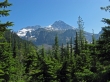
Mt. Rainier as we gain elevation towards Indian Henry's Hunting Ground.
|
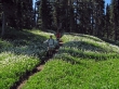
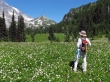
rodman, BarbE and avalanche lilies near Indian Henry's.
|
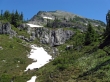
At 5 miles (5280'), take the trail to Mirror Lakes.
|
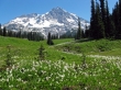
Mt. Rainier from Indian Henry's Hunting Ground.
|
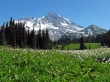
Mt. Rainier with Pyramid Peak on the right.
|
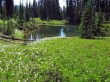
At 5.7 miles (5400'), we arrived at the larger of the Mirror Lakes.
|
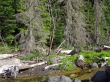
Lots of water sources on this hike.
|
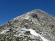
We are getting closer to Pyramid Peak.
|
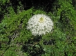
Bear Grass.
|
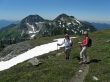
rodman and BarbE... with Iron Mtn and Copper Mtn in the distance.
|
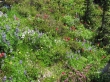
The flowers were abundant.
|
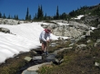
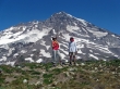
BarbE and rodman near the Pyramid Peak summit.
|
At 7 miles, BarbE and rodman reach the roomy Pyramid Peak summit (6937')... with Mt. Rainier behind.
|
A pano shot of Mt. Rainier from Pyramid Peak... Glacier Island in the left foreground.
|
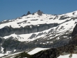
Tokaloo Spire and Tokaloo Rock from Pyramid Peak.
|
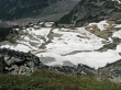
The lower part of the South Tahoma Glacier... which separates Pyramid Peak from Glacier Island.
|
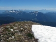
Looking across the Tatoosh Range to Goat Rocks and Mt. Adams.
|
|
rodman and BarbE coming down from the Pyramid Peak summit.
|
BarbE and rodman return to Indian Henry's Hunting Ground... Pyramid Peak in the distance.
|
BarbE takes a last look at Pyramid Peak.
|
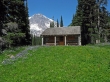
We decided to take the short walk over to the Indian Henry's Patrol Cabin... isn't the porch facing in the wrong direction?
|
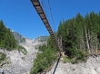
Back at the suspension bridge... 3.3 miles left to get back to the car.
|
